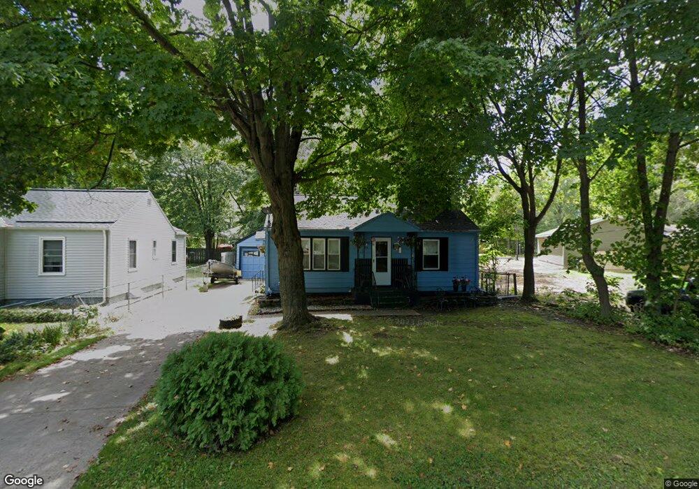
356 Bluff Ct Benton Harbor, MI 49022
Fair Plain NeighborhoodEstimated Value: $108,000 - $124,985
2
Beds
1
Bath
1,212
Sq Ft
$97/Sq Ft
Est. Value
About This Home
This home is located at 356 Bluff Ct, Benton Harbor, MI 49022 and is currently estimated at $117,746, approximately $97 per square foot. 356 Bluff Ct is a home located in Berrien County with nearby schools including Fair Plain Middle School, Benton Harbor High School, and Benton Harbor Charter School Academy.
Ownership History
Date
Name
Owned For
Owner Type
Purchase Details
Closed on
Mar 29, 2013
Sold by
Brooks Ernestine
Bought by
Depriest Joe Tom and Depriest Wanda Louise
Current Estimated Value
Purchase Details
Closed on
Jul 13, 2000
Purchase Details
Closed on
Feb 22, 1999
Purchase Details
Closed on
Oct 7, 1994
Purchase Details
Closed on
Jan 3, 1994
Purchase Details
Closed on
Nov 21, 1984
Purchase Details
Closed on
Apr 5, 1983
Create a Home Valuation Report for This Property
The Home Valuation Report is an in-depth analysis detailing your home's value as well as a comparison with similar homes in the area
Home Values in the Area
Average Home Value in this Area
Purchase History
| Date | Buyer | Sale Price | Title Company |
|---|---|---|---|
| Depriest Joe Tom | -- | None Available | |
| -- | -- | -- | |
| -- | -- | -- | |
| -- | $30,000 | -- | |
| -- | $35,000 | -- | |
| -- | $24,000 | -- | |
| -- | $6,500 | -- | |
| -- | $100 | -- |
Source: Public Records
Tax History Compared to Growth
Tax History
| Year | Tax Paid | Tax Assessment Tax Assessment Total Assessment is a certain percentage of the fair market value that is determined by local assessors to be the total taxable value of land and additions on the property. | Land | Improvement |
|---|---|---|---|---|
| 2025 | $826 | $43,200 | $0 | $0 |
| 2024 | $484 | $35,900 | $0 | $0 |
| 2023 | $460 | $31,000 | $0 | $0 |
| 2022 | $439 | $29,300 | $0 | $0 |
| 2021 | $718 | $30,700 | $7,400 | $23,300 |
| 2020 | $670 | $30,100 | $0 | $0 |
| 2019 | $640 | $25,400 | $3,500 | $21,900 |
| 2018 | $597 | $25,400 | $0 | $0 |
| 2017 | $588 | $24,400 | $0 | $0 |
| 2016 | $572 | $24,200 | $0 | $0 |
| 2015 | $571 | $22,100 | $0 | $0 |
| 2014 | $393 | $23,300 | $0 | $0 |
Source: Public Records
Map
Nearby Homes
- 304 W May St
- 202 Searles Ave
- 1000 Riverview Dr Unit 11
- 941 Colfax Ave
- 979 Lavette Ave
- 171 E Empire Ave
- 131 Clay St
- 872 Mc Alister Ave
- 694 Colfax Ave
- 1235 Colfax Ave
- 161 Kline Ave
- 576 Colfax Ave
- 398 Anchors Way Unit 82s
- 398 Anchors Way Unit 87s
- 1045 Broadway
- 180 Emery Ave
- 972 Pearl St
- 379 Western Ave
- 39884 Anchors Way
- 833 Pearl St