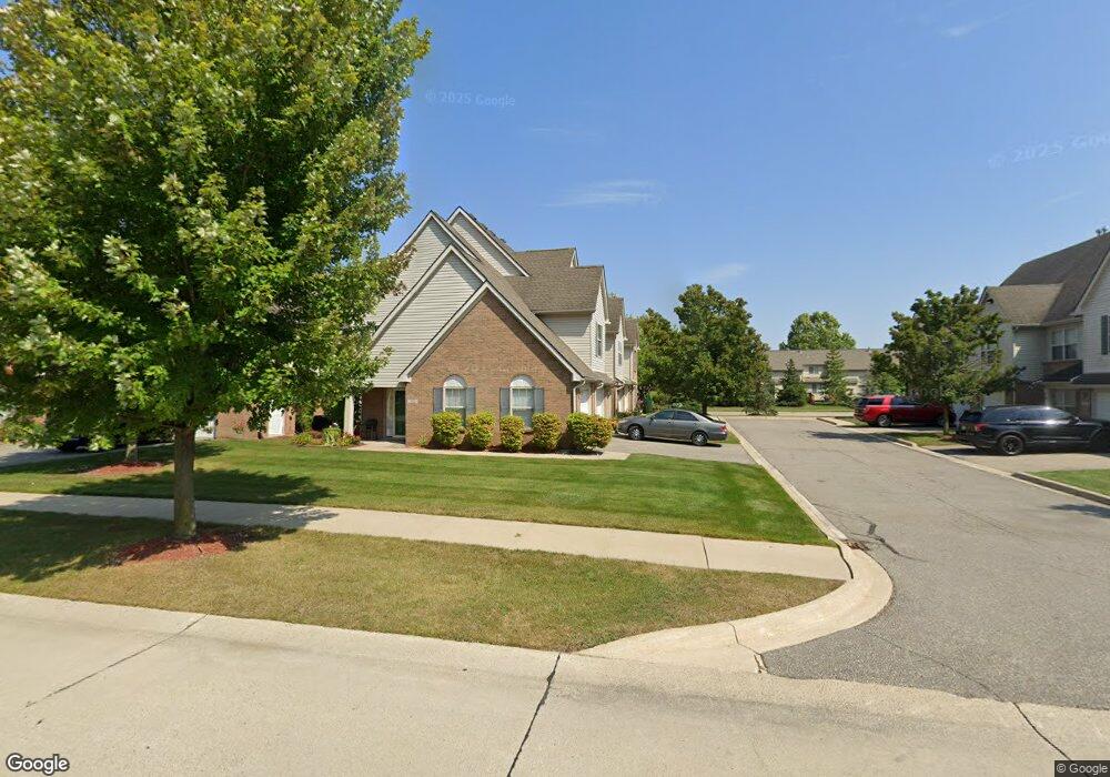
356 Brookfield Dr Unit 14 Westland, MI 48185
Estimated Value: $236,956 - $290,000
2
Beds
2
Baths
1,568
Sq Ft
$174/Sq Ft
Est. Value
About This Home
This home is located at 356 Brookfield Dr Unit 14, Westland, MI 48185 and is currently estimated at $272,989, approximately $174 per square foot. 356 Brookfield Dr Unit 14 is a home located in Wayne County with nearby schools including P.D. Graham Elementary School, Marshall Upper Elementary School, and Adlai Stevenson Middle School.
Ownership History
Date
Name
Owned For
Owner Type
Purchase Details
Closed on
Dec 16, 2010
Sold by
Przybyla Deborah
Bought by
Vacaru Aneta
Current Estimated Value
Purchase Details
Closed on
Nov 13, 2006
Sold by
Galaxy Builders Inc
Bought by
Przybyla Deborah
Purchase Details
Closed on
Nov 10, 2006
Sold by
Leverette Tinesha D
Bought by
Darzene Ii Llc
Create a Home Valuation Report for This Property
The Home Valuation Report is an in-depth analysis detailing your home's value as well as a comparison with similar homes in the area
Home Values in the Area
Average Home Value in this Area
Purchase History
| Date | Buyer | Sale Price | Title Company |
|---|---|---|---|
| Vacaru Aneta | $73,000 | Hometown One Title Agency Ll | |
| Przybyla Deborah | $165,780 | Greco | |
| Galaxy Builders Inc | $32,500 | None Available | |
| Darzene Ii Llc | -- | Greco |
Source: Public Records
Tax History Compared to Growth
Tax History
| Year | Tax Paid | Tax Assessment Tax Assessment Total Assessment is a certain percentage of the fair market value that is determined by local assessors to be the total taxable value of land and additions on the property. | Land | Improvement |
|---|---|---|---|---|
| 2025 | $1,918 | $105,400 | $0 | $0 |
| 2024 | $1,918 | $103,400 | $0 | $0 |
| 2023 | $1,832 | $94,300 | $0 | $0 |
| 2022 | $2,133 | $81,800 | $0 | $0 |
| 2021 | $2,079 | $76,400 | $0 | $0 |
| 2020 | $2,054 | $73,900 | $0 | $0 |
| 2019 | $1,982 | $69,900 | $0 | $0 |
| 2018 | $1,507 | $64,800 | $0 | $0 |
| 2017 | $709 | $63,900 | $0 | $0 |
| 2016 | $1,922 | $61,700 | $0 | $0 |
| 2015 | $3,731 | $56,690 | $0 | $0 |
| 2013 | $3,614 | $37,880 | $0 | $0 |
| 2012 | $1,737 | $38,140 | $0 | $0 |
Source: Public Records
Map
Nearby Homes
- 157 Carson Dr Unit 175
- 285 Brookfield Dr Unit 25
- 571 Summerfield Dr Unit 196
- 39194 Brookfield Dr Unit 182
- 39400 Cherry Hill Rd
- 151 Dawson Ct
- 127 S John Hix St
- 673 Ethan Dr
- 714 Autumn Ridge Dr Unit 64
- 336 Marigold Cir Unit 45
- 39615 Kirkland Dr
- 39635 Lotzford Rd
- 39214 Dillingham St
- 870 N Lotz Rd
- 172 N Bryar St
- 0 Cherry Hill Unit 16924
- 39279 Huron Pkwy
- 38386 Maes St
- 632 Georgetown St
- 170 Cherry Hill Pointe Dr
- 308 Brookfield Dr Unit 3
- 203 Carson Dr Unit 166
- 172 Carson Dr Unit 122
- 328 Brookfield Dr Unit 8
- 324 Brookfield Dr Unit 7
- 285 Carson Dr Unit 156
- 166 Carson Dr Unit 121
- 386 Brookfield Dr Unit 22
- 295 Carson Dr Unit 155
- 370 Brookfield Dr Unit 18
- 394 Brookfield Dr Unit 24
- 310 Carson Dr Unit 133
- 293 Brookfield Dr Unit 27
- 225 Carson Dr Unit 161
- 382 Brookfield Dr Unit 21
- 344 Brookfield Dr Unit 12
- 355 Carson Dr Unit 152
- 124 Carson Dr Unit 114
- 332 Brookfield Dr Unit 9
- 362 Brookfield Dr Unit 16