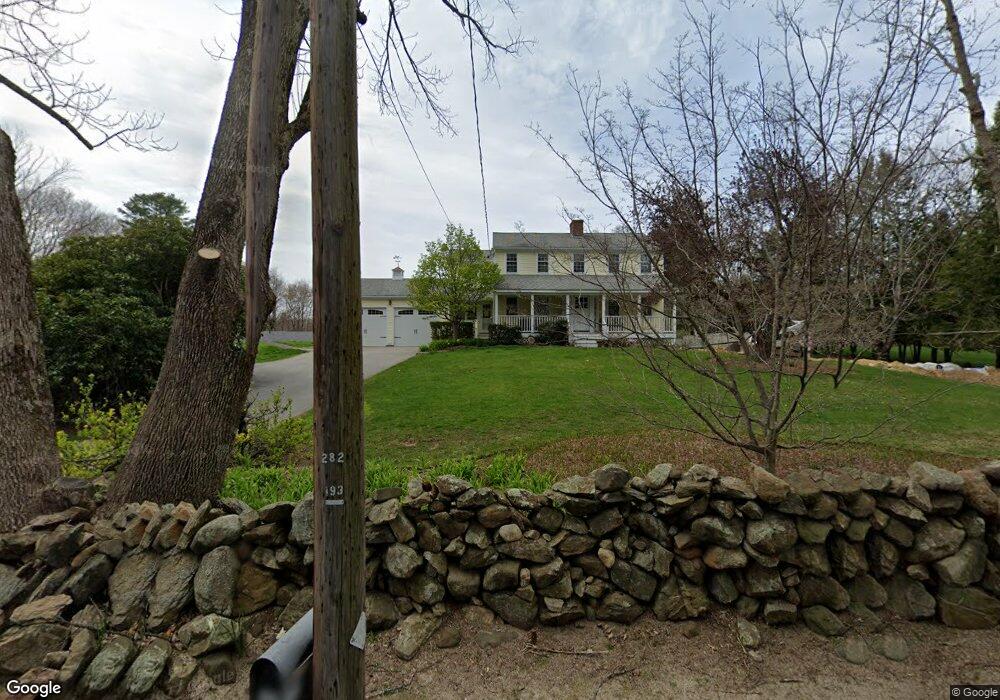
356 Main St Boxford, MA 01921
Estimated Value: $1,053,000 - $1,342,000
4
Beds
5
Baths
3,573
Sq Ft
$322/Sq Ft
Est. Value
About This Home
This home is located at 356 Main St, Boxford, MA 01921 and is currently estimated at $1,150,971, approximately $322 per square foot. 356 Main St is a home located in Essex County with nearby schools including Harry Lee Cole, Spofford Pond School, and Brooks School.
Ownership History
Date
Name
Owned For
Owner Type
Purchase Details
Closed on
Nov 1, 2012
Sold by
Miner Joshua F
Bought by
Miner Joshua F and Billis Jacqueline L
Current Estimated Value
Purchase Details
Closed on
Dec 8, 2009
Sold by
Miner 4Th Joshua L and Miner Mary B
Bought by
Miner Rt
Purchase Details
Closed on
Sep 8, 1988
Sold by
Hall Gerald E
Bought by
Miner Joshua L
Home Financials for this Owner
Home Financials are based on the most recent Mortgage that was taken out on this home.
Original Mortgage
$125,000
Interest Rate
10.43%
Mortgage Type
Purchase Money Mortgage
Create a Home Valuation Report for This Property
The Home Valuation Report is an in-depth analysis detailing your home's value as well as a comparison with similar homes in the area
Home Values in the Area
Average Home Value in this Area
Purchase History
| Date | Buyer | Sale Price | Title Company |
|---|---|---|---|
| Miner Joshua F | -- | -- | |
| Miner Rt | -- | -- | |
| Miner Joshua L | $280,000 | -- |
Source: Public Records
Mortgage History
| Date | Status | Borrower | Loan Amount |
|---|---|---|---|
| Previous Owner | Miner Joshua L | $250,000 | |
| Previous Owner | Miner Joshua L | $150,000 | |
| Previous Owner | Miner Joshua L | $125,000 |
Source: Public Records
Tax History
| Year | Tax Paid | Tax Assessment Tax Assessment Total Assessment is a certain percentage of the fair market value that is determined by local assessors to be the total taxable value of land and additions on the property. | Land | Improvement |
|---|---|---|---|---|
| 2025 | $13,223 | $983,100 | $400,300 | $582,800 |
| 2024 | $12,840 | $983,900 | $400,300 | $583,600 |
| 2023 | $11,073 | $800,100 | $357,600 | $442,500 |
| 2022 | $10,853 | $713,100 | $298,400 | $414,700 |
| 2021 | $10,373 | $647,900 | $271,300 | $376,600 |
| 2020 | $10,380 | $641,900 | $271,300 | $370,600 |
| 2019 | $10,204 | $626,800 | $258,300 | $368,500 |
| 2018 | $9,602 | $592,700 | $258,300 | $334,400 |
| 2017 | $9,377 | $574,900 | $246,000 | $328,900 |
| 2016 | $9,101 | $552,900 | $246,000 | $306,900 |
| 2015 | $8,575 | $536,300 | $246,000 | $290,300 |
Source: Public Records
Map
Nearby Homes
- 590 Foster St
- 427b Ipswich Rd
- Lot 10 Stonecleave Rd
- 499 Main St
- 94 Lawrence Rd
- Lot 2 (31) Lawrence Rd
- 94 Boxford St
- 50 Boxford St
- 534 Ipswich Rd
- 24 Appleton Ln
- 122 Forest St
- Lot B Willow Ave
- 71 Regency Place
- 65 Saile Way
- 674 Salem St
- 61 Abbott St
- 626 Forest St
- 445 Salem St
- 224 Raleigh Tavern Ln
- 335 Salem St
Your Personal Tour Guide
Ask me questions while you tour the home.