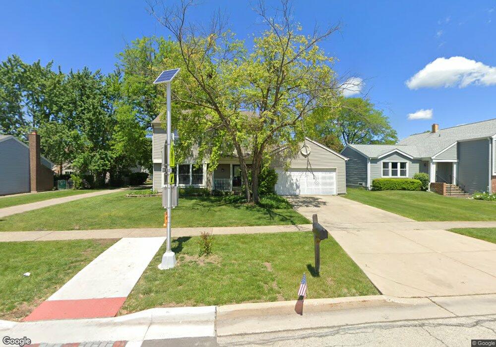
356 N Walnut Ln Schaumburg, IL 60194
West Schaumburg NeighborhoodEstimated Value: $476,711 - $511,000
3
Beds
3
Baths
1,840
Sq Ft
$270/Sq Ft
Est. Value
About This Home
This home is located at 356 N Walnut Ln, Schaumburg, IL 60194 and is currently estimated at $497,428, approximately $270 per square foot. 356 N Walnut Ln is a home located in Cook County with nearby schools including Elizabeth Blackwell Elementary School, Jane Addams Junior High School, and Schaumburg High School.
Ownership History
Date
Name
Owned For
Owner Type
Purchase Details
Closed on
Feb 18, 1998
Sold by
Corus Bank Na
Bought by
Abrams Barbara H
Current Estimated Value
Home Financials for this Owner
Home Financials are based on the most recent Mortgage that was taken out on this home.
Original Mortgage
$113,700
Interest Rate
7.06%
Create a Home Valuation Report for This Property
The Home Valuation Report is an in-depth analysis detailing your home's value as well as a comparison with similar homes in the area
Home Values in the Area
Average Home Value in this Area
Purchase History
| Date | Buyer | Sale Price | Title Company |
|---|---|---|---|
| Abrams Barbara H | -- | -- |
Source: Public Records
Mortgage History
| Date | Status | Borrower | Loan Amount |
|---|---|---|---|
| Previous Owner | Abrams Barbara H | $113,700 |
Source: Public Records
Tax History Compared to Growth
Tax History
| Year | Tax Paid | Tax Assessment Tax Assessment Total Assessment is a certain percentage of the fair market value that is determined by local assessors to be the total taxable value of land and additions on the property. | Land | Improvement |
|---|---|---|---|---|
| 2024 | $5,119 | $36,000 | $6,175 | $29,825 |
| 2023 | $5,121 | $36,000 | $6,175 | $29,825 |
| 2022 | $5,121 | $36,000 | $6,175 | $29,825 |
| 2021 | $5,564 | $30,105 | $4,225 | $25,880 |
| 2020 | $7,304 | $30,105 | $4,225 | $25,880 |
| 2019 | $7,312 | $33,451 | $4,225 | $29,226 |
| 2018 | $5,683 | $30,104 | $3,575 | $26,529 |
| 2017 | $5,495 | $30,104 | $3,575 | $26,529 |
| 2016 | $6,023 | $30,104 | $3,575 | $26,529 |
| 2015 | $6,872 | $27,467 | $3,087 | $24,380 |
| 2014 | $6,636 | $27,467 | $3,087 | $24,380 |
| 2013 | $6,619 | $27,467 | $3,087 | $24,380 |
Source: Public Records
Map
Nearby Homes
- 413 Linsey Ave
- 508 N Walnut Ln
- 569 N Walnut Ln
- 454 Willington Dr
- 133 White Branch Ct S Unit 539
- 2317 Broadway Ln
- 2312 Hyde Ct
- 198 Camden Ct Unit Z2
- 741 N Walnut Ln
- 8 Warwick Ct
- 2216 Andover Ct
- 2342 Hamilton Place
- 1968 Quaker Hollow Ln Unit 12
- 604 N Brookdale Dr
- 1924 Quaker Hollow Ln Unit 14
- 1916 Quaker Hollow Ln Unit 14
- 808 Bishop Ct Unit 2
- 1939 Weston Ln
- 100 Waban Ct
- 135 S Walnut Ln
- 364 N Walnut Ln
- 348 N Walnut Ln
- 2163 Hitching Post Ln
- 2157 Hitching Post Ln
- 372 N Walnut Ln
- 2169 Hitching Post Ln
- 340 N Walnut Ln
- 2151 Hitching Post Ln
- 2177 Hitching Post Ln
- 380 N Walnut Ln
- 2145 Hitching Post Ln
- 325 Continental Ln
- 332 N Walnut Ln
- 2185 Hitching Post Ln
- 2168 Hitching Post Ln
- 2160 Hitching Post Ln
- 388 N Walnut Ln
- 2152 Hitching Post Ln
- 324 N Walnut Ln
- 2139 Hitching Post Ln