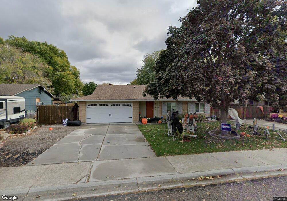
3564 Shamrock St Boise, ID 83713
West Boise NeighborhoodEstimated Value: $401,000 - $415,000
3
Beds
2
Baths
1,344
Sq Ft
$303/Sq Ft
Est. Value
About This Home
This home is located at 3564 Shamrock St, Boise, ID 83713 and is currently estimated at $407,151, approximately $302 per square foot. 3564 Shamrock St is a home located in Ada County with nearby schools including Frontier Elementary School, Lowell Scott Middle School, and Centennial High School.
Ownership History
Date
Name
Owned For
Owner Type
Purchase Details
Closed on
Apr 4, 2014
Sold by
Ocepek Patricia A
Bought by
Maben Troy Dean and Maben Sue Anne
Current Estimated Value
Home Financials for this Owner
Home Financials are based on the most recent Mortgage that was taken out on this home.
Original Mortgage
$98,000
Interest Rate
4.3%
Mortgage Type
Seller Take Back
Purchase Details
Closed on
Oct 28, 1998
Sold by
Wright Colt M
Bought by
Ocepek Patricia A
Home Financials for this Owner
Home Financials are based on the most recent Mortgage that was taken out on this home.
Original Mortgage
$94,900
Interest Rate
6.6%
Mortgage Type
Purchase Money Mortgage
Create a Home Valuation Report for This Property
The Home Valuation Report is an in-depth analysis detailing your home's value as well as a comparison with similar homes in the area
Home Values in the Area
Average Home Value in this Area
Purchase History
| Date | Buyer | Sale Price | Title Company |
|---|---|---|---|
| Maben Troy Dean | -- | Titleone Boise | |
| Ocepek Patricia A | -- | Alliance Title Company |
Source: Public Records
Mortgage History
| Date | Status | Borrower | Loan Amount |
|---|---|---|---|
| Closed | Maben Troy Dean | $98,000 | |
| Previous Owner | Ocepek Patricia A | $94,900 |
Source: Public Records
Tax History Compared to Growth
Tax History
| Year | Tax Paid | Tax Assessment Tax Assessment Total Assessment is a certain percentage of the fair market value that is determined by local assessors to be the total taxable value of land and additions on the property. | Land | Improvement |
|---|---|---|---|---|
| 2025 | $1,390 | $356,300 | -- | -- |
| 2024 | $1,454 | $335,200 | -- | -- |
| 2023 | $1,454 | $333,900 | $0 | $0 |
| 2022 | $1,754 | $384,800 | $0 | $0 |
| 2021 | $1,564 | $303,400 | $0 | $0 |
| 2020 | $1,316 | $232,000 | $0 | $0 |
| 2019 | $1,478 | $215,400 | $0 | $0 |
| 2018 | $1,310 | $184,400 | $0 | $0 |
| 2017 | $1,249 | $165,400 | $0 | $0 |
| 2016 | $1,104 | $142,700 | $0 | $0 |
| 2015 | $1,011 | $132,900 | $0 | $0 |
| 2012 | -- | $89,400 | $0 | $0 |
Source: Public Records
Map
Nearby Homes
- 11143 W Ramrod Dr
- 11175 W Hinsdale St
- 11000 W Ramrod Dr
- 3958 N Bryson Way
- 3552 N Covered Wagon Way
- 10992 W Musket Dr
- 11900 W Ramrod Dr
- 11266 W Race Ct
- 11288 W Race Ct
- 3860 N Elgin Way
- 10974 W Edna St
- 12116 W Musket Dr
- 12137 W Ginger Creek Dr
- 12159 W Ginger Creek Dr
- 12169 W Ginger Creek Dr
- 12153 W Ginger Creek Dr
- 11301 W Goldenrod Ave
- 12123 W Ginger Creek Dr
- Plan 2301 at Mooseland
- Plan 2800 at Mooseland
- 3592 N Shamrock Ave
- 3592 Shamrock St
- 3536 Shamrock St
- 3595 Chuckwagon Ave
- 3619 Chuckwagon Ave
- 3571 Chuckwagon Ave
- 3593 Shamrock St
- 3537 Shamrock St
- 3620 Shamrock St
- 3508 Shamrock St
- 3547 N Chuckwagon Ave
- 3547 Chuckwagon Ave
- 3643 Chuckwagon Ave
- 3621 Shamrock St
- 11327 Cartridge St
- 3480 Shamrock St
- 11383 Powderhorn St
- 3570 Chuckwagon Ave
- 3594 Bryson Way
- 11431 W Ramrod Dr