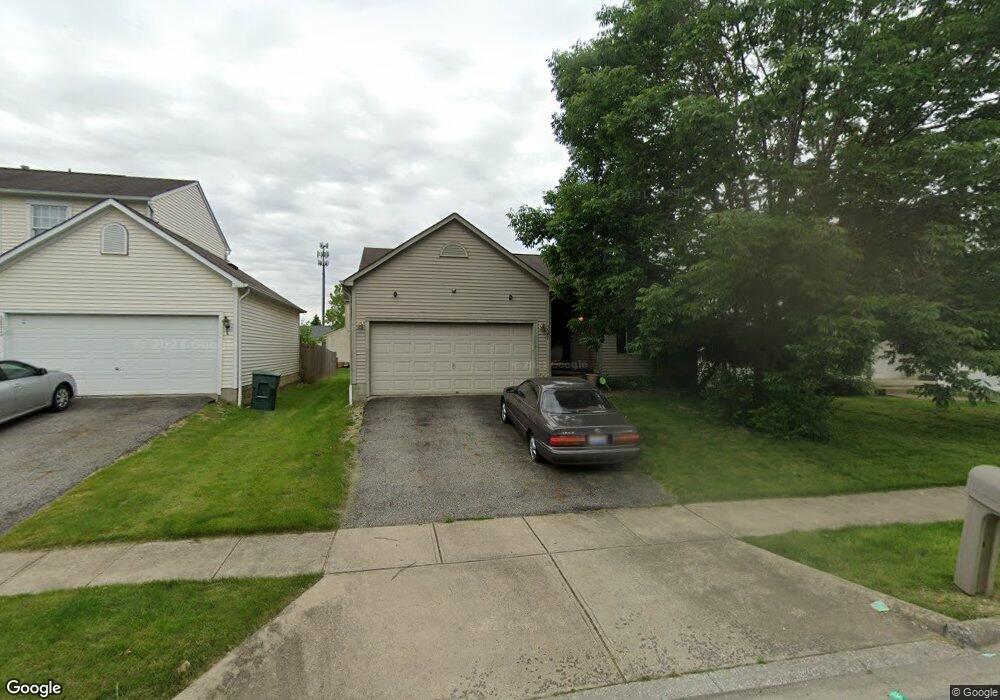
3567 Delport Way Columbus, OH 43232
Glenbrook NeighborhoodEstimated Value: $254,899 - $287,000
3
Beds
2
Baths
1,252
Sq Ft
$215/Sq Ft
Est. Value
About This Home
This home is located at 3567 Delport Way, Columbus, OH 43232 and is currently estimated at $269,725, approximately $215 per square foot. 3567 Delport Way is a home located in Franklin County with nearby schools including Groveport Madison High School, Eastland Preparatory Academy, and Millennium Community School.
Ownership History
Date
Name
Owned For
Owner Type
Purchase Details
Closed on
Mar 31, 1999
Sold by
Dominion Homes Inc
Bought by
Ennis Pamela L
Current Estimated Value
Home Financials for this Owner
Home Financials are based on the most recent Mortgage that was taken out on this home.
Original Mortgage
$110,430
Outstanding Balance
$27,614
Interest Rate
6.89%
Mortgage Type
FHA
Estimated Equity
$242,111
Create a Home Valuation Report for This Property
The Home Valuation Report is an in-depth analysis detailing your home's value as well as a comparison with similar homes in the area
Home Values in the Area
Average Home Value in this Area
Purchase History
| Date | Buyer | Sale Price | Title Company |
|---|---|---|---|
| Ennis Pamela L | $131,600 | Alliance Title |
Source: Public Records
Mortgage History
| Date | Status | Borrower | Loan Amount |
|---|---|---|---|
| Open | Ennis Pamela L | $110,430 |
Source: Public Records
Tax History Compared to Growth
Tax History
| Year | Tax Paid | Tax Assessment Tax Assessment Total Assessment is a certain percentage of the fair market value that is determined by local assessors to be the total taxable value of land and additions on the property. | Land | Improvement |
|---|---|---|---|---|
| 2024 | $2,670 | $72,770 | $21,000 | $51,770 |
| 2023 | $2,671 | $72,765 | $21,000 | $51,765 |
| 2022 | $1,614 | $40,710 | $6,090 | $34,620 |
| 2021 | $1,619 | $40,710 | $6,090 | $34,620 |
| 2020 | $1,621 | $40,710 | $6,090 | $34,620 |
| 2019 | $1,390 | $33,260 | $4,870 | $28,390 |
| 2018 | $1,529 | $33,260 | $4,870 | $28,390 |
| 2017 | $1,403 | $33,260 | $4,870 | $28,390 |
| 2016 | $1,641 | $34,940 | $7,250 | $27,690 |
| 2015 | $1,658 | $34,940 | $7,250 | $27,690 |
| 2014 | $1,677 | $34,940 | $7,250 | $27,690 |
| 2013 | $751 | $36,785 | $7,630 | $29,155 |
Source: Public Records
Map
Nearby Homes
- 3111 Briar Ridge Rd
- 3059 Remington Ridge Rd
- 2964 Askins Rd
- 3130 Marwick Rd
- 2835 Schwartz Rd
- 2979 Lake Park Dr
- 2825 S Hampton Rd
- 3114 Wessex Ct
- 3075 Wessex Ct
- 0 Wessex Ct
- 3471 Marlin Dr
- 3847 Lamarque Ct Unit 18-F
- 4479 Gerling Blvd
- 3806 Charbonnett Ct
- 3499 S Hamilton Rd
- 2410 Clarkston Ln
- 2503 Burgandy Ln Unit 46A
- 4468 Reinbeau Dr
- 4496 Reinbeau Dr
- 3887 Highland Bluff Dr
- 3561 Delport Way
- 3573 Delport Way
- 3555 Delport Way
- 3568 Delport Way
- 3562 Delport Way
- 3574 Delport Way
- 3551 Delport Way
- 3113 Westaire Ct
- 3100 Westaire Ct
- 3094 Westaire Ct
- 3556 Delport Way
- 3106 Westaire Ct
- 3088 Noelle Ct
- 3069 Noelle Ct
- 3550 Delport Way
- 3082 Noelle Ct
- 3124 Westaire Ct
- 3112 Westaire Ct
- 3076 Noelle Ct
- 3063 Noelle Ct