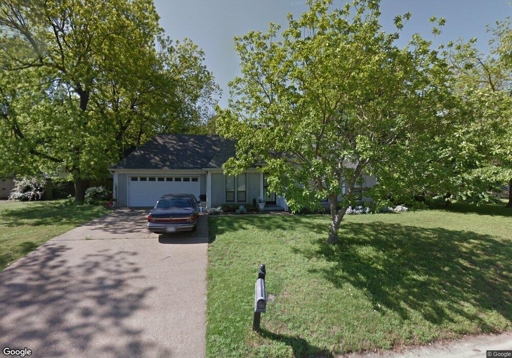
357 Shady Grove Dr Hernando, MS 38632
Estimated Value: $261,000 - $290,000
3
Beds
2
Baths
1,800
Sq Ft
$155/Sq Ft
Est. Value
About This Home
This home is located at 357 Shady Grove Dr, Hernando, MS 38632 and is currently estimated at $279,220, approximately $155 per square foot. 357 Shady Grove Dr is a home located in DeSoto County with nearby schools including Oak Grove Central Elementary School, Hernando Elementary School, and Hernando Hills Elementary.
Ownership History
Date
Name
Owned For
Owner Type
Purchase Details
Closed on
Dec 21, 2023
Sold by
Lannom Jean Harness
Bought by
Agner Claire D and Agner Josh
Current Estimated Value
Home Financials for this Owner
Home Financials are based on the most recent Mortgage that was taken out on this home.
Original Mortgage
$213,750
Outstanding Balance
$197,835
Interest Rate
7.5%
Mortgage Type
New Conventional
Estimated Equity
$81,385
Create a Home Valuation Report for This Property
The Home Valuation Report is an in-depth analysis detailing your home's value as well as a comparison with similar homes in the area
Home Values in the Area
Average Home Value in this Area
Purchase History
| Date | Buyer | Sale Price | Title Company |
|---|---|---|---|
| Agner Claire D | -- | None Listed On Document | |
| Agner Claire D | -- | None Listed On Document |
Source: Public Records
Mortgage History
| Date | Status | Borrower | Loan Amount |
|---|---|---|---|
| Open | Agner Claire D | $213,750 |
Source: Public Records
Tax History
| Year | Tax Paid | Tax Assessment Tax Assessment Total Assessment is a certain percentage of the fair market value that is determined by local assessors to be the total taxable value of land and additions on the property. | Land | Improvement |
|---|---|---|---|---|
| 2025 | $3,071 | $26,363 | $3,750 | $22,613 |
| 2024 | $1,799 | $12,970 | $2,500 | $10,470 |
| 2023 | $1,799 | $12,133 | $0 | $0 |
| 2022 | $643 | $12,133 | $2,500 | $9,633 |
| 2021 | $643 | $12,133 | $2,500 | $9,633 |
| 2020 | $643 | $12,133 | $0 | $0 |
| 2019 | $643 | $12,133 | $2,500 | $9,633 |
| 2017 | $598 | $21,072 | $11,786 | $9,286 |
| 2016 | $573 | $11,786 | $2,500 | $9,286 |
| 2015 | $1,575 | $21,072 | $11,786 | $9,286 |
| 2014 | $559 | $11,786 | $0 | $0 |
| 2013 | $551 | $11,786 | $0 | $0 |
Source: Public Records
Map
Nearby Homes
- 186 E South St
- 0 E Commerce St
- 5 W Commerce St
- 665 Cedar Grove Cove
- 2833 Mount Pleasant S
- 2035 Highway 51 S
- 1705 Cedar Lake Cove
- 120 N Parkway St
- 285 Northwood Hills Dr
- 1335 Creekside Blvd
- 136 N Parkway St
- 2365 Mason Dr
- 69 Lake Pointe Dr
- 1 E Oak Grove Rd
- 187 Cross Creek Dr
- 1231 Cross Creek Dr E
- 1280 S Lake Dr
- 5188 Reserve Way
- 2197 Hyacinth Ln
- 3066 Meadows Way
- 377 Shady Grove Dr
- 337 Shady Grove Dr
- 2183 Pleasant Grove Dr
- 350 E Robinson St
- 356 Shady Grove Dr
- 374 Shady Grove Dr
- 2163 Pleasant Grove Dr
- 323 Shady Grove Dr
- 338 Shady Grove Dr
- 368 E Robinson St
- 595 W Robinson St
- 390 Shady Grove Dr
- 320 Shady Grove Dr
- 384 E Robinson St
- 384 E Robinson St
- 407 Shady Grove Dr
- 2158 Pleasant Grove Dr
- 2164 Pleasant Grove Dr
- 2172 Pleasant Grove Dr
- 418 Shady Grove Dr
Your Personal Tour Guide
Ask me questions while you tour the home.