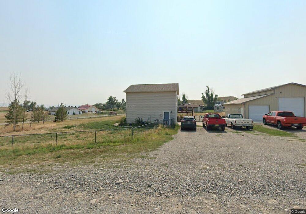
3570 Clint Rd Billings, MT 59105
Billings Heights NeighborhoodEstimated Value: $401,000 - $447,000
4
Beds
2
Baths
3,288
Sq Ft
$128/Sq Ft
Est. Value
About This Home
This home is located at 3570 Clint Rd, Billings, MT 59105 and is currently estimated at $420,417, approximately $127 per square foot. 3570 Clint Rd is a home located in Yellowstone County with nearby schools including Independent Elementary School, Castle Rock Junior High School, and Skyview High School.
Ownership History
Date
Name
Owned For
Owner Type
Purchase Details
Closed on
Sep 10, 2021
Sold by
Barman Brenda and Hallsted Brenda
Bought by
Barman Brenda and Barman Eric
Current Estimated Value
Home Financials for this Owner
Home Financials are based on the most recent Mortgage that was taken out on this home.
Original Mortgage
$276,760
Outstanding Balance
$252,754
Interest Rate
3.05%
Mortgage Type
FHA
Estimated Equity
$167,663
Purchase Details
Closed on
Aug 9, 2016
Sold by
Poor Tara J
Bought by
Hallsted Brenda
Home Financials for this Owner
Home Financials are based on the most recent Mortgage that was taken out on this home.
Original Mortgage
$269,037
Interest Rate
3.43%
Purchase Details
Closed on
Jul 30, 2007
Sold by
Croy Guy A and Croy Shelbie C
Bought by
Poor Eric and Poor Tara J
Home Financials for this Owner
Home Financials are based on the most recent Mortgage that was taken out on this home.
Original Mortgage
$169,600
Interest Rate
6.73%
Mortgage Type
Unknown
Create a Home Valuation Report for This Property
The Home Valuation Report is an in-depth analysis detailing your home's value as well as a comparison with similar homes in the area
Home Values in the Area
Average Home Value in this Area
Purchase History
| Date | Buyer | Sale Price | Title Company |
|---|---|---|---|
| Barman Brenda | -- | Old Republic Title | |
| Hallsted Brenda | $316,500 | -- | |
| Poor Eric | -- | None Available |
Source: Public Records
Mortgage History
| Date | Status | Borrower | Loan Amount |
|---|---|---|---|
| Open | Barman Brenda | $276,760 | |
| Closed | Hallsted Brenda | $269,037 | |
| Closed | Hallsted Brenda | -- | |
| Previous Owner | Poor Eric | $169,600 |
Source: Public Records
Tax History
| Year | Tax Paid | Tax Assessment Tax Assessment Total Assessment is a certain percentage of the fair market value that is determined by local assessors to be the total taxable value of land and additions on the property. | Land | Improvement |
|---|---|---|---|---|
| 2025 | $2,595 | $385,200 | $74,048 | $311,152 |
| 2024 | $2,595 | $345,800 | $58,859 | $286,941 |
| 2023 | $2,642 | $345,800 | $58,859 | $286,941 |
| 2022 | $2,034 | $281,600 | $0 | $0 |
| 2021 | $2,511 | $281,600 | $0 | $0 |
| 2020 | $2,208 | $271,800 | $0 | $0 |
| 2019 | $2,220 | $271,800 | $0 | $0 |
| 2018 | $2,138 | $240,300 | $0 | $0 |
| 2017 | $2,147 | $240,300 | $0 | $0 |
| 2016 | $2,003 | $240,200 | $0 | $0 |
| 2015 | $1,889 | $240,200 | $0 | $0 |
| 2014 | $1,678 | $108,332 | $0 | $0 |
Source: Public Records
Map
Nearby Homes
- 2719 Strapper Ln
- 2737 Strapper Ln
- 2738 Strapper Ln
- 2743 Strapper Ln
- 2731 Strapper Ln
- 1709 Oxbow Cir
- 1395 W Eugene Ave
- 2647 Palmer Ln
- 2635 Palmer Ln
- 2623 Palmer Ln
- 2624 Palmer Ln
- 2617 Palmer Ln
- 1384 W Eugene Ave
- 1385 W Eugene Ave
- 2618 Palmer Ln
- 2629 Palmer Ln
- 2648 Palmer Ln
- 2641 Palmer Ln
- 1365 W Eugene Ave
- 2611 Palmer Ln
- 1819 Wagon Wheel Rd
- 3608 Clint Rd
- 3550 Clint Rd
- 1801 Wagon Wheel Rd
- 1800 Wagon Wheel Rd
- 3622 Clint Rd
- 3555 Clint Rd
- 3536 Clint Rd
- 1728 Wagon Wheel Rd
- 3537 Clint Rd
- 3608 Stampede Trail
- 0 Stampede Trail
- 3527 Clint Rd
- 3526 Clint Rd
- 3632 Clint Rd
- 3621 Clint Rd
- 3618 Stampede Trail
- NHN Stampede Trail
- 3507 Us Highway 312
- 3639 Stampede Trail
Your Personal Tour Guide
Ask me questions while you tour the home.