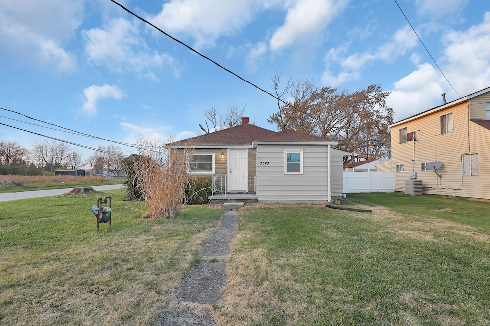
3570 Dover Rd Columbus, OH 43204
Estimated payment $1,235/month
Highlights
- No HOA
- 1-Story Property
- Forced Air Heating System
- 2 Car Detached Garage
About This Home
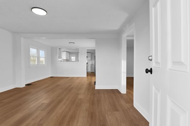
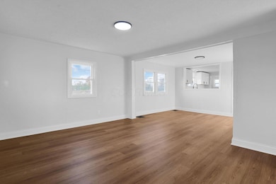
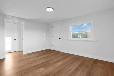
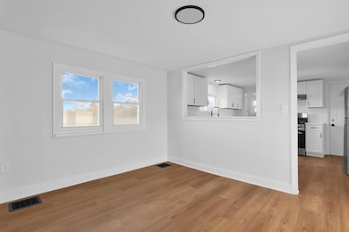
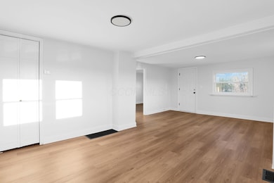
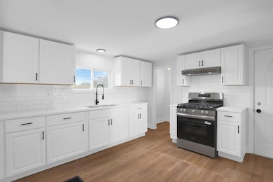
Come and see this updated and move-in ready property! This home features a fully updated kitchen with modern finishes, an updated bathroom, fresh paint, and new flooring throughout.
Home Details
Home Type
- Single Family
Est. Annual Taxes
- $1,623
Year Built
- Built in 1949
Lot Details
- 0.25 Acre Lot
Parking
- 2 Car Detached Garage
- Garage Door Opener
Home Design
- Block Foundation
Interior Spaces
- 940 Sq Ft Home
- 1-Story Property
- Basement
Bedrooms and Bathrooms
- 3 Main Level Bedrooms
- 1 Full Bathroom
Utilities
- Forced Air Heating System
- Heating System Uses Gas
- Well
Community Details
- No Home Owners Association
Listing and Financial Details
- Assessor Parcel Number 140-001920
Map
Home Values in the Area
Average Home Value in this Area
Tax History
| Year | Tax Paid | Tax Assessment Tax Assessment Total Assessment is a certain percentage of the fair market value that is determined by local assessors to be the total taxable value of land and additions on the property. | Land | Improvement |
|---|---|---|---|---|
| 2024 | $1,623 | $31,820 | $9,770 | $22,050 |
| 2023 | $1,614 | $31,815 | $9,765 | $22,050 |
| 2022 | $1,721 | $23,320 | $4,520 | $18,800 |
| 2021 | $1,635 | $23,320 | $4,520 | $18,800 |
| 2020 | $1,632 | $23,320 | $4,520 | $18,800 |
| 2019 | $1,434 | $18,380 | $3,640 | $14,740 |
| 2018 | $1,561 | $21,210 | $3,640 | $17,570 |
| 2017 | $1,613 | $21,210 | $3,640 | $17,570 |
| 2016 | $1,587 | $19,250 | $3,920 | $15,330 |
| 2015 | $1,473 | $19,250 | $3,920 | $15,330 |
| 2014 | $1,474 | $19,250 | $3,920 | $15,330 |
| 2013 | $804 | $21,385 | $4,340 | $17,045 |
Property History
| Date | Event | Price | List to Sale | Price per Sq Ft |
|---|---|---|---|---|
| 11/22/2025 11/22/25 | For Sale | $209,900 | -- | $223 / Sq Ft |
Purchase History
| Date | Type | Sale Price | Title Company |
|---|---|---|---|
| Warranty Deed | $135,000 | Axxis Title Agency | |
| Executors Deed | $42,500 | Chase Title | |
| Deed | $48,000 | -- | |
| Deed | $29,900 | -- | |
| Deed | -- | -- |
Mortgage History
| Date | Status | Loan Amount | Loan Type |
|---|---|---|---|
| Open | $174,100 | Construction | |
| Previous Owner | $42,500 | Purchase Money Mortgage |
Source: Columbus and Central Ohio Regional MLS
MLS Number: 225043910
APN: 140-001920
Disclaimer: Certain information contained herein is derived from information provided by parties other than Homes.com. All information provided is deemed reliable, but is not guaranteed to be accurate and should be independently verified.
![]() IDX information is provided exclusively for personal, non-commercial use, and may not be used for any purpose other than to identify prospective properties consumers may be interested in purchasing.
IDX information is provided exclusively for personal, non-commercial use, and may not be used for any purpose other than to identify prospective properties consumers may be interested in purchasing.
Information is deemed reliable but not guaranteed.
- 3757 Gibbstone Dr
- 3761 Gibbstone Dr
- 3254 Dover Rd
- 3252 Dover Rd
- 1272 Deer Lake Ct
- 1150 Romona Place
- 0 Lowell Dr Unit 223009270
- 4106 Ongaro Dr
- 4000 Sandy Ridge Dr
- 3495 La Coste Ln
- 664 N Wilson Rd
- 3307 Rudon Ln
- 3161 Bowdoin Cir
- 1664 Demaret Ln
- 2875 Lowell Dr
- 355-357 N Algonquin Ave
- 2051 Tuckaway Ct
- 4457 Nickerson Rd
- 4451 Sherwill Rd
- 527 N Hague Ave
- 1248 Warble Dr
- 3400 Twin Creeks Dr
- 3733 Gibbstone Dr
- 3691 Windward Way
- 3886 Farm Brook Ln
- 1655 Gilmore Park Ave
- 4441 Trabue Rd
- 3160 Donny Cove Place
- 1104 Mullens Ct
- 2900 Angelo Joseph Ln
- 169 N Wilson Rd
- 3255 Mckinley Ave
- 1199 Onaway Ct
- 1480 Runaway Bay Dr
- 2828 Marblevista Blvd
- 3080 Steele Ave
- 2211 Dublin Rd
- 2299 River Oaks Dr
- 3333 W Broad St Unit Apartment 19
- 2791 Hopper Way
