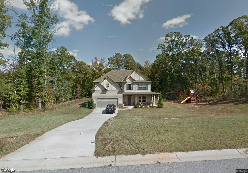
358 Brandish Dr Newnan, GA 30263
Estimated Value: $391,391 - $462,000
4
Beds
3
Baths
2,726
Sq Ft
$159/Sq Ft
Est. Value
About This Home
This home is located at 358 Brandish Dr, Newnan, GA 30263 and is currently estimated at $432,098, approximately $158 per square foot. 358 Brandish Dr is a home located in Coweta County with nearby schools including Atkinson Elementary School, Smokey Road Middle School, and Newnan High School.
Ownership History
Date
Name
Owned For
Owner Type
Purchase Details
Closed on
Dec 14, 2007
Sold by
Jeff Lindsey Communities Inc
Bought by
Donato Michael J and Masrob Christine
Current Estimated Value
Home Financials for this Owner
Home Financials are based on the most recent Mortgage that was taken out on this home.
Original Mortgage
$29,000
Outstanding Balance
$18,270
Interest Rate
6.21%
Mortgage Type
New Conventional
Estimated Equity
$413,828
Purchase Details
Closed on
Jun 6, 2007
Sold by
David Lindsey Homes Inc
Bought by
Jeff Lindsey Communities Inc
Purchase Details
Closed on
Nov 8, 2005
Sold by
Scott Neely Construction Inc
Bought by
David Lindsey Homes Inc
Purchase Details
Closed on
Nov 30, 1986
Sold by
Robertson Carl A
Bought by
Robertson Carl A
Create a Home Valuation Report for This Property
The Home Valuation Report is an in-depth analysis detailing your home's value as well as a comparison with similar homes in the area
Home Values in the Area
Average Home Value in this Area
Purchase History
| Date | Buyer | Sale Price | Title Company |
|---|---|---|---|
| Donato Michael J | $193,700 | -- | |
| Jeff Lindsey Communities Inc | $416,900 | -- | |
| David Lindsey Homes Inc | $1,829,000 | -- | |
| Robertson Carl A | $202,000 | -- |
Source: Public Records
Mortgage History
| Date | Status | Borrower | Loan Amount |
|---|---|---|---|
| Open | Donato Michael J | $29,000 |
Source: Public Records
Tax History Compared to Growth
Tax History
| Year | Tax Paid | Tax Assessment Tax Assessment Total Assessment is a certain percentage of the fair market value that is determined by local assessors to be the total taxable value of land and additions on the property. | Land | Improvement |
|---|---|---|---|---|
| 2024 | $3,519 | $151,596 | $24,000 | $127,596 |
| 2023 | $3,519 | $147,378 | $20,000 | $127,378 |
| 2022 | $2,990 | $121,382 | $20,000 | $101,382 |
| 2021 | $2,819 | $107,069 | $12,000 | $95,069 |
| 2020 | $2,838 | $107,069 | $12,000 | $95,069 |
| 2019 | $2,667 | $91,112 | $16,000 | $75,112 |
| 2018 | $2,671 | $91,112 | $16,000 | $75,112 |
| 2017 | $2,624 | $89,515 | $12,000 | $77,515 |
| 2016 | $2,262 | $78,098 | $12,000 | $66,098 |
| 2015 | $2,223 | $78,098 | $12,000 | $66,098 |
| 2014 | $1,832 | $72,090 | $12,000 | $60,090 |
Source: Public Records
Map
Nearby Homes
- 46 Brandish Dr
- 23 Corn Crib Ct
- 23 Corn Crib Dr
- 140 Beverly Park Ct
- 110 Corn Row Ct
- 135 Widgeon Dr
- 1967 Corinth Rd
- 1756 Millard Farmer Rd
- 972 Earl Rd N
- 130 Mallard Dr
- 58 Bailey Dr
- 31 Festiva Dr
- 0 Meadowsweet Ln Unit 10582479
- 25 Bailey Dr
- 75 Davis McLendon Way
- 68 Timberland Trail
- 56 Fox Hollow Run
- 0 Smokey Rd Unit 10495165
- 0000 Smokey Rd
- LOT 1 Joe Roberts Rd
- 380 Brandish Dr
- 334 Brandish Dr
- 353 Brandish Dr
- 367 Brandish Dr
- 292 Brandish Dr
- 224 Brandish Dr
- 224 Brandish Dr Unit B-52
- 190 Brandish Dr
- 325 Brandish Dr
- 178 Brandish Dr
- 394 Brandish Dr
- 397 Brandish Dr
- 391 Brandish Dr
- 295 Brandish Dr
- 281 Brandish Dr
- 309 Brandish Dr
- 152 Brandish Dr
- 162 Brandish Dr
- 0 Brandish Dr Unit 8932596
- 0 Brandish Dr Unit 3138396