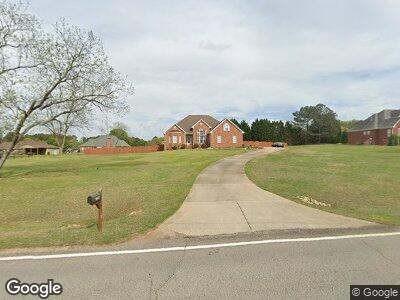
358 Brannan Rd McDonough, GA 30253
Estimated Value: $391,660 - $423,000
4
Beds
2
Baths
2,552
Sq Ft
$158/Sq Ft
Est. Value
About This Home
This home is located at 358 Brannan Rd, McDonough, GA 30253 and is currently estimated at $402,915, approximately $157 per square foot. 358 Brannan Rd is a home located in Henry County with nearby schools including Union Grove Middle School, Union Grove High School, and Hickory Flat Elementary School.
Ownership History
Date
Name
Owned For
Owner Type
Purchase Details
Closed on
Jul 31, 2019
Sold by
Dunn Robert J
Bought by
Slade Cheryl Ann
Current Estimated Value
Home Financials for this Owner
Home Financials are based on the most recent Mortgage that was taken out on this home.
Original Mortgage
$240,350
Interest Rate
3.7%
Mortgage Type
New Conventional
Purchase Details
Closed on
Jun 27, 2002
Sold by
Hillside Hms Inc
Bought by
Dunn Robert J and Dunn Jennifer L
Home Financials for this Owner
Home Financials are based on the most recent Mortgage that was taken out on this home.
Original Mortgage
$171,200
Interest Rate
6.79%
Mortgage Type
New Conventional
Create a Home Valuation Report for This Property
The Home Valuation Report is an in-depth analysis detailing your home's value as well as a comparison with similar homes in the area
Home Values in the Area
Average Home Value in this Area
Purchase History
| Date | Buyer | Sale Price | Title Company |
|---|---|---|---|
| Slade Cheryl Ann | $253,000 | -- | |
| Dunn Robert J | $218,000 | -- |
Source: Public Records
Mortgage History
| Date | Status | Borrower | Loan Amount |
|---|---|---|---|
| Open | Slade Cheryl Ann | $27,000 | |
| Open | Slade Cheryl Ann | $244,270 | |
| Closed | Slade Cheryl Ann | $240,350 | |
| Previous Owner | Dunn Robert J | $149,000 | |
| Previous Owner | Dunn Robert J | $193,500 | |
| Previous Owner | Dunn Robert J | $171,200 |
Source: Public Records
Tax History Compared to Growth
Tax History
| Year | Tax Paid | Tax Assessment Tax Assessment Total Assessment is a certain percentage of the fair market value that is determined by local assessors to be the total taxable value of land and additions on the property. | Land | Improvement |
|---|---|---|---|---|
| 2024 | $4,954 | $155,200 | $13,680 | $141,520 |
| 2023 | $4,384 | $152,840 | $13,160 | $139,680 |
| 2022 | $4,173 | $122,560 | $12,160 | $110,400 |
| 2021 | $3,864 | $109,480 | $10,440 | $99,040 |
| 2020 | $3,510 | $97,520 | $9,800 | $87,720 |
| 2019 | $3,750 | $102,400 | $9,320 | $93,080 |
| 2018 | $3,750 | $96,720 | $8,600 | $88,120 |
| 2016 | $3,227 | $83,080 | $6,400 | $76,680 |
| 2015 | $3,330 | $83,200 | $7,200 | $76,000 |
| 2014 | $3,035 | $74,840 | $7,200 | $67,640 |
Source: Public Records
Map
Nearby Homes
- 142 Gillson Dr
- 397 Campground Rd
- 230 Acorn Ct Unit 2
- 360 Campground Rd
- 98 Country Acres Ct
- 108 Country Acres Ct
- 129 Crown Walk
- 124 Crown Walk
- 203 Brannan Rd
- 126 Country Acres Ct
- 330 Campground Rd
- 1739A Highway 42
- 321 Whitney Ln
- 422 Old Ivy Path
- 318 Summit View Dr Unit 3
- 508 Cascade Walk
- 421 Old Ivy Path
- 280 Brannan Rd
- 96 Daniel Ct
- 736 Mesa Rd
- 358 Brannan Rd
- 130 Gillson Dr
- 424 Brannan Rd
- 350 Brannan Rd
- 134 Gillson Dr
- 126 Gillson Dr
- 122 Gillson Dr
- 138 Gillson Dr
- 432 Brannan Rd
- 417 Brannan Rd
- 342 Brannan Rd
- 0 Gillson Dr Unit 7515924
- 0 Gillson Dr Unit 7512537
- 0 Gillson Dr Unit 3274597
- 0 Gillson Dr Unit 3182381
- 0 Gillson Dr Unit 3190782
- 0 Gillson Dr Unit 8786536
- 0 Gillson Dr Unit 8564876
- 0 Gillson Dr Unit 8207537
- 0 Gillson Dr Unit 8084329