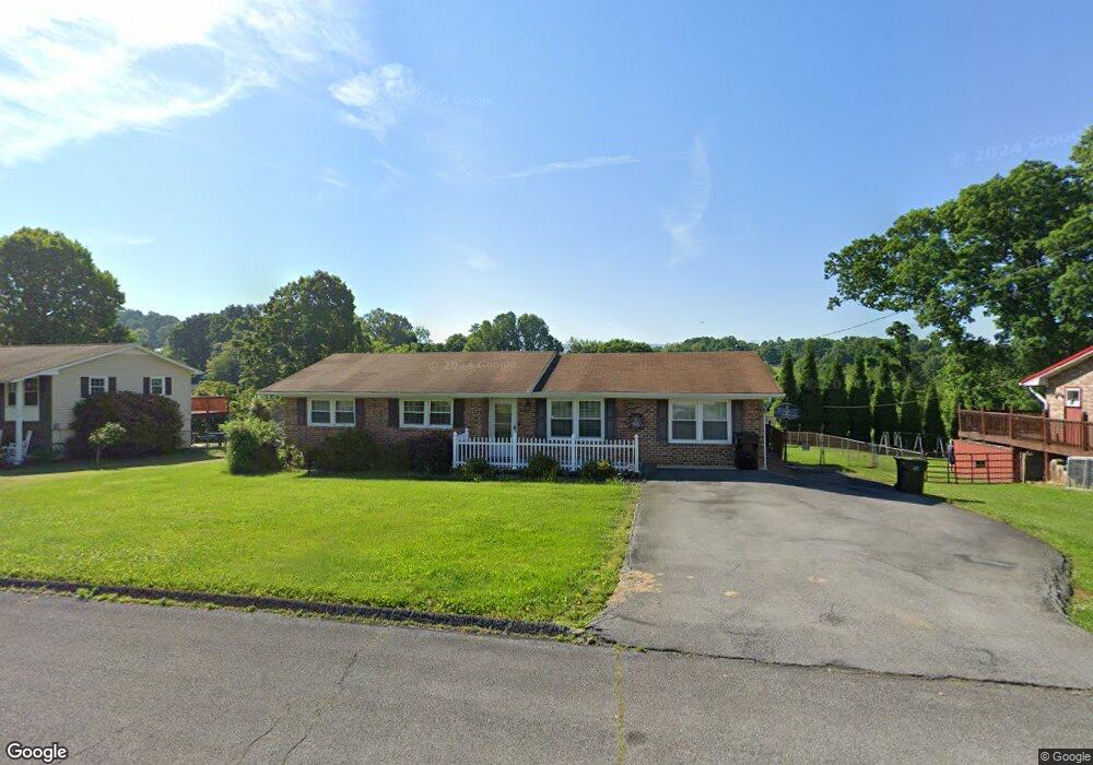
358 Mayfield Dr Bristol, TN 37620
Estimated Value: $233,000 - $297,000
3
Beds
2
Baths
1,369
Sq Ft
$192/Sq Ft
Est. Value
About This Home
This home is located at 358 Mayfield Dr, Bristol, TN 37620 and is currently estimated at $262,246, approximately $191 per square foot. 358 Mayfield Dr is a home located in Sullivan County with nearby schools including Bluff City Elementary School, Sullivan East Middle School, and Sullivan East High School.
Ownership History
Date
Name
Owned For
Owner Type
Purchase Details
Closed on
May 25, 2018
Sold by
Hall Sandra Renee
Bought by
Hall Richard Travis and Hall Guy Richardson
Current Estimated Value
Purchase Details
Closed on
Mar 20, 2009
Sold by
Pennington Douglas R
Bought by
Hall Richard Travis
Home Financials for this Owner
Home Financials are based on the most recent Mortgage that was taken out on this home.
Original Mortgage
$104,080
Outstanding Balance
$65,791
Interest Rate
5.1%
Estimated Equity
$196,455
Purchase Details
Closed on
Oct 21, 1996
Sold by
Hamm Woodrow S and Hamm Eva D
Bought by
Douglas Pennington
Home Financials for this Owner
Home Financials are based on the most recent Mortgage that was taken out on this home.
Original Mortgage
$38,000
Interest Rate
8.15%
Create a Home Valuation Report for This Property
The Home Valuation Report is an in-depth analysis detailing your home's value as well as a comparison with similar homes in the area
Home Values in the Area
Average Home Value in this Area
Purchase History
| Date | Buyer | Sale Price | Title Company |
|---|---|---|---|
| Hall Richard Travis | -- | None Available | |
| Hall Richard Travis | $106,000 | -- | |
| Douglas Pennington | $76,000 | -- |
Source: Public Records
Mortgage History
| Date | Status | Borrower | Loan Amount |
|---|---|---|---|
| Open | Douglas Pennington | $104,080 | |
| Previous Owner | Douglas Pennington | $38,000 |
Source: Public Records
Tax History Compared to Growth
Tax History
| Year | Tax Paid | Tax Assessment Tax Assessment Total Assessment is a certain percentage of the fair market value that is determined by local assessors to be the total taxable value of land and additions on the property. | Land | Improvement |
|---|---|---|---|---|
| 2024 | $764 | $30,625 | $3,375 | $27,250 |
| 2023 | $737 | $30,625 | $3,375 | $27,250 |
| 2022 | $737 | $30,625 | $3,375 | $27,250 |
| 2021 | $737 | $30,625 | $3,375 | $27,250 |
| 2020 | $741 | $30,625 | $3,375 | $27,250 |
| 2019 | $741 | $28,825 | $3,375 | $25,450 |
| 2018 | $735 | $28,825 | $3,375 | $25,450 |
| 2017 | $735 | $28,825 | $3,375 | $25,450 |
| 2016 | $689 | $26,750 | $3,375 | $23,375 |
| 2014 | $620 | $26,904 | $0 | $0 |
Source: Public Records
Map
Nearby Homes
- Tbd Hill Dr
- 2158 Vance Tank Rd
- 3493 Weaver Pike
- 1237 White Top Rd
- 143 Lazy Acres
- 496 Pleasant Grove Rd
- TBD Sweet Knobs Trail
- 159 Peoples Rd
- 292 Peters Rd
- 1026 Deer Harbour Rd
- 4045 Weaver Pike
- 1476 Silver Grove Rd
- 403 Martindale Rd
- 302 Martindale Rd
- 100 Martindale Rd
- 1056 White Top Rd
- 101 Timberlane Rd
- 216 Old Weaver Pike
- 316 Timberlane Rd
- 305 Sunnybrook Dr
- 350 Mayfield Dr
- 366 Mayfield Dr
- 448 Springfield Dr
- 456 Springfield Dr
- 342 Mayfield Dr
- 440 Springfield Dr
- 374 Mayfield Dr
- 365 Mayfield Dr
- 357 Mayfield Dr
- 464 Springfield Dr
- 373 Mayfield Dr
- 436 Springfield Dr
- 334 Mayfield Dr
- 341 Mayfield Dr
- 472 Springfield Dr
- 410 Skyland Dr
- 394 Skyland Dr
- 441 Springfield Dr
- 449 Springfield Dr
- 409 Springfield Dr