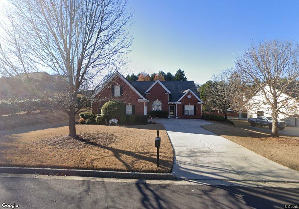
3580 Rolling Creek Dr Buford, GA 30519
Estimated Value: $474,103 - $588,000
3
Beds
2
Baths
2,596
Sq Ft
$201/Sq Ft
Est. Value
About This Home
This home is located at 3580 Rolling Creek Dr, Buford, GA 30519 and is currently estimated at $521,276, approximately $200 per square foot. 3580 Rolling Creek Dr is a home located in Gwinnett County with nearby schools including Harmony Elementary School and Glenn C. Jones Middle School.
Ownership History
Date
Name
Owned For
Owner Type
Purchase Details
Closed on
Aug 15, 2002
Sold by
Ivey Green Builders Inc
Bought by
Mcentyre Darwin A and Mcentyre Linda K
Current Estimated Value
Home Financials for this Owner
Home Financials are based on the most recent Mortgage that was taken out on this home.
Original Mortgage
$85,000
Outstanding Balance
$35,916
Interest Rate
6.53%
Mortgage Type
New Conventional
Estimated Equity
$485,360
Create a Home Valuation Report for This Property
The Home Valuation Report is an in-depth analysis detailing your home's value as well as a comparison with similar homes in the area
Home Values in the Area
Average Home Value in this Area
Purchase History
| Date | Buyer | Sale Price | Title Company |
|---|---|---|---|
| Mcentyre Darwin A | $189,200 | -- |
Source: Public Records
Mortgage History
| Date | Status | Borrower | Loan Amount |
|---|---|---|---|
| Open | Mcentyre Darwin A | $85,000 |
Source: Public Records
Tax History Compared to Growth
Tax History
| Year | Tax Paid | Tax Assessment Tax Assessment Total Assessment is a certain percentage of the fair market value that is determined by local assessors to be the total taxable value of land and additions on the property. | Land | Improvement |
|---|---|---|---|---|
| 2024 | $1,554 | $165,720 | $39,600 | $126,120 |
| 2023 | $1,554 | $150,200 | $39,600 | $110,600 |
| 2022 | $0 | $150,200 | $39,600 | $110,600 |
| 2021 | $1,501 | $119,720 | $30,720 | $89,000 |
| 2020 | $1,498 | $119,720 | $30,720 | $89,000 |
| 2019 | $1,381 | $119,720 | $30,720 | $89,000 |
| 2018 | $1,361 | $94,680 | $25,600 | $69,080 |
| 2016 | $1,301 | $81,430 | $21,760 | $59,670 |
| 2015 | $1,333 | $81,960 | $18,400 | $63,560 |
| 2014 | $1,275 | $76,880 | $18,400 | $58,480 |
Source: Public Records
Map
Nearby Homes
- 2692 Bogan Creek Dr
- 3685 Rolling Creek Dr
- 3665 Mystic Dr Unit 2
- 4041 Lost Mill Ln
- 2753 Blue Moon Dr Unit 4
- 2380 Black Bear Ct
- 2361 Black Bear Ct Unit 2
- 2330 Chandler Grove Dr
- 3775 Rolling Creek Dr
- 2551 E Maddox Rd
- 3765 Woodlawn Ct
- 2550 Kilgore Rd
- 2551 Kilgore Rd
- 3848 Heirloom Loop Ct
- 2710 Kilgore Rd
- 3600 Devenwood Way
- 2859 Preserve Walk Ct NE
- 2718 Kilgore Rd
- 2859 Presertve at Hamilton Mill
- 4017 S South Bogan Rd
- 3590 Rolling Creek Dr
- 3570 Rolling Creek Dr
- 2712 Bogan Creek Dr
- 2732 Bogan Creek Dr
- 3560 Rolling Creek Dr
- 3600 Rolling Creek Dr
- 3585 Rolling Creek Dr
- 2702 Bogan Creek Dr
- 3575 Rolling Creek Dr
- 3595 Rolling Creek Dr
- 0 Bogan Creek Dr Unit 8343391
- 0 Bogan Creek Dr Unit 8073748
- 0 Bogan Creek Dr Unit 8077394
- 0 Bogan Creek Dr Unit 8212338
- 0 Bogan Creek Dr Unit 8017513
- 0 Bogan Creek Dr Unit 8030477
- 0 Bogan Creek Dr
- 3540 Rolling Creek Dr
- 3565 Rolling Creek Dr
- 3615 Rolling Creek Dr