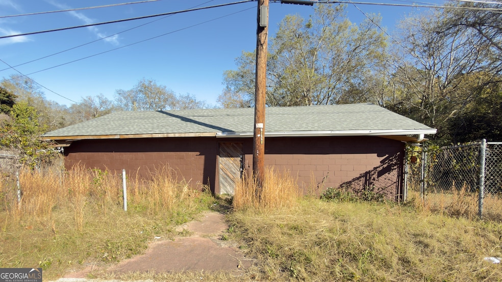
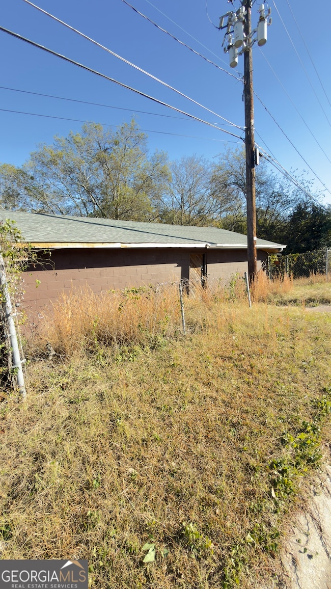

3581 Hollingsworth Rd Macon, GA 31210
Estimated payment $175/month
Highlights
- No HOA
- 1-Story Property
- Central Heating and Cooling System
About This Home
Investor Special in Macon! This 2-bedroom, 1-bath home is full of potential and ready for your vision. Located less than 10 minutes from the new amphitheater and major Macon attractions, this property sits in a growing area with strong rental and resale demand. Inside, the home needs a full renovation, making it a perfect project for investors, flippers, or savvy buyers looking to add value. Property sold as is.

Home Details
Home Type
- Single Family
Est. Annual Taxes
- $319
Year Built
- Built in 1972
Interior Spaces
- 1,146 Sq Ft Home
- 1-Story Property
Bedrooms and Bathrooms
- 2 Main Level Bedrooms
- 1 Full Bathroom
Schools
- Union Elementary School
- Weaver Middle School
- Westside High School
Additional Features
- 7,405 Sq Ft Lot
- Central Heating and Cooling System
Community Details
- No Home Owners Association
- No Laundry Facilities
Map
Home Values in the Area
Average Home Value in this Area
Tax History
| Year | Tax Paid | Tax Assessment Tax Assessment Total Assessment is a certain percentage of the fair market value that is determined by local assessors to be the total taxable value of land and additions on the property. | Land | Improvement |
|---|---|---|---|---|
| 2025 | $319 | $13,000 | $7,854 | $5,146 |
| 2024 | $330 | $13,000 | $7,854 | $5,146 |
| 2023 | $1,167 | $13,000 | $7,854 | $5,146 |
| 2022 | $244 | $7,054 | $6,300 | $754 |
| 2021 | $268 | $7,054 | $6,300 | $754 |
| 2020 | $274 | $7,054 | $6,300 | $754 |
| 2019 | $276 | $7,054 | $6,300 | $754 |
| 2018 | $429 | $7,160 | $6,300 | $860 |
| 2017 | $268 | $7,160 | $6,300 | $860 |
| 2016 | $253 | $7,310 | $6,300 | $1,010 |
| 2015 | $398 | $8,136 | $6,300 | $1,836 |
| 2014 | $461 | $8,183 | $6,300 | $1,883 |
Property History
| Date | Event | Price | List to Sale | Price per Sq Ft |
|---|---|---|---|---|
| 11/13/2025 11/13/25 | For Sale | $28,000 | -- | $24 / Sq Ft |
Purchase History
| Date | Type | Sale Price | Title Company |
|---|---|---|---|
| Warranty Deed | $10,788 | None Listed On Document | |
| Warranty Deed | $10,788 | None Listed On Document | |
| Limited Warranty Deed | $8,500 | None Available | |
| Public Action Common In Florida Clerks Tax Deed Or Tax Deeds Or Property Sold For Taxes | $6,579 | None Available | |
| Interfamily Deed Transfer | $3,000 | None Available |
Source: Georgia MLS
MLS Number: 10643639
APN: M072-0155
Disclaimer: Certain information contained herein is derived from information provided by parties other than Homes.com. All information provided is deemed reliable, but is not guaranteed to be accurate and should be independently verified.
![]() The data relating to real estate for sale on this web site comes in part from the Broker Reciprocity Program of Georgia MLS. Real estate listings held by brokerage firms other than Redfin are marked with the Broker Reciprocity logo and detailed information about them includes the name of the listing brokers. Information deemed reliable but not guaranteed. Copyright 2025 Georgia MLS. All rights reserved.
The data relating to real estate for sale on this web site comes in part from the Broker Reciprocity Program of Georgia MLS. Real estate listings held by brokerage firms other than Redfin are marked with the Broker Reciprocity logo and detailed information about them includes the name of the listing brokers. Information deemed reliable but not guaranteed. Copyright 2025 Georgia MLS. All rights reserved.
- 3620 Earl St
- 3620 Earl St Unit A
- 3778 Log Cabin Dr
- 3708 Log Cabin Dr
- 107 Cold Creek Pkwy
- 116 Poplar Pass
- 3867 Log Cabin Dr
- 644 Ivy Brook Way
- 3566 Mckenzie Dr
- 345 Ironwood Ct
- 342 Ironwood Ct
- 114 Emily St
- 346 Ironwood Ct
- 3808 Fairmont Ave Unit A
- 354 Ironwood Ct
- 360 Ironwood Ct
- 366 Ironwood Ct
- 372 Ironwood Ct
- 1187 Edna Place
- 1207 Edna Place