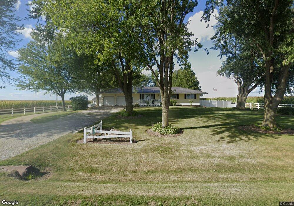
3585 150th St Stockton, IA 52769
Estimated Value: $221,000 - $395,000
3
Beds
3
Baths
1,152
Sq Ft
$289/Sq Ft
Est. Value
About This Home
This home is located at 3585 150th St, Stockton, IA 52769 and is currently estimated at $333,285, approximately $289 per square foot. 3585 150th St is a home located in Muscatine County with nearby schools including Grant Elementary School, Central Middle School, and Muscatine High School.
Ownership History
Date
Name
Owned For
Owner Type
Purchase Details
Closed on
Nov 12, 2021
Sold by
Schumaker Randall L and Schumaker Catherine J
Bought by
Stecher Justin and Murphy Jessica
Current Estimated Value
Home Financials for this Owner
Home Financials are based on the most recent Mortgage that was taken out on this home.
Original Mortgage
$215,000
Interest Rate
3.05%
Mortgage Type
New Conventional
Create a Home Valuation Report for This Property
The Home Valuation Report is an in-depth analysis detailing your home's value as well as a comparison with similar homes in the area
Home Values in the Area
Average Home Value in this Area
Purchase History
| Date | Buyer | Sale Price | Title Company |
|---|---|---|---|
| Stecher Justin | $275,000 | None Listed On Document |
Source: Public Records
Mortgage History
| Date | Status | Borrower | Loan Amount |
|---|---|---|---|
| Previous Owner | Stecher Justin | $215,000 |
Source: Public Records
Tax History Compared to Growth
Tax History
| Year | Tax Paid | Tax Assessment Tax Assessment Total Assessment is a certain percentage of the fair market value that is determined by local assessors to be the total taxable value of land and additions on the property. | Land | Improvement |
|---|---|---|---|---|
| 2025 | $3,562 | $294,140 | $31,800 | $262,340 |
| 2024 | $3,562 | $293,540 | $31,800 | $261,740 |
| 2023 | $3,308 | $282,713 | $31,800 | $250,913 |
| 2022 | $2,760 | $253,080 | $30,000 | $223,080 |
| 2021 | $2,760 | $209,850 | $30,000 | $179,850 |
| 2020 | $2,822 | $204,850 | $25,000 | $179,850 |
| 2019 | $2,964 | $202,800 | $0 | $0 |
| 2018 | $2,880 | $201,910 | $0 | $0 |
| 2017 | $2,880 | $197,140 | $0 | $0 |
| 2016 | $2,954 | $197,140 | $0 | $0 |
| 2015 | $2,954 | $199,660 | $0 | $0 |
| 2014 | $3,020 | $199,660 | $0 | $0 |
Source: Public Records
Map
Nearby Homes
- 3881 Highway 61
- 508 Prairie Meadow Dr
- 3792 110th St
- 680 Sweet Wood Ln
- 1875 Stagecoach Ln
- 3158 120th St
- 702 N Juniata St
- 707 N Mississippi St
- 207 N Mississippi St Unit 4
- 6203 116th St
- 801 4th St
- 11640 61st Avenue Place
- 608 3rd St
- 401 Dolan Dr
- 1203 8th St
- 507 9th Ave
- 423 Kevin Rd
- 607 9th Ave
- 403 4th St
- 909 8th St
- 3573 150th St
- 3562 150th St
- 3565 150th St
- 1511 Pleasant Prairie Rd
- 3563 150th St
- 1515 Pleasant Prairie Rd
- 1504 Pleasant Prairie Rd
- 3528 150th St
- 3881 Federal Hwy 61 Hwy
- 3526 150th St
- 3526 150th St
- 1522 Pleasant Prairie Rd
- 1466 Vine Ave
- 3522 150th St
- 3520 150th St
- 3610 Highway 61
- 3502 150th St
- 1509 Verde Ave
- 1423 Pleasant Prairie Rd
- 0 Ward Unit 15048