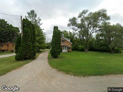
35865 N Il Route 21 Gurnee, IL 60031
Estimated Value: $229,554 - $317,000
--
Bed
2
Baths
1,080
Sq Ft
$262/Sq Ft
Est. Value
About This Home
This home is located at 35865 N Il Route 21, Gurnee, IL 60031 and is currently estimated at $283,389, approximately $262 per square foot. 35865 N Il Route 21 is a home located in Lake County with nearby schools including Spaulding Elementary School, Viking Middle School, and Warren Township High School.
Create a Home Valuation Report for This Property
The Home Valuation Report is an in-depth analysis detailing your home's value as well as a comparison with similar homes in the area
Home Values in the Area
Average Home Value in this Area
Tax History Compared to Growth
Tax History
| Year | Tax Paid | Tax Assessment Tax Assessment Total Assessment is a certain percentage of the fair market value that is determined by local assessors to be the total taxable value of land and additions on the property. | Land | Improvement |
|---|---|---|---|---|
| 2024 | $6,238 | $65,092 | $26,386 | $38,706 |
| 2023 | $5,837 | $60,432 | $24,497 | $35,935 |
| 2022 | $5,837 | $54,360 | $18,735 | $35,625 |
| 2021 | $5,339 | $52,179 | $17,983 | $34,196 |
| 2020 | $5,156 | $50,896 | $17,541 | $33,355 |
| 2019 | $5,076 | $49,419 | $17,032 | $32,387 |
| 2018 | $5,941 | $58,096 | $23,130 | $34,966 |
| 2017 | $5,943 | $56,431 | $22,467 | $33,964 |
| 2016 | $5,814 | $53,919 | $21,467 | $32,452 |
| 2015 | $5,671 | $51,137 | $20,359 | $30,778 |
| 2014 | $5,546 | $51,603 | $20,272 | $31,331 |
| 2012 | $5,236 | $51,998 | $20,427 | $31,571 |
Source: Public Records
Map
Nearby Homes
- 1629 Deer Run Rd
- 5033 Boulders Dr
- 5042 Boulders Dr
- 1999 N Fuller Rd
- 1701 Wausau Ln
- 5156 Eau Claire Ct
- 5116 Beechwood Ave
- 5118 Carol Ln Unit 16
- 5133 Carol Ln Unit 31
- 1723 Victor Terrace
- 5177 Coventry Ln Unit D
- 36396 N Skokie Hwy
- 1338 Stratford Dr Unit 13A1
- 1328 Sunrise Ln Unit 16C1
- 5317 Cypress Cir
- 1012 Elsie Ave
- 5416 Ebony Ct
- 5423 Ashwood Ln
- 1577 N Dilleys Rd
- 2107 Lawson Blvd