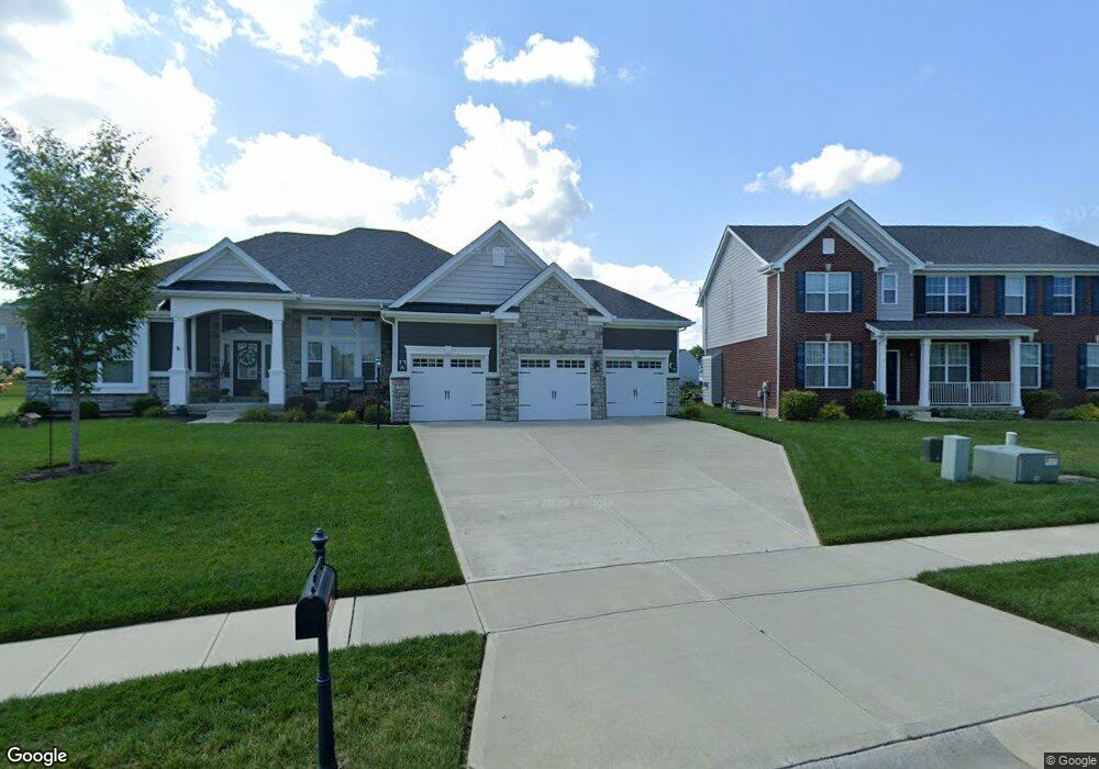
3589 Cypress Pointe Dr Bellbrook, OH 45305
Estimated Value: $534,000 - $647,000
4
Beds
3
Baths
2,173
Sq Ft
$269/Sq Ft
Est. Value
About This Home
This home is located at 3589 Cypress Pointe Dr, Bellbrook, OH 45305 and is currently estimated at $584,185, approximately $268 per square foot. 3589 Cypress Pointe Dr is a home with nearby schools including Bell Creek Intermediate School, Stephen Bell Elementary School, and Bellbrook Middle School.
Ownership History
Date
Name
Owned For
Owner Type
Purchase Details
Closed on
Mar 29, 2024
Sold by
Milton Stephen Charles and Milton April Lynn
Bought by
Stephen And April Milton Revocable Living Tru and Milton
Current Estimated Value
Purchase Details
Closed on
Jun 20, 2019
Sold by
Inverness Group Incorporated
Bought by
Lynn Milton Stephen Charles and Lynn Milton April
Home Financials for this Owner
Home Financials are based on the most recent Mortgage that was taken out on this home.
Original Mortgage
$473,950
Interest Rate
3.9%
Mortgage Type
VA
Create a Home Valuation Report for This Property
The Home Valuation Report is an in-depth analysis detailing your home's value as well as a comparison with similar homes in the area
Home Values in the Area
Average Home Value in this Area
Purchase History
| Date | Buyer | Sale Price | Title Company |
|---|---|---|---|
| Stephen And April Milton Revocable Living Tru | -- | None Listed On Document | |
| Lynn Milton Stephen Charles | $499,000 | None Available |
Source: Public Records
Mortgage History
| Date | Status | Borrower | Loan Amount |
|---|---|---|---|
| Previous Owner | Lynn Milton Stephen Charles | $473,950 |
Source: Public Records
Tax History Compared to Growth
Tax History
| Year | Tax Paid | Tax Assessment Tax Assessment Total Assessment is a certain percentage of the fair market value that is determined by local assessors to be the total taxable value of land and additions on the property. | Land | Improvement |
|---|---|---|---|---|
| 2024 | $9,032 | $163,690 | $27,380 | $136,310 |
| 2023 | $9,032 | $163,690 | $27,380 | $136,310 |
| 2022 | $9,035 | $136,260 | $27,380 | $108,880 |
| 2021 | $9,136 | $136,260 | $27,380 | $108,880 |
| 2020 | $8,534 | $136,260 | $27,380 | $108,880 |
| 2019 | $1,490 | $0 | $0 | $0 |
| 2018 | $0 | $0 | $0 | $0 |
Source: Public Records
Map
Nearby Homes
- 3509 Marwood Dr
- 3656 Persimmon Ridge Place
- 3604 Cypress Pointe Dr
- 3604 Cypress Pointe Dr
- 144 Upper Hillside Dr
- 3849 Sable Ridge Dr
- 161 Belair Cir
- 1667 Ardennes Oak Dr
- 3553 Shellbark Dr
- 2018 Amberwood Ct
- 1713 Fox Trail
- Winslow Plan at Bent Creek Woods - Masterpiece Collection
- Margot Plan at Bent Creek Woods - Masterpiece Collection
- Beckett Plan at Bent Creek Woods - Masterpiece Collection
- Pearson Plan at Bent Creek Woods - Masterpiece Collection
- Paxton Plan at Bent Creek Woods - Masterpiece Collection
- Stanton Plan at Bent Creek Woods - Masterpiece Collection
- Clay Plan at Bent Creek Woods - Masterpiece Collection
- Huxley Plan at Bent Creek Woods - Masterpiece Collection
- Leland Plan at Bent Creek Woods - Masterpiece Collection
- 3593 Cypress Pointe Dr
- 3585 Cypress Pointe Dr
- 3581 Cypress Pointe Dr
- 3515 Marwood Dr
- 3586 Cypress Pointe Dr
- 3590 Cypress Pointe Dr
- 3597 Cypress Pointe Dr
- 3582 Cypress Pointe Dr
- 3503 Marwood Dr
- 3577 Cypress Pointe Dr
- 3521 Marwood Dr
- 3594 Cypress Pointe Dr
- 3631 Magnolia Trace Dr
- 3615 Magnolia Trace Dr
- 3627 Magnolia Trace Dr
- 3635 Magnolia Trace Dr
- 3640 Magnolia Trace Dr
- 3639 Magnolia Trace Dr
- 1611 Bur Oak Dr
- 3603 Magnolia Trace Dr