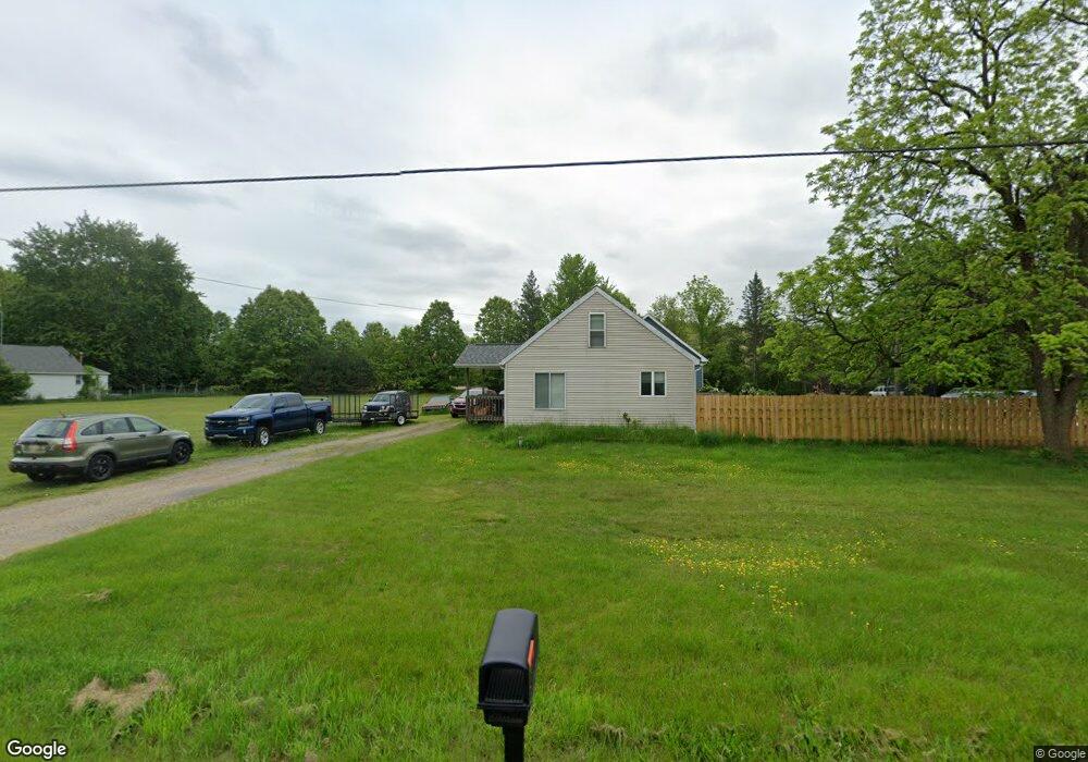
359 Clarence Blvd Battle Creek, MI 49014
Estimated Value: $176,000 - $241,000
3
Beds
1
Bath
1,360
Sq Ft
$145/Sq Ft
Est. Value
About This Home
This home is located at 359 Clarence Blvd, Battle Creek, MI 49014 and is currently estimated at $197,169, approximately $144 per square foot. 359 Clarence Blvd is a home located in Calhoun County with nearby schools including Pennfield Dunlap Elementary School, Pennfield Purdy School, and Pennfield Middle School.
Ownership History
Date
Name
Owned For
Owner Type
Purchase Details
Closed on
Apr 16, 2024
Sold by
Carter Daniel G
Bought by
Benton Samantha Joy and Inman Travis Scott
Current Estimated Value
Purchase Details
Closed on
Jun 21, 2012
Sold by
Duboise Will and Duboise Bobbi Jo
Bought by
Carter Daniel
Purchase Details
Closed on
Aug 24, 2011
Sold by
U S Bank National Association
Bought by
Duboise Will and Duboise Bobbi Jo
Purchase Details
Closed on
Oct 21, 2010
Sold by
Johnson Dale P
Bought by
U S Bank National Association
Purchase Details
Closed on
Jun 12, 2003
Sold by
Johnson Ronald and Johnson Priscilla S
Bought by
Johnson Dale
Home Financials for this Owner
Home Financials are based on the most recent Mortgage that was taken out on this home.
Original Mortgage
$67,500
Interest Rate
10.25%
Mortgage Type
Purchase Money Mortgage
Create a Home Valuation Report for This Property
The Home Valuation Report is an in-depth analysis detailing your home's value as well as a comparison with similar homes in the area
Home Values in the Area
Average Home Value in this Area
Purchase History
| Date | Buyer | Sale Price | Title Company |
|---|---|---|---|
| Benton Samantha Joy | $1,800 | None Listed On Document | |
| Benton Samantha Joy | $1,800 | None Listed On Document | |
| Carter Daniel | $30,000 | None Available | |
| Duboise Will | $23,500 | None Available | |
| U S Bank National Association | $25,900 | None Available | |
| Johnson Dale | $75,000 | -- | |
| Johnson Dale P | $75,000 | -- |
Source: Public Records
Mortgage History
| Date | Status | Borrower | Loan Amount |
|---|---|---|---|
| Previous Owner | Johnson Dale P | $67,500 |
Source: Public Records
Tax History Compared to Growth
Tax History
| Year | Tax Paid | Tax Assessment Tax Assessment Total Assessment is a certain percentage of the fair market value that is determined by local assessors to be the total taxable value of land and additions on the property. | Land | Improvement |
|---|---|---|---|---|
| 2025 | $1,574 | $73,600 | $0 | $0 |
| 2024 | $716 | $65,300 | $0 | $0 |
| 2023 | $1,389 | $59,230 | $0 | $0 |
| 2022 | $650 | $48,570 | $0 | $0 |
| 2021 | $1,364 | $46,440 | $0 | $0 |
| 2020 | $1,139 | $41,670 | $0 | $0 |
| 2019 | $1,069 | $37,070 | $0 | $0 |
| 2018 | $959 | $29,360 | $6,300 | $23,060 |
| 2017 | $0 | $29,580 | $0 | $0 |
| 2016 | $0 | $26,940 | $0 | $0 |
| 2015 | -- | $23,600 | $13,428 | $10,172 |
| 2014 | -- | $22,860 | $13,428 | $9,432 |
Source: Public Records
Map
Nearby Homes
- 215 Pony Ave
- 8671 Gorsline Rd
- 114 Wanondoger Cir
- 150 Pennbrook Trail
- 220 Pennbrook Trail
- 1731 Capital Ave NE
- 125 Sunset Blvd W
- 20259 Pine Lake Rd
- 110 Harriet Ln
- 19687 East Ave N
- 21 Bradley St
- 0 Capital Ave NE
- 0 Hopkins St
- 0 Pickford Ave
- 731 Roosevelt Ave E
- 52 Thorncroft Ave
- 20291 Chippewa Trail
- 955 Capital Ave NE
- 6722 Morgan Rd E
- 31 Oxford St
- 347 Clarence Blvd
- 377 Clarence Blvd
- 374 Clarence Blvd
- 364 Clarence Blvd
- 352 Clarence Blvd
- 331 Clarence Blvd
- 336 Clarence Blvd
- 392 Clarence Blvd
- 327 Clarence Blvd
- 38 Daugherty Dr Unit 36
- 328 Clarence Blvd
- 405 Clarence Blvd
- 321 Clarence Blvd
- 324 Clarence Blvd
- 315 Clarence Blvd
- 440 Clarence Blvd
- 310 Clarence Blvd
- 311 Clarence Blvd
- 568 Pony Ave
- 8749 Bellevue Rd