Estimated Value: $534,000 - $607,000
3
Beds
1
Bath
1,374
Sq Ft
$410/Sq Ft
Est. Value
About This Home
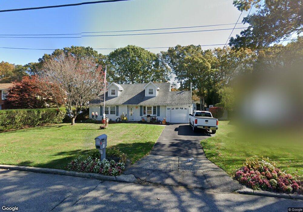
This home is located at 359 Randall Rd, Ridge, NY 11961 and is currently estimated at $563,116, approximately $409 per square foot. 359 Randall Rd is a home located in Suffolk County with nearby schools including Longwood Middle School, Longwood Junior High School, and Longwood Senior High School.
Ownership History
Date
Name
Owned For
Owner Type
Purchase Details
Closed on
Nov 8, 2024
Sold by
Crispi Linda M and Crispi Donald P
Bought by
Crispi Donald P
Current Estimated Value
Purchase Details
Closed on
Dec 27, 2005
Purchase Details
Closed on
Jun 29, 1998
Sold by
Dallanegra Steven D and Dallanegra Robin T
Bought by
Piazza Linda
Home Financials for this Owner
Home Financials are based on the most recent Mortgage that was taken out on this home.
Original Mortgage
$106,550
Interest Rate
7.02%
Mortgage Type
FHA
Create a Home Valuation Report for This Property
The Home Valuation Report is an in-depth analysis detailing your home's value as well as a comparison with similar homes in the area
Home Values in the Area
Average Home Value in this Area
Purchase History
| Date | Buyer | Sale Price | Title Company |
|---|---|---|---|
| Crispi Donald P | -- | None Available | |
| Crispi Donald P | -- | None Available | |
| -- | -- | -- | |
| -- | -- | -- | |
| Piazza Linda | $108,000 | First American Title Ins Co | |
| Piazza Linda | $108,000 | First American Title Ins Co |
Source: Public Records
Mortgage History
| Date | Status | Borrower | Loan Amount |
|---|---|---|---|
| Previous Owner | Piazza Linda | $106,550 |
Source: Public Records
Tax History
| Year | Tax Paid | Tax Assessment Tax Assessment Total Assessment is a certain percentage of the fair market value that is determined by local assessors to be the total taxable value of land and additions on the property. | Land | Improvement |
|---|---|---|---|---|
| 2024 | $8,572 | $2,150 | $300 | $1,850 |
| 2023 | $8,572 | $2,150 | $300 | $1,850 |
| 2022 | $7,717 | $2,150 | $300 | $1,850 |
| 2021 | $7,717 | $2,150 | $300 | $1,850 |
| 2020 | $7,901 | $2,150 | $300 | $1,850 |
| 2019 | $7,901 | $0 | $0 | $0 |
| 2018 | $7,380 | $2,150 | $300 | $1,850 |
| 2017 | $7,380 | $2,150 | $300 | $1,850 |
| 2016 | $7,304 | $2,150 | $300 | $1,850 |
| 2015 | -- | $2,150 | $300 | $1,850 |
| 2014 | -- | $2,150 | $300 | $1,850 |
Source: Public Records
Map
Nearby Homes
- 33 Highview Ln
- 41 Woodbrook Dr
- 18 Woodbrook Dr
- 51 Ridge Haven Dr
- 7 Woodbrook Dr
- 145 Edinburgh Dr
- 190 Edinburgh Dr
- 2 Bedford Ct
- 304 Kingston Ct
- 206 Belfast Ln
- 151 Laurance Ln
- 190 Canterbury Dr
- 42 Wildflower Dr
- 506 Lancaster Ct
- 9 Lilac Ln
- 475 Stratford Ln
- 498 Cranston Ln
- 427 Aylesbury Ct Unit A
- 0 Elizabeth Way Unit KEY803253
- Lot 39 Fox Run Ct
- 357 Randall Rd
- 361 Randall Rd
- 30 Cedar Ridge Dr
- 32 Cedar Ridge Dr
- 355 Randall Rd
- 363 Randall Rd
- 28 Cedar Ridge Dr
- 34 Cedar Ridge Dr
- 358 Randall Rd
- 356 Randall Rd
- 354 Randall Rd
- 353 Randall Rd
- 360 Randall Rd
- 26 Cedar Ridge Dr
- 1 Havendale Gate
- 3 Havendale Gate
- 352 Randall Rd
- 362 Randall Rd
- 36 Cedar Ridge Dr
- 351 Randall Rd
Your Personal Tour Guide
Ask me questions while you tour the home.