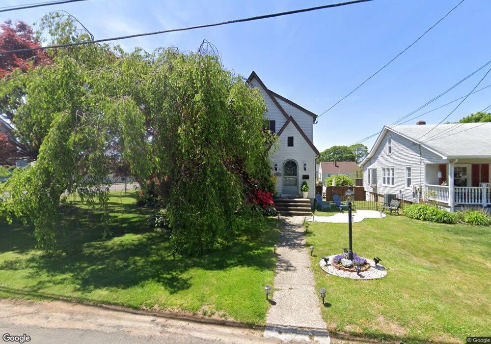
359 Washington Pkwy Stratford, CT 06615
Lordship NeighborhoodEstimated Value: $779,552 - $911,000
1
Bed
1
Bath
1,641
Sq Ft
$518/Sq Ft
Est. Value
About This Home
This home is located at 359 Washington Pkwy, Stratford, CT 06615 and is currently estimated at $849,638, approximately $517 per square foot. 359 Washington Pkwy is a home located in Fairfield County with nearby schools including Lordship School, David Wooster Middle School, and Stratford High School.
Ownership History
Date
Name
Owned For
Owner Type
Purchase Details
Closed on
Apr 29, 2005
Sold by
Welman Jeremy and Welman Amanda
Bought by
Menz Thomas
Current Estimated Value
Home Financials for this Owner
Home Financials are based on the most recent Mortgage that was taken out on this home.
Original Mortgage
$380,000
Outstanding Balance
$209,576
Interest Rate
6.75%
Estimated Equity
$640,062
Purchase Details
Closed on
Jul 3, 2002
Sold by
Rotanno Michael
Bought by
Welman Jeremy P and Welman Amanda E
Home Financials for this Owner
Home Financials are based on the most recent Mortgage that was taken out on this home.
Original Mortgage
$319,920
Interest Rate
6.82%
Purchase Details
Closed on
Apr 30, 1987
Sold by
Autuori Joseph
Bought by
Rotunno Michael
Create a Home Valuation Report for This Property
The Home Valuation Report is an in-depth analysis detailing your home's value as well as a comparison with similar homes in the area
Home Values in the Area
Average Home Value in this Area
Purchase History
| Date | Buyer | Sale Price | Title Company |
|---|---|---|---|
| Menz Thomas | $475,000 | -- | |
| Welman Jeremy P | $349,900 | -- | |
| Rotunno Michael | $255,000 | -- |
Source: Public Records
Mortgage History
| Date | Status | Borrower | Loan Amount |
|---|---|---|---|
| Open | Rotunno Michael | $380,000 | |
| Previous Owner | Rotunno Michael | $328,000 | |
| Previous Owner | Rotunno Michael | $319,920 | |
| Previous Owner | Rotunno Michael | $130,000 |
Source: Public Records
Tax History Compared to Growth
Tax History
| Year | Tax Paid | Tax Assessment Tax Assessment Total Assessment is a certain percentage of the fair market value that is determined by local assessors to be the total taxable value of land and additions on the property. | Land | Improvement |
|---|---|---|---|---|
| 2025 | $12,807 | $318,570 | $126,070 | $192,500 |
| 2024 | $12,807 | $318,570 | $126,070 | $192,500 |
| 2023 | $12,807 | $318,570 | $126,070 | $192,500 |
| 2022 | $12,571 | $318,570 | $126,070 | $192,500 |
| 2021 | $12,574 | $318,570 | $126,070 | $192,500 |
| 2020 | $12,628 | $318,570 | $126,070 | $192,500 |
| 2019 | $12,660 | $317,520 | $118,930 | $198,590 |
| 2018 | $12,669 | $317,520 | $118,930 | $198,590 |
| 2017 | $12,691 | $317,520 | $118,930 | $198,590 |
| 2016 | $12,380 | $317,520 | $118,930 | $198,590 |
| 2015 | $11,742 | $317,520 | $118,930 | $198,590 |
| 2014 | $11,415 | $320,390 | $122,150 | $198,240 |
Source: Public Records
Map
Nearby Homes
- 559 Oak Bluff Ave
- 516 Valley Rd
- 90 Grove St
- 16 Shoreline Dr Unit 16
- 35 5th Ave
- 130 Ash St
- 464 Park Blvd
- 155 Short Beach Rd Unit 209
- 155 Short Beach Rd Unit 206
- 115 Short Beach Rd Unit 103
- 115 Short Beach Rd Unit 104
- 28 Frash St
- 909 Main St
- 238 Larkin Ct
- 394 Harding Ave
- 79 Wooster Ave
- 366 Columbus Ave
- 209 Mcgrath Ct
- 208 Harding Ave
- 325 Mckinley Ave
- 369 Washington Pkwy
- 381 Washington Pkwy
- 347 Washington Pkwy
- 90 Crown St
- 391 Washington Pkwy
- 337 Washington Pkwy
- 412 2nd Ave
- 400 2nd Ave Unit LANE
- 400 2nd Ave Unit LN
- 422 2nd Ave
- 79 Crown St
- 436 2nd Ave
- 401 Washington Pkwy
- 327 Washington Pkwy
- 348 Washington Pkwy
- 368 Washington Pkwy
- 315 Washington Pkwy
- 399 2nd Ave Unit A
- 380 Washington Pkwy
- 350 2nd Ave