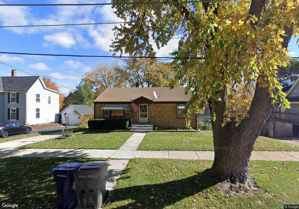
359 Wilcox Ave Elgin, IL 60123
Southwest Elgin NeighborhoodEstimated Value: $244,439 - $268,000
Studio
--
Bath
1,008
Sq Ft
$258/Sq Ft
Est. Value
About This Home
This home is located at 359 Wilcox Ave, Elgin, IL 60123 and is currently estimated at $260,360, approximately $258 per square foot. 359 Wilcox Ave is a home located in Kane County with nearby schools including Harriet Gifford Elementary School, Abbott Middle School, and Larkin High School.
Ownership History
Date
Name
Owned For
Owner Type
Purchase Details
Closed on
Sep 15, 1995
Sold by
Rasavongxay Say and Rasavongxay Jay
Bought by
Ratsavongxay Sayhong and Ratsavongxay Khamphone
Current Estimated Value
Home Financials for this Owner
Home Financials are based on the most recent Mortgage that was taken out on this home.
Original Mortgage
$104,500
Interest Rate
7.56%
Create a Home Valuation Report for This Property
The Home Valuation Report is an in-depth analysis detailing your home's value as well as a comparison with similar homes in the area
Home Values in the Area
Average Home Value in this Area
Purchase History
| Date | Buyer | Sale Price | Title Company |
|---|---|---|---|
| Ratsavongxay Sayhong | $110,000 | Chicago Title Insurance Co |
Source: Public Records
Mortgage History
| Date | Status | Borrower | Loan Amount |
|---|---|---|---|
| Previous Owner | Ratsavongxay Sayhong | $104,500 |
Source: Public Records
Tax History
| Year | Tax Paid | Tax Assessment Tax Assessment Total Assessment is a certain percentage of the fair market value that is determined by local assessors to be the total taxable value of land and additions on the property. | Land | Improvement |
|---|---|---|---|---|
| 2024 | $5,553 | $77,388 | $17,499 | $59,889 |
| 2023 | $5,278 | $69,914 | $15,809 | $54,105 |
| 2022 | $5,008 | $63,749 | $14,415 | $49,334 |
| 2021 | $4,782 | $59,601 | $13,477 | $46,124 |
| 2020 | $4,642 | $56,898 | $12,866 | $44,032 |
| 2019 | $4,502 | $54,199 | $12,256 | $41,943 |
| 2018 | $4,240 | $48,890 | $11,546 | $37,344 |
| 2017 | $4,137 | $46,218 | $10,915 | $35,303 |
| 2016 | $3,933 | $42,878 | $10,126 | $32,752 |
| 2015 | -- | $39,301 | $9,281 | $30,020 |
| 2014 | -- | $38,815 | $9,166 | $29,649 |
| 2013 | -- | $39,839 | $9,408 | $30,431 |
Source: Public Records
Map
Nearby Homes
- 353 Wilcox Ave
- 835 Oak St
- 400 Marguerite St
- 315 Vandalia St
- 756 Walnut Ave
- 761 South St
- 453 Orchard St
- 552 Walnut Ave
- 118 S Union St
- 118 Wilcox Ave
- 208 Moseley St
- 50 Sheridan St
- 532 South St
- 331 Orange St
- 262 S Weston Ave
- 44 Monroe St
- 70 S Weston Ave
- 705 W Highland Ave
- 96 S Crystal St
- 121 Monroe Ave
- 365 Wilcox Ave
- 765 Washburn St
- 759 Washburn St
- 766 Oak St
- 371 Wilcox Ave
- 366 Vandalia St
- 370 Vandalia St
- 760 Oak St
- 360 Vandalia St
- 358 Wilcox Ave
- 347 Wilcox Ave
- 352 Wilcox Ave
- 362 Wilcox Ave
- 378 Vandalia St
- 350 Vandalia St
- 368 Wilcox Ave
- 802 Washburn St
- 403 Wilcox Ave
- 341 Wilcox Ave
- 813 Washburn St
Your Personal Tour Guide
Ask me questions while you tour the home.