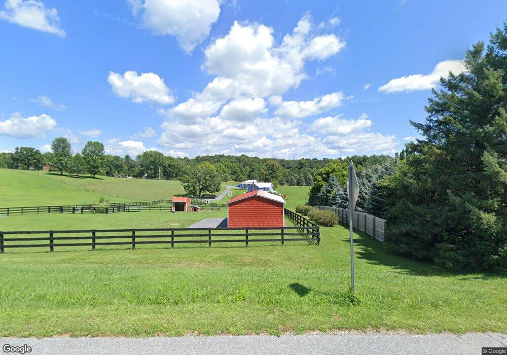
3590 Lowman Ln Union Bridge, MD 21791
Estimated Value: $431,000 - $901,000
--
Bed
--
Bath
1,808
Sq Ft
$356/Sq Ft
Est. Value
About This Home
This home is located at 3590 Lowman Ln, Union Bridge, MD 21791 and is currently estimated at $643,444, approximately $355 per square foot. 3590 Lowman Ln is a home with nearby schools including Elmer A. Wolfe Elementary School, Northwest Middle School, and Francis Scott Key High School.
Ownership History
Date
Name
Owned For
Owner Type
Purchase Details
Closed on
Aug 25, 2020
Sold by
Heise Stephen H and Heise Virginia P
Bought by
Bittner Steven Ray
Current Estimated Value
Home Financials for this Owner
Home Financials are based on the most recent Mortgage that was taken out on this home.
Original Mortgage
$54,300
Outstanding Balance
$48,188
Interest Rate
2.9%
Mortgage Type
New Conventional
Estimated Equity
$595,256
Purchase Details
Closed on
Mar 11, 2004
Sold by
Shryock Joseph A
Bought by
Heise Stephen P and Kurta Virginia P
Purchase Details
Closed on
Jan 23, 1997
Sold by
Reichlin Karl V
Bought by
Shryock Joseph A
Purchase Details
Closed on
Nov 5, 1992
Sold by
Green Paul G
Bought by
Reichlin Karl
Create a Home Valuation Report for This Property
The Home Valuation Report is an in-depth analysis detailing your home's value as well as a comparison with similar homes in the area
Home Values in the Area
Average Home Value in this Area
Purchase History
| Date | Buyer | Sale Price | Title Company |
|---|---|---|---|
| Bittner Steven Ray | $110,000 | Lakeside Title Co | |
| Heise Stephen P | $150,000 | -- | |
| Shryock Joseph A | $62,000 | -- | |
| Reichlin Karl | $53,500 | -- |
Source: Public Records
Mortgage History
| Date | Status | Borrower | Loan Amount |
|---|---|---|---|
| Open | Bittner Steven Ray | $54,300 |
Source: Public Records
Tax History Compared to Growth
Tax History
| Year | Tax Paid | Tax Assessment Tax Assessment Total Assessment is a certain percentage of the fair market value that is determined by local assessors to be the total taxable value of land and additions on the property. | Land | Improvement |
|---|---|---|---|---|
| 2025 | $4,934 | $478,567 | $0 | $0 |
| 2024 | $4,934 | $435,233 | $0 | $0 |
| 2023 | $4,449 | $391,900 | $154,800 | $237,100 |
| 2022 | $4,398 | $387,400 | $0 | $0 |
| 2021 | $1,510 | $134,800 | $134,800 | $0 |
| 2020 | $1,510 | $134,800 | $134,800 | $0 |
| 2019 | $1,372 | $134,800 | $134,800 | $0 |
| 2018 | $1,525 | $134,800 | $134,800 | $0 |
| 2017 | $1,510 | $134,800 | $0 | $0 |
| 2016 | -- | $134,800 | $0 | $0 |
| 2015 | -- | $134,800 | $0 | $0 |
| 2014 | -- | $146,800 | $0 | $0 |
Source: Public Records
Map
Nearby Homes
- 3875 Bark Hill Rd
- 3459 Uniontown Rd
- 285 Stem Rd
- 0 Stem Rd
- 244 Stem Rd
- 57B Hoff Rd
- 1309 Trevanion Rd
- 11420 Green Valley Rd
- 120 Water St
- 216 Main St
- 2823 Graybill Ct
- 6 N Farquhar St
- 147 Union Bridge Rd
- 4939 Middleburg Rd
- 45 N Main St
- 1624 Baust Church Rd
- 2810 Union Square Rd
- 2461 Old New Windsor Pike
- 1414 Old New Windsor Rd
- 2138 Old Taneytown Rd
- 121 Clear Ridge Rd
- 0 Uniontown Rd Unit 1006926792
- 0 Uniontown Rd Unit 1006741922
- 0 Uniontown Rd Unit CR7845426
- 0 Uniontown Rd Unit MDCR187860
- 3599 Lowman Ln
- 108 Clear Ridge Rd
- 114 Clear Ridge Rd
- 105 Clear Ridge Rd
- 0 Clear Ridge Rd Unit 1006340894
- 0 Clear Ridge Rd Unit 1002099616
- 0 Clear Ridge Rd Unit CR10219075
- 0 Clear Ridge Rd Unit MDCR195978
- 0 Clear Ridge Rd Unit MDCR195038
- 0 Clear Ridge Rd Unit MDCR193646
- 0 Clear Ridge Rd Unit 1000439202
- 0 Clear Ridge Rd Unit 1000080435
- 0 Clear Ridge Rd Unit MDCR189698
- 0 Clear Ridge Rd Unit MDCR182176
- 0 Clear Ridge Rd Unit MDCR154142