Estimated Value: $260,035 - $309,000
3
Beds
2
Baths
1,500
Sq Ft
$190/Sq Ft
Est. Value
About This Home
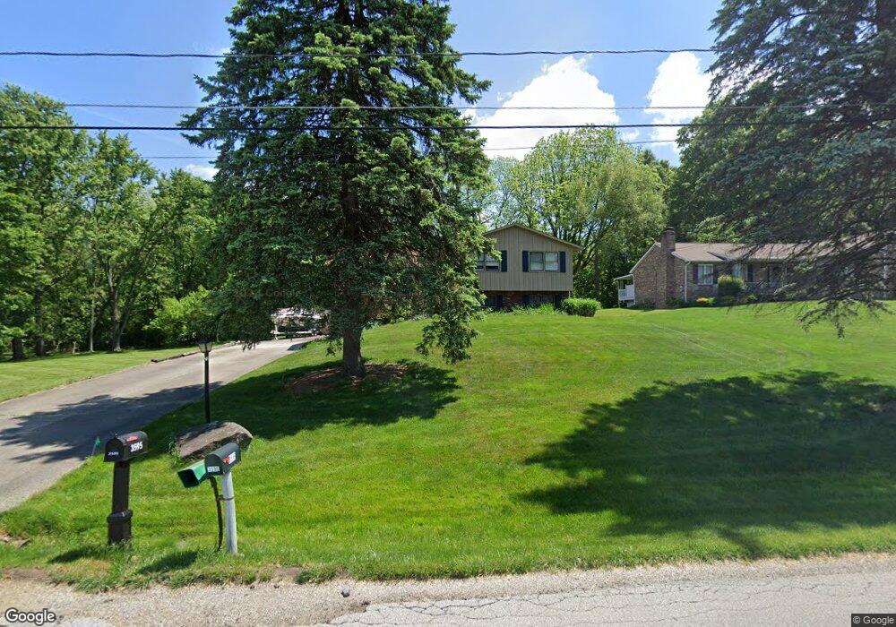
This home is located at 3595 Charleston Dr, Akron, OH 44319 and is currently estimated at $285,009, approximately $190 per square foot. 3595 Charleston Dr is a home located in Summit County with nearby schools including Greenwood Elementary School, Green Intermediate Elementary School, and Green Primary School.
Ownership History
Date
Name
Owned For
Owner Type
Purchase Details
Closed on
Aug 22, 1994
Sold by
Sharpe Donald R
Bought by
Dean Arthur C and Dean Mary K
Current Estimated Value
Home Financials for this Owner
Home Financials are based on the most recent Mortgage that was taken out on this home.
Original Mortgage
$116,026
Interest Rate
8.73%
Mortgage Type
New Conventional
Create a Home Valuation Report for This Property
The Home Valuation Report is an in-depth analysis detailing your home's value as well as a comparison with similar homes in the area
Home Values in the Area
Average Home Value in this Area
Purchase History
| Date | Buyer | Sale Price | Title Company |
|---|---|---|---|
| Dean Arthur C | $112,500 | -- |
Source: Public Records
Mortgage History
| Date | Status | Borrower | Loan Amount |
|---|---|---|---|
| Previous Owner | Dean Arthur C | $116,026 |
Source: Public Records
Tax History Compared to Growth
Tax History
| Year | Tax Paid | Tax Assessment Tax Assessment Total Assessment is a certain percentage of the fair market value that is determined by local assessors to be the total taxable value of land and additions on the property. | Land | Improvement |
|---|---|---|---|---|
| 2025 | $3,048 | $74,200 | $12,649 | $61,551 |
| 2024 | $3,048 | $74,200 | $12,649 | $61,551 |
| 2023 | $3,048 | $74,200 | $12,649 | $61,551 |
| 2022 | $2,369 | $54,135 | $9,100 | $45,035 |
| 2021 | $2,221 | $54,135 | $9,100 | $45,035 |
| 2020 | $2,178 | $54,140 | $9,100 | $45,040 |
| 2019 | $2,042 | $48,600 | $9,100 | $39,500 |
| 2018 | $2,088 | $48,600 | $9,100 | $39,500 |
| 2017 | $1,819 | $48,600 | $9,100 | $39,500 |
| 2016 | $1,810 | $41,330 | $9,100 | $32,230 |
| 2015 | $1,819 | $41,330 | $9,100 | $32,230 |
| 2014 | $1,807 | $41,330 | $9,100 | $32,230 |
| 2013 | $1,909 | $42,910 | $9,100 | $33,810 |
Source: Public Records
Map
Nearby Homes
- 435 Bonshire Rd
- 399 Abbyshire Rd
- 3113 Sparrows Crest
- 652 Bobwhite Trail
- 3845 Cayugas Dr
- 0 Bayview Terrace
- 111 Magua Dr
- 0 Fortuna Dr Unit 5005346
- 583 Knollwood Dr
- 3785 S Main St
- 3870 S Main St
- 0 Sandy Beach Dr
- TBD Heron Watch Dr
- 3145 Daisy Ave
- 63 Starboard Cir Unit 64
- 1096 Cookhill Cir Unit 50
- 4138 S Main St
- 68 Starboard Cir
- 2 Starboard Cir Unit 77
- 4298 S Main St Unit 4302
- 3579 Charleston Dr
- 3603 Charleston Dr
- 3596 Charleston Dr
- 3586 Charleston Dr
- 3571 Charleston Dr
- 3606 Charleston Dr
- 3611 Charleston Dr
- 3563 Charleston Dr
- 492 Abbyshire Rd
- 499 Bonshire Rd
- 488 Abbyshire Rd
- 3560 Charleston Dr
- 495 Abbyshire Rd
- 491 Bonshire Rd
- 3553 Charleston Dr
- 3554 Charleston Dr
- 487 Abbyshire Rd
- 483 Bonshire Rd
- 490 Bonshire Rd
- 479 Abbyshire Rd