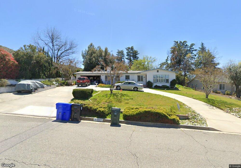
35977 Date St Yucaipa, CA 92399
Estimated Value: $405,000 - $512,000
2
Beds
1
Bath
1,431
Sq Ft
$322/Sq Ft
Est. Value
About This Home
This home is located at 35977 Date St, Yucaipa, CA 92399 and is currently estimated at $460,346, approximately $321 per square foot. 35977 Date St is a home located in San Bernardino County with nearby schools including Ridgeview Elementary School, Park View Middle School, and Yucaipa High School.
Ownership History
Date
Name
Owned For
Owner Type
Purchase Details
Closed on
Dec 8, 2022
Sold by
West James B and West Jacquelyn L
Bought by
West Family Revocable Living Trust and West
Current Estimated Value
Purchase Details
Closed on
Aug 2, 1996
Sold by
Bell Leo M
Bought by
Federal National Mortgage Association
Home Financials for this Owner
Home Financials are based on the most recent Mortgage that was taken out on this home.
Original Mortgage
$72,750
Interest Rate
8.11%
Mortgage Type
Seller Take Back
Purchase Details
Closed on
Jun 13, 1996
Sold by
Federal National Mortgage Association
Bought by
West James B and West Jacquelyn Lee
Home Financials for this Owner
Home Financials are based on the most recent Mortgage that was taken out on this home.
Original Mortgage
$72,750
Interest Rate
8.11%
Mortgage Type
Seller Take Back
Create a Home Valuation Report for This Property
The Home Valuation Report is an in-depth analysis detailing your home's value as well as a comparison with similar homes in the area
Purchase History
| Date | Buyer | Sale Price | Title Company |
|---|---|---|---|
| West Family Revocable Living Trust | -- | None Listed On Document | |
| Federal National Mortgage Association | $72,000 | Chicago Title Co | |
| West James B | $75,000 | First American Title Ins Co |
Source: Public Records
Mortgage History
| Date | Status | Borrower | Loan Amount |
|---|---|---|---|
| Previous Owner | West James B | $72,750 |
Source: Public Records
Tax History
| Year | Tax Paid | Tax Assessment Tax Assessment Total Assessment is a certain percentage of the fair market value that is determined by local assessors to be the total taxable value of land and additions on the property. | Land | Improvement |
|---|---|---|---|---|
| 2025 | $1,910 | $122,151 | $32,573 | $89,578 |
| 2024 | $1,858 | $119,756 | $31,934 | $87,822 |
| 2023 | $1,740 | $117,408 | $31,308 | $86,100 |
| 2022 | $1,618 | $115,106 | $30,694 | $84,412 |
| 2021 | $1,583 | $112,849 | $30,092 | $82,757 |
| 2020 | $1,583 | $111,691 | $29,783 | $81,908 |
| 2019 | $1,519 | $109,501 | $29,199 | $80,302 |
| 2018 | $1,255 | $107,353 | $28,626 | $78,727 |
| 2017 | $1,227 | $105,248 | $28,065 | $77,183 |
| 2016 | $1,210 | $103,185 | $27,515 | $75,670 |
| 2015 | $1,196 | $101,635 | $27,102 | $74,533 |
| 2014 | $1,171 | $99,644 | $26,571 | $73,073 |
Source: Public Records
Map
Nearby Homes
- 0 Pendleton Unit SW24186609
- 36041 Highland Ave
- 11758 Grant St
- 36231 Panorama Dr
- 36140 Highland Ave
- 35688 Date Ave
- 9813 Fremont St
- 36289 Panorama Dr
- 0 Kelly Ln Unit TR25227155
- 34625 Wildwood Canyon
- 34524 Carnation Ct
- 12874 #48 California
- 36313 Highland Ave
- 11764 Sutter Ave
- 0 Ivy Unit EV22227209
- 1 Aldbury
- 0 Pine Bench Rd Unit EV23119958
- 12151 Fremont St Unit 47
- 11675 Calvin St
- 11262 Oakdel Ct
- 35991 Date St
- 35963 Date St
- 11716 Pendleton Rd
- 11712 Pendleton Rd
- 35941 Date St
- 11688 Pendleton Rd
- 11711 Pendleton Rd
- 11774 Pendleton Rd
- 0 Pendleton Unit EV14205830
- 0 Pendleton Unit EV14220226
- 0 Pendleton Unit CRSW24186609
- 0 Pendleton Unit EV21006297
- 35937 Date St
- 11687 Pendleton Rd
- 11760 Pendleton Rd
- 11666 Pendleton Rd
- 11772 Pendleton Rd
- 11667 Pendleton Rd
- 35930 Date Ave
- 36027 Wheeler Place
Your Personal Tour Guide
Ask me questions while you tour the home.