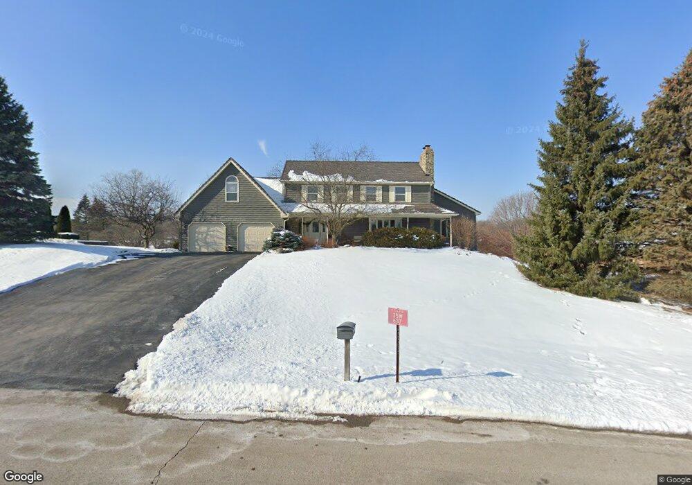
35W637 Parsons Rd Dundee, IL 60118
Estimated Value: $600,090 - $706,000
4
Beds
--
Bath
3,816
Sq Ft
$177/Sq Ft
Est. Value
About This Home
This home is located at 35W637 Parsons Rd, Dundee, IL 60118 and is currently estimated at $674,273, approximately $176 per square foot. 35W637 Parsons Rd is a home located in Kane County with nearby schools including Liberty Elementary School, Dundee Middle School, and Harry D Jacobs High School.
Ownership History
Date
Name
Owned For
Owner Type
Purchase Details
Closed on
Feb 1, 2019
Sold by
Phillips Robert Scott and Phillips Katherine A
Bought by
Phillips Robert S and Phillips Katherine A
Current Estimated Value
Create a Home Valuation Report for This Property
The Home Valuation Report is an in-depth analysis detailing your home's value as well as a comparison with similar homes in the area
Home Values in the Area
Average Home Value in this Area
Purchase History
| Date | Buyer | Sale Price | Title Company |
|---|---|---|---|
| Phillips Robert S | -- | Attorney |
Source: Public Records
Tax History Compared to Growth
Tax History
| Year | Tax Paid | Tax Assessment Tax Assessment Total Assessment is a certain percentage of the fair market value that is determined by local assessors to be the total taxable value of land and additions on the property. | Land | Improvement |
|---|---|---|---|---|
| 2024 | $11,463 | $177,723 | $36,024 | $141,699 |
| 2023 | $10,822 | $159,909 | $32,413 | $127,496 |
| 2022 | $11,011 | $154,133 | $32,413 | $121,720 |
| 2021 | $10,658 | $145,532 | $30,604 | $114,928 |
| 2020 | $10,432 | $142,260 | $29,916 | $112,344 |
| 2019 | $12,057 | $153,868 | $28,399 | $125,469 |
| 2018 | $12,878 | $159,622 | $30,984 | $128,638 |
| 2017 | $12,337 | $149,319 | $28,984 | $120,335 |
| 2016 | $12,655 | $144,577 | $28,064 | $116,513 |
| 2015 | -- | $135,473 | $26,297 | $109,176 |
| 2014 | -- | $127,649 | $25,571 | $102,078 |
| 2013 | -- | $131,556 | $26,354 | $105,202 |
Source: Public Records
Map
Nearby Homes
- 3404 Green Pastures Rd
- 35W543 Miller Rd
- 18N732 Westhill Rd
- 0000 State Route 31
- 3835 Parsons Rd
- Route 31 Route
- 1681 Highmeadow Ln
- 6415 Grassmere Ln
- 6109 Dunroven Lakes Ct
- 5 Lancaster Ct
- 1551 Westbourne Pkwy
- 6 Greyshire Ct
- 1530 Westbourne Pkwy
- 1540 Westbourne Pkwy
- lot 009 Huntley Rd
- 6850 Huntley Rd
- 7349 Grandview Ct Unit 103
- 7046 Nathan Ln
- 2705 Westwood Cir
- 2219 Barrett Dr
- 35W635 Parsons Rd Unit 2
- 35W645 Parsons Rd
- 35W640 Parsons Rd
- 35W636 Parsons Rd
- 35W625 Parsons Rd
- 35W707 Parsons Rd
- 35W646 Parsons Rd
- 35W741 Valley View Rd
- 35W650 Parsons Rd
- 35W740 Valley View Rd
- 35W550 Parsons Rd
- 35W611 Parsons Rd
- 35W723 Parsons Rd
- 35W710 Parsons Rd
- 35W744 Valley View Rd
- 35W532 Parsons Rd
- 35W530 Parsons Rd
- 35W739 Parsons Rd
- 35W528 Parsons Rd
- 35W807 Valley View Rd Unit 6