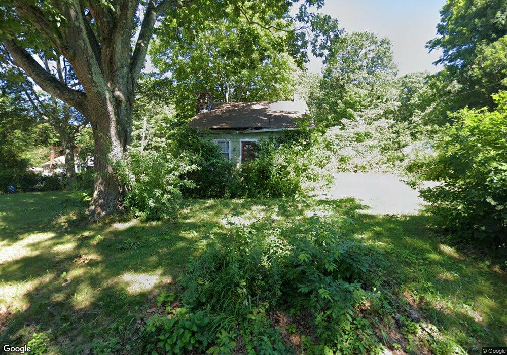
36 Algonquin Rd Middlefield, CT 06455
Estimated Value: $306,000 - $345,000
3
Beds
2
Baths
1,307
Sq Ft
$251/Sq Ft
Est. Value
About This Home
This home is located at 36 Algonquin Rd, Middlefield, CT 06455 and is currently estimated at $327,797, approximately $250 per square foot. 36 Algonquin Rd is a home located in Middlesex County with nearby schools including Frank Ward Strong School and Coginchaug Regional High School.
Ownership History
Date
Name
Owned For
Owner Type
Purchase Details
Closed on
Sep 11, 2019
Sold by
Corley David W Est
Bought by
Corley William and Corley Thomas
Current Estimated Value
Home Financials for this Owner
Home Financials are based on the most recent Mortgage that was taken out on this home.
Original Mortgage
$112,000
Outstanding Balance
$98,103
Interest Rate
3.6%
Mortgage Type
Purchase Money Mortgage
Estimated Equity
$229,694
Purchase Details
Closed on
Nov 2, 1978
Bought by
Corley David W and Corley Karen R
Create a Home Valuation Report for This Property
The Home Valuation Report is an in-depth analysis detailing your home's value as well as a comparison with similar homes in the area
Home Values in the Area
Average Home Value in this Area
Purchase History
| Date | Buyer | Sale Price | Title Company |
|---|---|---|---|
| Corley William | $160,000 | -- | |
| Corley David W | -- | -- |
Source: Public Records
Mortgage History
| Date | Status | Borrower | Loan Amount |
|---|---|---|---|
| Open | Corley William | $112,000 | |
| Previous Owner | Corley David W | $55,000 | |
| Previous Owner | Corley David W | $13,500 |
Source: Public Records
Tax History
| Year | Tax Paid | Tax Assessment Tax Assessment Total Assessment is a certain percentage of the fair market value that is determined by local assessors to be the total taxable value of land and additions on the property. | Land | Improvement |
|---|---|---|---|---|
| 2025 | $3,642 | $122,200 | $67,900 | $54,300 |
| 2024 | $3,429 | $122,200 | $67,900 | $54,300 |
| 2023 | $3,451 | $122,200 | $67,900 | $54,300 |
| 2022 | $3,368 | $122,200 | $67,900 | $54,300 |
| 2021 | $3,564 | $112,000 | $63,000 | $49,000 |
| 2020 | $3,610 | $112,000 | $63,000 | $49,000 |
| 2019 | $3,637 | $112,000 | $63,000 | $49,000 |
| 2018 | $3,863 | $112,000 | $63,000 | $49,000 |
| 2017 | $4,100 | $112,000 | $63,000 | $49,000 |
| 2016 | $4,167 | $126,900 | $63,000 | $63,900 |
| 2015 | $4,273 | $126,900 | $63,000 | $63,900 |
| 2014 | $4,304 | $126,900 | $63,000 | $63,900 |
Source: Public Records
Map
Nearby Homes
- 0 Baileyville Rd
- 31 High St Unit Lot 2
- 31 High St Unit Lot 3
- 20 Lakeview Estates Unit 20
- 45 Dwight Rd
- 1561 E Main St Unit 13
- 88 Powder Hill Rd
- 198 Mildred Rd
- 17 Esther Dr
- 129 Valley View Dr
- 1280 E Main St
- 1274 E Main St Unit D27
- 5 Race Track Hollow
- 45 Meadow Way
- 169 Cedar St
- 160 Bee St
- 170 Bee St
- 180 Bee St
- 291 Cartpath Dr
- 46 Cliffside Dr
- 32 Algonquin Rd
- 31 Algonquin Rd
- 7 Seneca Rd
- 28 Algonquin Rd
- 1 Seneca Rd
- 5 Seneca Rd
- 12 Seneca Rd
- 9 Massasoit Rd
- 43 Algonquin Rd
- 13 Massasoit Rd
- 24 Algonquin Rd
- 12 Mattabeseck Rd
- 0 Massasoit Rd
- 0 Mattabeseck Rd Unit N275349
- 0 Mattabeseck Rd
- 0 Mattabeseck Rd Unit N275944
- 6 Massasoit Rd
- 16 Seneca Rd
- 4 Massasoit Rd
- 1 Mattabeseck Rd
Your Personal Tour Guide
Ask me questions while you tour the home.