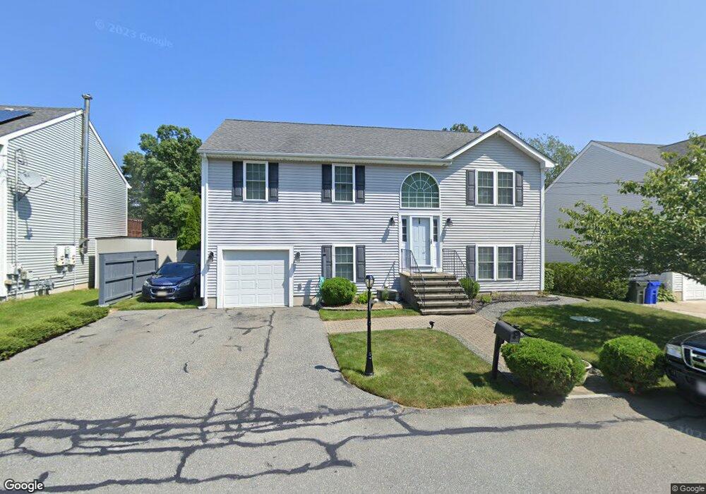
36 Carol Ct Fall River, MA 02721
Maplewood NeighborhoodEstimated Value: $444,174 - $528,000
3
Beds
2
Baths
1,232
Sq Ft
$391/Sq Ft
Est. Value
About This Home
This home is located at 36 Carol Ct, Fall River, MA 02721 and is currently estimated at $481,794, approximately $391 per square foot. 36 Carol Ct is a home located in Bristol County with nearby schools including Henry Lord Community School, B M C Durfee High School, and Argosy Collegiate Charter School.
Ownership History
Date
Name
Owned For
Owner Type
Purchase Details
Closed on
Mar 4, 2021
Sold by
Duff John M
Bought by
Duff Lee
Current Estimated Value
Home Financials for this Owner
Home Financials are based on the most recent Mortgage that was taken out on this home.
Original Mortgage
$71,000
Outstanding Balance
$50,699
Interest Rate
2.6%
Mortgage Type
Stand Alone Refi Refinance Of Original Loan
Estimated Equity
$431,095
Purchase Details
Closed on
Jan 25, 2021
Sold by
Duff Kathren A and Duff John M
Bought by
Duff John
Home Financials for this Owner
Home Financials are based on the most recent Mortgage that was taken out on this home.
Original Mortgage
$71,000
Outstanding Balance
$50,699
Interest Rate
2.6%
Mortgage Type
Stand Alone Refi Refinance Of Original Loan
Estimated Equity
$431,095
Purchase Details
Closed on
Nov 20, 2006
Sold by
Robillard Building Cor
Bought by
Duff John M and Duff Kathren A
Home Financials for this Owner
Home Financials are based on the most recent Mortgage that was taken out on this home.
Original Mortgage
$129,000
Interest Rate
6.33%
Mortgage Type
Purchase Money Mortgage
Create a Home Valuation Report for This Property
The Home Valuation Report is an in-depth analysis detailing your home's value as well as a comparison with similar homes in the area
Home Values in the Area
Average Home Value in this Area
Purchase History
| Date | Buyer | Sale Price | Title Company |
|---|---|---|---|
| Duff Lee | -- | None Available | |
| Duff John | -- | None Available | |
| Duff John | -- | None Available | |
| Duff John M | $260,000 | -- | |
| Duff John M | $260,000 | -- |
Source: Public Records
Mortgage History
| Date | Status | Borrower | Loan Amount |
|---|---|---|---|
| Open | Duff John | $71,000 | |
| Closed | Duff John | $71,000 | |
| Previous Owner | Duff John M | $153,000 | |
| Previous Owner | Duff John M | $129,000 |
Source: Public Records
Tax History
| Year | Tax Paid | Tax Assessment Tax Assessment Total Assessment is a certain percentage of the fair market value that is determined by local assessors to be the total taxable value of land and additions on the property. | Land | Improvement |
|---|---|---|---|---|
| 2025 | $4,372 | $381,800 | $120,700 | $261,100 |
| 2024 | $3,942 | $343,100 | $118,400 | $224,700 |
| 2023 | $3,977 | $324,100 | $106,700 | $217,400 |
| 2022 | $3,513 | $278,400 | $100,600 | $177,800 |
| 2021 | $3,554 | $257,000 | $96,100 | $160,900 |
| 2020 | $3,465 | $239,800 | $91,700 | $148,100 |
| 2019 | $3,558 | $244,000 | $95,900 | $148,100 |
| 2018 | $3,439 | $235,200 | $96,600 | $138,600 |
| 2017 | $3,276 | $234,000 | $96,600 | $137,400 |
| 2016 | $3,143 | $230,600 | $99,600 | $131,000 |
| 2015 | $2,748 | $210,100 | $83,200 | $126,900 |
| 2014 | $2,698 | $214,500 | $87,600 | $126,900 |
Source: Public Records
Map
Nearby Homes
Your Personal Tour Guide
Ask me questions while you tour the home.