Estimated Value: $342,000 - $468,000
2
Beds
2
Baths
1,370
Sq Ft
$304/Sq Ft
Est. Value
About This Home
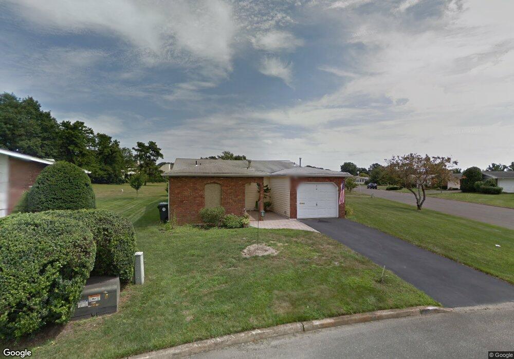
This home is located at 36 Phillips Rd, Brick, NJ 08724 and is currently estimated at $416,635, approximately $304 per square foot. 36 Phillips Rd is a home located in Ocean County with nearby schools including Lanes Mill Elementary School, Veterans Memorial Middle School, and Brick Township Memorial High School.
Ownership History
Date
Name
Owned For
Owner Type
Purchase Details
Closed on
Feb 7, 2020
Sold by
Shoup Brunhilda L and Bissey Brunhilda L
Bought by
Richard And Bh Shoup Living Trust
Current Estimated Value
Purchase Details
Closed on
Aug 24, 2007
Sold by
Berk Lynn S
Bought by
Bissey Brunhilda L
Home Financials for this Owner
Home Financials are based on the most recent Mortgage that was taken out on this home.
Original Mortgage
$147,000
Outstanding Balance
$93,642
Interest Rate
6.78%
Mortgage Type
Purchase Money Mortgage
Estimated Equity
$322,993
Create a Home Valuation Report for This Property
The Home Valuation Report is an in-depth analysis detailing your home's value as well as a comparison with similar homes in the area
Home Values in the Area
Average Home Value in this Area
Purchase History
| Date | Buyer | Sale Price | Title Company |
|---|---|---|---|
| Richard And Bh Shoup Living Trust | -- | None Available | |
| Bissey Brunhilda L | $232,000 | Platinum Title Agency |
Source: Public Records
Mortgage History
| Date | Status | Borrower | Loan Amount |
|---|---|---|---|
| Open | Bissey Brunhilda L | $147,000 |
Source: Public Records
Tax History
| Year | Tax Paid | Tax Assessment Tax Assessment Total Assessment is a certain percentage of the fair market value that is determined by local assessors to be the total taxable value of land and additions on the property. | Land | Improvement |
|---|---|---|---|---|
| 2025 | $3,586 | $137,400 | $40,000 | $97,400 |
| 2024 | $3,403 | $137,400 | $40,000 | $97,400 |
Source: Public Records
Map
Nearby Homes
- 234 Oak Forest Dr
- 10 Whitman St
- 25 Whitman St
- 48 Northrup Dr Unit 196
- 18 Northrup Dr Unit 201
- 318 Tina Lee Ct
- 39 Marlow Ave
- 56 Joseph Byrne Dr
- 55 Tony Ct
- 15 Brandywine Ct
- 12 Barker St
- 53 Albert Cucci Dr
- 21 Chatham Ct
- 603 Zinnia Ct Unit 3
- 6 Lisa Dr
- 42 Sidney Ct
- 100 Baser Ln
- 37 Central Blvd
- 104 Baser Ln
- 159 Clay Cir
Your Personal Tour Guide
Ask me questions while you tour the home.