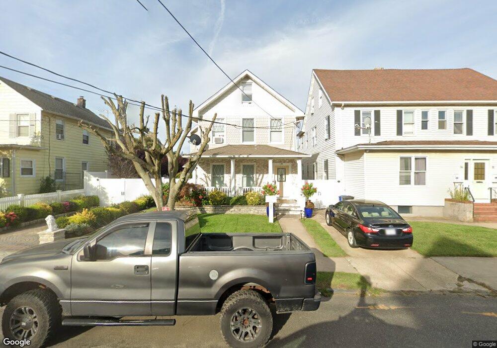
36 S 5th Ave Long Branch, NJ 07740
Estimated Value: $686,297 - $793,000
4
Beds
3
Baths
2,472
Sq Ft
$298/Sq Ft
Est. Value
About This Home
This home is located at 36 S 5th Ave, Long Branch, NJ 07740 and is currently estimated at $736,574, approximately $297 per square foot. 36 S 5th Ave is a home located in Monmouth County with nearby schools including Long Branch High School and Holy Trinity School.
Ownership History
Date
Name
Owned For
Owner Type
Purchase Details
Closed on
Sep 22, 2009
Sold by
Gmac Mortgage Llc
Bought by
Guiomar Amadeu and Guiomar Marlene
Current Estimated Value
Purchase Details
Closed on
Feb 1, 2004
Sold by
Reis Maria
Bought by
Costas Marilia and Santos Carlos
Home Financials for this Owner
Home Financials are based on the most recent Mortgage that was taken out on this home.
Original Mortgage
$316,000
Interest Rate
5.85%
Mortgage Type
Commercial
Purchase Details
Closed on
Feb 26, 1999
Sold by
Forsyth Gary
Bought by
Pereira Jose and Pereira Maria
Create a Home Valuation Report for This Property
The Home Valuation Report is an in-depth analysis detailing your home's value as well as a comparison with similar homes in the area
Home Values in the Area
Average Home Value in this Area
Purchase History
| Date | Buyer | Sale Price | Title Company |
|---|---|---|---|
| Guiomar Amadeu | $164,900 | Multiple | |
| Costas Marilia | $321,000 | -- | |
| Pereira Jose | $90,000 | -- |
Source: Public Records
Mortgage History
| Date | Status | Borrower | Loan Amount |
|---|---|---|---|
| Previous Owner | Costas Marilia | $316,000 |
Source: Public Records
Tax History Compared to Growth
Tax History
| Year | Tax Paid | Tax Assessment Tax Assessment Total Assessment is a certain percentage of the fair market value that is determined by local assessors to be the total taxable value of land and additions on the property. | Land | Improvement |
|---|---|---|---|---|
| 2025 | $8,718 | $694,600 | $244,600 | $450,000 |
| 2024 | $7,939 | $567,200 | $214,600 | $352,600 |
| 2023 | $7,939 | $511,200 | $174,600 | $336,600 |
| 2022 | $7,502 | $436,100 | $139,600 | $296,500 |
| 2021 | $7,502 | $374,900 | $120,600 | $254,300 |
| 2020 | $7,783 | $372,400 | $119,600 | $252,800 |
| 2019 | $7,372 | $350,700 | $109,600 | $241,100 |
| 2018 | $6,947 | $328,600 | $101,600 | $227,000 |
| 2017 | $6,437 | $312,300 | $89,600 | $222,700 |
| 2016 | $6,297 | $311,600 | $94,600 | $217,000 |
| 2015 | $4,659 | $209,200 | $96,500 | $112,700 |
| 2014 | $4,325 | $204,700 | $108,200 | $96,500 |
Source: Public Records
Map
Nearby Homes
- 39 Slocum Place
- 14 Slocum Place
- 40 N 5th Ave
- 145 Stokes Place
- 144 Westwood Ave
- 143 Stokes Place
- 167 Chelsea Ave
- 176 Chelsea Ave
- 399 Willow Ave
- 170 Franklin Ave
- 158 Franklin Ave
- 152 Franklin Ave
- 150 Franklin Ave Unit 5
- 148 Sixth Ave
- 166 Franklin Ave Unit 8
- 103 Franklin Ave
- 151 N 5th Ave
- 40 University Dr
- 184 N 5th Ave
- 401 Joline Ave
- 40 S 5th Ave
- 32 S 5th Ave
- 28 S 5th Ave
- 44 S 5th Ave
- 48 S 5th Ave
- 24 S 5th Ave Unit 26
- 50 S 5th Ave
- 31 Slocum Place
- 27 Slocum Place
- 35 Slocum Place Unit 37
- 43 Slocum Place
- 20 S 5th Ave Unit 22
- 54 S 5th Ave
- 23 Slocum Place
- 35 S 5th Ave Unit 37
- 47 Slocum Place
- 39 S 5th Ave Unit 41
- 31 S 5th Ave Unit 33
- 27 S 5th Ave
- 43 S 5th Ave