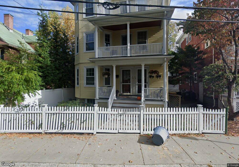
36 Sparks St Unit 2 Cambridge, MA 02138
West Cambridge NeighborhoodEstimated Value: $952,619 - $1,331,000
2
Beds
1
Bath
968
Sq Ft
$1,218/Sq Ft
Est. Value
About This Home
This home is located at 36 Sparks St Unit 2, Cambridge, MA 02138 and is currently estimated at $1,178,905, approximately $1,217 per square foot. 36 Sparks St Unit 2 is a home located in Middlesex County with nearby schools including St Peter School, Cambridge Montessori School, and Cambridge Friends School.
Ownership History
Date
Name
Owned For
Owner Type
Purchase Details
Closed on
Jul 7, 1998
Sold by
Teuber Andreas
Bought by
Henry B Thomas
Current Estimated Value
Home Financials for this Owner
Home Financials are based on the most recent Mortgage that was taken out on this home.
Original Mortgage
$261,600
Outstanding Balance
$53,721
Interest Rate
7.04%
Mortgage Type
Purchase Money Mortgage
Estimated Equity
$1,125,184
Create a Home Valuation Report for This Property
The Home Valuation Report is an in-depth analysis detailing your home's value as well as a comparison with similar homes in the area
Home Values in the Area
Average Home Value in this Area
Purchase History
| Date | Buyer | Sale Price | Title Company |
|---|---|---|---|
| Henry B Thomas | $327,000 | -- | |
| Henry B Thomas | $327,000 | -- |
Source: Public Records
Mortgage History
| Date | Status | Borrower | Loan Amount |
|---|---|---|---|
| Open | Henry B Thomas | $261,600 | |
| Closed | Henry B Thomas | $261,600 | |
| Previous Owner | Henry B Thomas | $90,000 |
Source: Public Records
Tax History Compared to Growth
Tax History
| Year | Tax Paid | Tax Assessment Tax Assessment Total Assessment is a certain percentage of the fair market value that is determined by local assessors to be the total taxable value of land and additions on the property. | Land | Improvement |
|---|---|---|---|---|
| 2025 | $6,313 | $994,100 | $0 | $994,100 |
| 2024 | $5,866 | $990,900 | $0 | $990,900 |
| 2023 | $5,598 | $955,300 | $0 | $955,300 |
| 2022 | $5,575 | $941,800 | $0 | $941,800 |
| 2021 | $5,457 | $932,900 | $0 | $932,900 |
| 2020 | $5,188 | $902,300 | $0 | $902,300 |
| 2019 | $4,969 | $836,600 | $0 | $836,600 |
| 2018 | $4,621 | $734,600 | $0 | $734,600 |
| 2017 | $4,452 | $686,000 | $0 | $686,000 |
| 2016 | $4,336 | $620,300 | $0 | $620,300 |
| 2015 | $4,293 | $549,000 | $0 | $549,000 |
| 2014 | $4,225 | $504,200 | $0 | $504,200 |
Source: Public Records
Map
Nearby Homes
- 11 Brown St
- 15 Hubbard Park Rd
- 20 Maynard Place
- 48 Hubbard Park Rd
- 153 Brattle St
- 1010 Memorial Dr Unit 7D&E
- 158 Brattle St
- 3 Berkeley Place
- 32 Hawthorn St
- 12 Berkeley St
- 172 Brattle St
- 34 Ash St Unit 204
- 988 Memorial Dr Unit 386
- 5 Brewer St Unit 5
- 22 Concord Ave Unit 10
- 14 Concord Ave Unit 810/814
- 29 Concord Ave Unit 302
- 985 Memorial Dr Unit 603
- 12 Ash Street Place
- 38 Garden St
- 36 Sparks St Unit 1
- 38 Sparks St
- 38 Sparks St Unit 1
- 34 Sparks St
- 34 Sparks St Unit 2
- 34 Sparks St Unit 3
- 32 Sparks St
- 32 Sparks St Unit 3
- 32 Sparks St Unit 1
- 32 Sparks St Unit 2
- 5 Mercer Cir
- 63 Foster St
- 65 Foster St
- 74 Foster St
- 72 Foster St Unit 1
- 72 Foster St Unit 3
- 2 Hubbard Park Rd
- 2 Hubbard Park Rd Unit 3
- 2 Hubbard Park Rd Unit 2
- 0 Hubbard Park Rd Unit 1