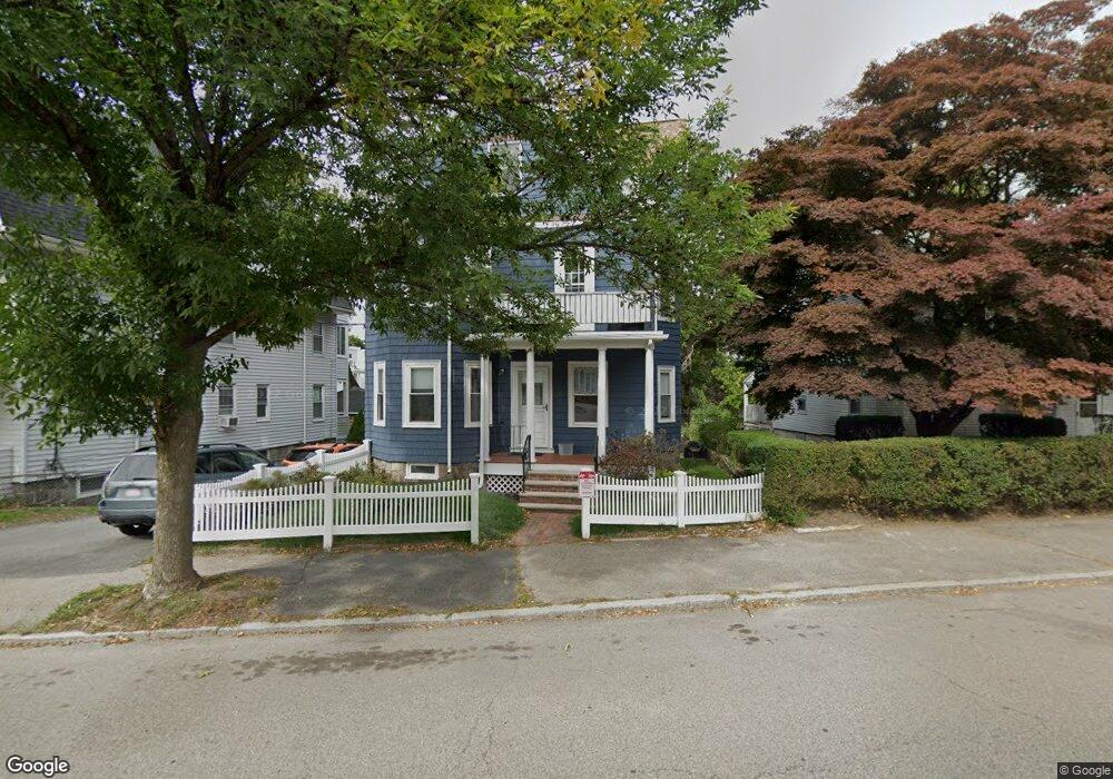
36 Walter St Unit 3 Roslindale, MA 02131
Roslindale NeighborhoodEstimated Value: $496,549 - $589,000
1
Bed
1
Bath
878
Sq Ft
$618/Sq Ft
Est. Value
About This Home
This home is located at 36 Walter St Unit 3, Roslindale, MA 02131 and is currently estimated at $542,387, approximately $617 per square foot. 36 Walter St Unit 3 is a home located in Suffolk County with nearby schools including Brooke Charter School Roslindale, Holy Name Parish School, and Sacred Heart STEM School.
Ownership History
Date
Name
Owned For
Owner Type
Purchase Details
Closed on
Sep 14, 2015
Sold by
Garry Eileen M
Bought by
Perry Carol L and Perry Garry Eileen
Current Estimated Value
Purchase Details
Closed on
Jun 30, 2004
Sold by
Walter St Condo 36
Bought by
Garry Eileen M
Home Financials for this Owner
Home Financials are based on the most recent Mortgage that was taken out on this home.
Original Mortgage
$250,800
Interest Rate
6.3%
Mortgage Type
Purchase Money Mortgage
Create a Home Valuation Report for This Property
The Home Valuation Report is an in-depth analysis detailing your home's value as well as a comparison with similar homes in the area
Home Values in the Area
Average Home Value in this Area
Purchase History
| Date | Buyer | Sale Price | Title Company |
|---|---|---|---|
| Perry Carol L | -- | -- | |
| Garry Eileen M | $279,000 | -- |
Source: Public Records
Mortgage History
| Date | Status | Borrower | Loan Amount |
|---|---|---|---|
| Previous Owner | Garry Eileen M | $223,200 | |
| Previous Owner | Garry Eileen M | $250,800 |
Source: Public Records
Tax History Compared to Growth
Tax History
| Year | Tax Paid | Tax Assessment Tax Assessment Total Assessment is a certain percentage of the fair market value that is determined by local assessors to be the total taxable value of land and additions on the property. | Land | Improvement |
|---|---|---|---|---|
| 2025 | $4,956 | $428,000 | $0 | $428,000 |
| 2024 | $4,667 | $428,200 | $0 | $428,200 |
| 2023 | $4,508 | $419,700 | $0 | $419,700 |
| 2022 | $4,269 | $392,400 | $0 | $392,400 |
| 2021 | $4,105 | $384,700 | $0 | $384,700 |
| 2020 | $3,368 | $318,900 | $0 | $318,900 |
| 2019 | $3,375 | $320,200 | $0 | $320,200 |
| 2018 | $3,032 | $289,300 | $0 | $289,300 |
| 2017 | $2,916 | $275,400 | $0 | $275,400 |
| 2016 | $2,780 | $252,700 | $0 | $252,700 |
| 2015 | $3,092 | $255,300 | $0 | $255,300 |
| 2014 | $2,946 | $234,200 | $0 | $234,200 |
Source: Public Records
Map
Nearby Homes
- 79 Robert St Unit 3
- 15 S Fairview St Unit 3
- 103 Belgrade Ave Unit 2
- 87 Knoll St
- 26 Bradfield Ave Unit 3
- 24 Hazelmere Rd
- 65 Birch St Unit 3
- 17 Metcalf St
- 2 Weld Hill St Unit PH2
- 80 Roslindale Ave Unit 3
- 15 Newburg St Unit 1
- 112 Roslindale Ave Unit 2
- 142 Birch St
- 142 Birch St Unit 1
- 142 Birch St Unit 2
- 242 Belgrade Ave
- 620 South St
- 257 Belgrade Ave
- 108 Florence St Unit 3
- 108 Florence St Unit 4
- 36 Walter St Unit 2
- 36 Walter St Unit 1
- 38 Walter St Unit 1
- 32 Walter St
- 40 Walter St
- 15 Sheffield Rd Unit 17
- 15 Sheffield Rd Unit 3
- 15 Sheffield Rd Unit 1
- 15 Sheffield Rd Unit 2
- 44 Walter St
- 10 Ardale St
- 39 Walter St
- 39 Walter St Unit 1
- 22 Walter St
- 22 Walter St Unit 2
- 22 Walter St Unit 3
- 22 Walter St Unit 1
- 19 Sheffield Rd Unit 3
- 19 Sheffield Rd Unit 2
- 19 Sheffield Rd Unit 1