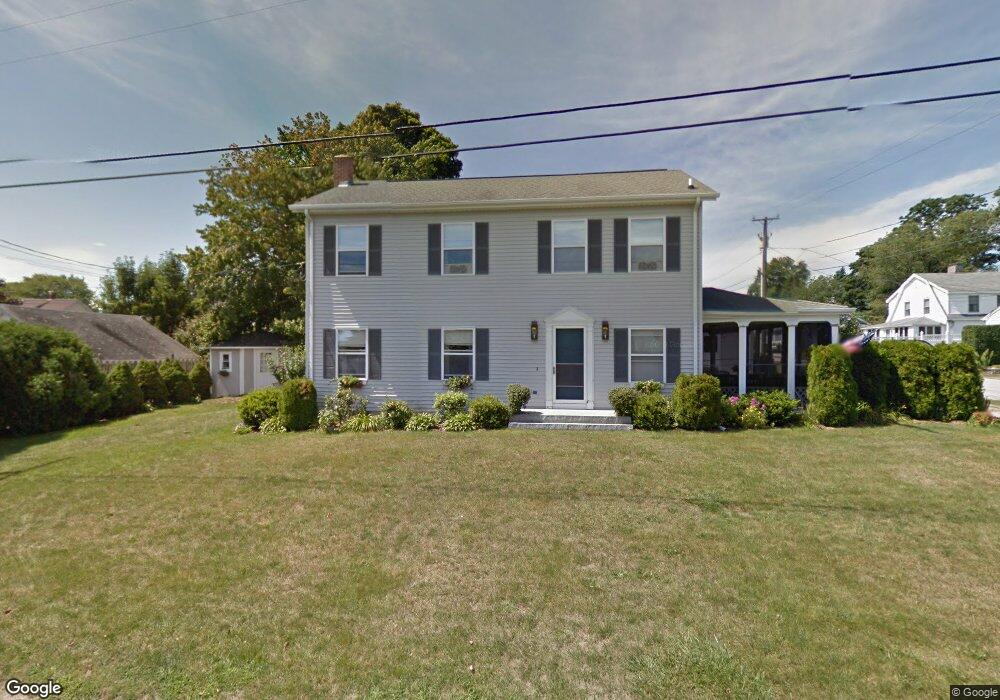
36 Whitecap Rd Niantic, CT 06357
Estimated Value: $781,208 - $917,000
4
Beds
4
Baths
2,716
Sq Ft
$314/Sq Ft
Est. Value
About This Home
This home is located at 36 Whitecap Rd, Niantic, CT 06357 and is currently estimated at $853,052, approximately $314 per square foot. 36 Whitecap Rd is a home located in New London County with nearby schools including East Lyme Middle School, East Lyme High School, and The Light House Voc-Ed Center.
Ownership History
Date
Name
Owned For
Owner Type
Purchase Details
Closed on
Aug 29, 2025
Sold by
Lemieux Carol L and Lemieux Daniel J
Bought by
Carol L Lemieux T L and Carol Lemieux
Current Estimated Value
Purchase Details
Closed on
Aug 24, 1998
Sold by
Burnett John J and Burnett Mary
Bought by
Lemieux Daniel L and Lemieux Carol L
Home Financials for this Owner
Home Financials are based on the most recent Mortgage that was taken out on this home.
Original Mortgage
$131,600
Interest Rate
6.86%
Mortgage Type
Purchase Money Mortgage
Create a Home Valuation Report for This Property
The Home Valuation Report is an in-depth analysis detailing your home's value as well as a comparison with similar homes in the area
Home Values in the Area
Average Home Value in this Area
Purchase History
| Date | Buyer | Sale Price | Title Company |
|---|---|---|---|
| Carol L Lemieux T L | -- | -- | |
| Lemieux Daniel L | $172,000 | -- |
Source: Public Records
Mortgage History
| Date | Status | Borrower | Loan Amount |
|---|---|---|---|
| Previous Owner | Lemieux Daniel L | $303,700 | |
| Previous Owner | Lemieux Daniel L | $100,000 | |
| Previous Owner | Lemieux Daniel L | $131,600 | |
| Previous Owner | Lemieux Daniel L | $105,000 |
Source: Public Records
Tax History
| Year | Tax Paid | Tax Assessment Tax Assessment Total Assessment is a certain percentage of the fair market value that is determined by local assessors to be the total taxable value of land and additions on the property. | Land | Improvement |
|---|---|---|---|---|
| 2025 | $8,968 | $320,180 | $111,090 | $209,090 |
| 2024 | $6,581 | $249,760 | $111,090 | $138,670 |
| 2023 | $6,214 | $249,760 | $111,090 | $138,670 |
| 2022 | $5,954 | $249,760 | $111,090 | $138,670 |
| 2021 | $5,859 | $205,520 | $96,320 | $109,200 |
| 2020 | $5,829 | $205,520 | $96,320 | $109,200 |
| 2019 | $5,794 | $205,520 | $96,320 | $109,200 |
| 2018 | $5,621 | $205,520 | $96,320 | $109,200 |
| 2017 | $5,376 | $205,520 | $96,320 | $109,200 |
| 2016 | $5,175 | $204,050 | $96,320 | $107,730 |
| 2015 | $5,042 | $204,050 | $96,320 | $107,730 |
| 2014 | $4,903 | $204,050 | $96,320 | $107,730 |
Source: Public Records
Map
Nearby Homes
- 61 Whitecap Rd
- 36 Attawan Rd
- 26 Mohawk Dr
- 127 Black Point Rd Unit 7
- 15 Griswold Rd
- 42 S Washington Ave
- 19 Sapia Dr
- 12 Spinnaker Dr
- 31 Regatta Dr
- 18 Compass Ct
- 468 Main St Unit 318
- 468 Main St Unit 111
- 43 Village Crossing Unit 43
- 47 Village Crossing Unit 47
- 46 Village Crossing Unit 46
- 97 W Main St Unit 36
- 55 Corey Ln
- 185 Main St Unit 301
- 185 Main St Unit 305
- 43 Roxbury Ct
- 38 Whitecap Rd
- 40 Whitecap Rd
- 33 Sea Breeze Ave
- 37 Sea Breeze Ave
- 32 Whitecap Rd
- 25 Sunrise Ave
- 31 Sea Breeze Ave
- 42 Whitecap Rd
- 39 Whitecap Rd
- 41 Whitecap Rd
- 39 Sea Breeze Ave
- 29 Sea Breeze Ave
- 28 Whitecap Rd
- 31 Whitecap Rd
- 28 Whitecap Rd
- 27 Sea Breeze Ave
- 44 Whitecap Rd
- 41 Sea Breeze Ave
- 43 Whitecap Rd
- 36 Sea Breeze Ave
Your Personal Tour Guide
Ask me questions while you tour the home.