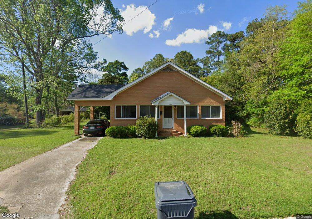
360 Burum St SW Pelham, GA 31779
Estimated Value: $157,414 - $212,000
3
Beds
2
Baths
1,710
Sq Ft
$108/Sq Ft
Est. Value
About This Home
This home is located at 360 Burum St SW, Pelham, GA 31779 and is currently estimated at $184,104, approximately $107 per square foot. 360 Burum St SW is a home located in Mitchell County with nearby schools including Pelham Elementary School, Pelham City Middle School, and Pelham High School.
Ownership History
Date
Name
Owned For
Owner Type
Purchase Details
Closed on
May 30, 2008
Sold by
Fnma
Bought by
Mejia Simon
Current Estimated Value
Purchase Details
Closed on
Mar 4, 2008
Sold by
Wachovia Mortgage Corp
Bought by
Federal National Mortgage Association
Purchase Details
Closed on
Apr 21, 2006
Sold by
Coarsey Linda Kay
Bought by
Rogers Matthew D and Rogers Dana A
Home Financials for this Owner
Home Financials are based on the most recent Mortgage that was taken out on this home.
Original Mortgage
$89,900
Interest Rate
6.28%
Mortgage Type
New Conventional
Create a Home Valuation Report for This Property
The Home Valuation Report is an in-depth analysis detailing your home's value as well as a comparison with similar homes in the area
Home Values in the Area
Average Home Value in this Area
Purchase History
| Date | Buyer | Sale Price | Title Company |
|---|---|---|---|
| Mejia Simon | $94,500 | -- | |
| Federal National Mortgage Association | $98,507 | -- | |
| Wachovia Mortgage Corporation | $98,507 | -- | |
| Rogers Matthew D | $89,900 | -- |
Source: Public Records
Mortgage History
| Date | Status | Borrower | Loan Amount |
|---|---|---|---|
| Previous Owner | Rogers Matthew D | $89,900 |
Source: Public Records
Tax History Compared to Growth
Tax History
| Year | Tax Paid | Tax Assessment Tax Assessment Total Assessment is a certain percentage of the fair market value that is determined by local assessors to be the total taxable value of land and additions on the property. | Land | Improvement |
|---|---|---|---|---|
| 2024 | $2,306 | $54,040 | $1,440 | $52,600 |
| 2023 | $2,379 | $54,040 | $1,440 | $52,600 |
| 2022 | $1,827 | $41,200 | $1,440 | $39,760 |
| 2021 | $1,586 | $36,600 | $1,440 | $35,160 |
| 2020 | $1,522 | $36,600 | $1,440 | $35,160 |
| 2019 | $1,532 | $36,080 | $1,440 | $34,640 |
| 2018 | $1,675 | $37,040 | $2,400 | $34,640 |
| 2017 | $657 | $35,418 | $2,400 | $33,018 |
| 2016 | $683 | $35,418 | $2,400 | $33,018 |
| 2015 | $683 | $35,418 | $2,400 | $33,018 |
| 2014 | $683 | $35,438 | $2,400 | $33,038 |
| 2013 | $683 | $35,438 | $2,400 | $33,038 |
Source: Public Records
Map
Nearby Homes
- 277 Saunders St SW
- 410 Hollis St SW
- 389 Stewart St SW
- 209 McDonald St SW
- 425 Hollis St SW
- 354 Bennett St NW
- 443 Stewart St SW
- 212 Hand Ave W
- 210 Castleberry St NW
- 233 Cannon St NW
- 135 Baggs Ave SE
- 5854 Mount Olive Rd
- 3** Youngs Mill Rd
- 183 Baggs Ave SE
- 0 Old Ga Highway 3
- 199 Carroll St NE
- 323 Curry St NE
- 335 Curry St NE
- 375 Baggs Ave SE
- 589 Liberia St NW
- 350 Burum St SW
- 370 Burum St SW
- 359 SW Burnam St
- 359 Burum St SW
- 347 Burum St SW
- 367 Burum St SW
- 386 Burum St SW
- 332 Burum St SW
- 331 Burum St SW
- Lot 14 SW Saunders St Unit 14
- Lot 14 SW Saunders St
- 280 Residence St SW
- 391 Burum St SW
- 261 Palmer St SW
- 189 Palmer St SW
- 281 Residence St SW
- 402 Burum St SW
- 292 Residence St SW
- 287 Saunders St SW
- 275 Palmer St SW