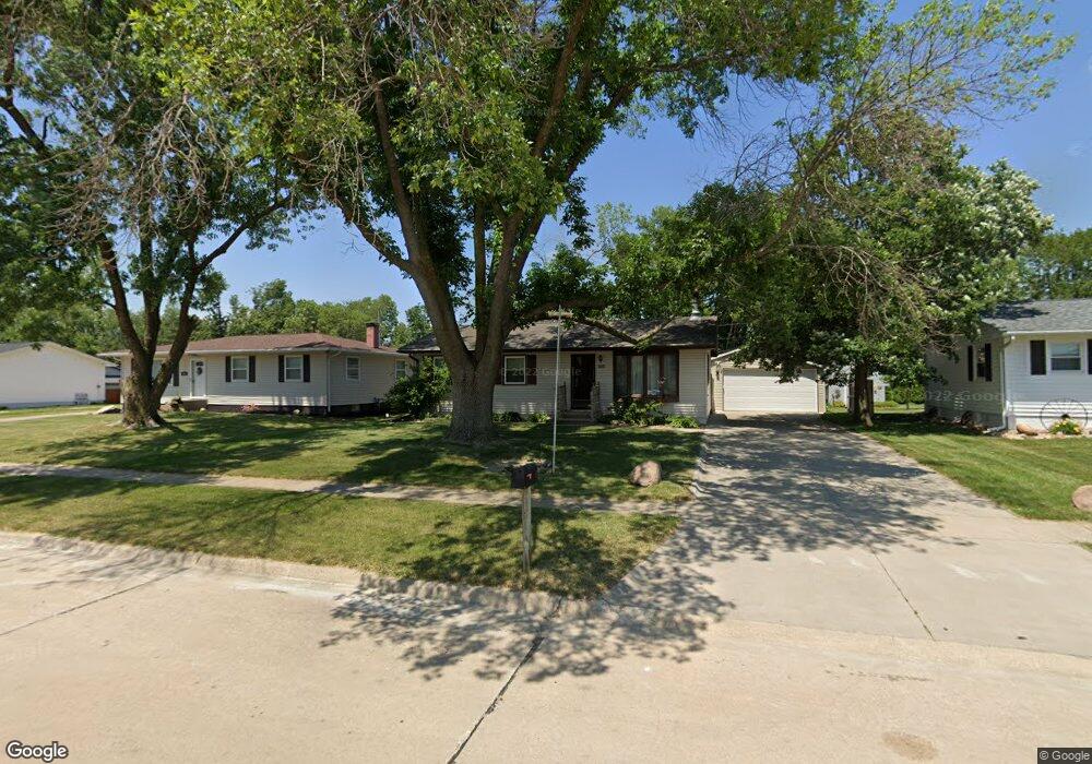
360 Daws Rd Hiawatha, IA 52233
Estimated Value: $216,296 - $247,000
3
Beds
2
Baths
1,510
Sq Ft
$150/Sq Ft
Est. Value
About This Home
This home is located at 360 Daws Rd, Hiawatha, IA 52233 and is currently estimated at $226,824, approximately $150 per square foot. 360 Daws Rd is a home located in Linn County with nearby schools including Hiawatha Elementary School, Harding Middle School, and John F. Kennedy High School.
Ownership History
Date
Name
Owned For
Owner Type
Purchase Details
Closed on
Jan 29, 2010
Sold by
Hagstrom Lori L and Hagstrom Christopher M
Bought by
Ryan Francis and Ryan Lois E
Current Estimated Value
Purchase Details
Closed on
Jan 7, 2004
Sold by
Hofer Jerry A and Hofer Danette C
Bought by
Stastny Lori L
Home Financials for this Owner
Home Financials are based on the most recent Mortgage that was taken out on this home.
Original Mortgage
$86,500
Interest Rate
5.94%
Mortgage Type
Purchase Money Mortgage
Purchase Details
Closed on
Mar 27, 1998
Sold by
Hendricks Floyd A and Hendricks Judith A
Bought by
Hofer Jerry A and Hofer Danette C
Home Financials for this Owner
Home Financials are based on the most recent Mortgage that was taken out on this home.
Original Mortgage
$63,800
Interest Rate
7.09%
Create a Home Valuation Report for This Property
The Home Valuation Report is an in-depth analysis detailing your home's value as well as a comparison with similar homes in the area
Home Values in the Area
Average Home Value in this Area
Purchase History
| Date | Buyer | Sale Price | Title Company |
|---|---|---|---|
| Ryan Francis | $129,500 | None Available | |
| Stastny Lori L | $111,000 | -- | |
| Hofer Jerry A | $80,500 | -- |
Source: Public Records
Mortgage History
| Date | Status | Borrower | Loan Amount |
|---|---|---|---|
| Previous Owner | Stastny Lori L | $86,500 | |
| Previous Owner | Hofer Jerry A | $63,800 | |
| Closed | Stastny Lori L | $25,000 |
Source: Public Records
Tax History
| Year | Tax Paid | Tax Assessment Tax Assessment Total Assessment is a certain percentage of the fair market value that is determined by local assessors to be the total taxable value of land and additions on the property. | Land | Improvement |
|---|---|---|---|---|
| 2025 | $2,406 | $201,000 | $23,900 | $177,100 |
| 2024 | $2,892 | $172,500 | $23,900 | $148,600 |
| 2023 | $2,892 | $172,500 | $23,900 | $148,600 |
| 2022 | $2,854 | $154,900 | $23,900 | $131,000 |
| 2021 | $2,874 | $154,900 | $23,900 | $131,000 |
| 2020 | $2,874 | $146,000 | $23,900 | $122,100 |
| 2019 | $2,630 | $135,100 | $22,100 | $113,000 |
Source: Public Records
Map
Nearby Homes
- 225 Clymer Rd
- 1355 Robins Rd
- 780 Ryan Ave
- 1011 Kacena Rd
- 114 Northwood Dr
- 2910 Hawkeye Dr
- 2900 Hawkeye Dr
- 2905 Hawkeye Dr
- 2915 Hawkeye Dr
- 6701 Stonybrook Ln NE
- 250 Cimarron Dr Unit 108
- 3 N Center Point Rd
- 1 N Center Point Rd
- 1623 Petrus Dr NE
- 6807 Kingswood Ln NE
- 1472 Tower Ln NE Unit 5
- 1224 Litchfield Dr Unit B
- 1224 Litchfield Dr
- 560 Ryker St
- 109 E Willman St