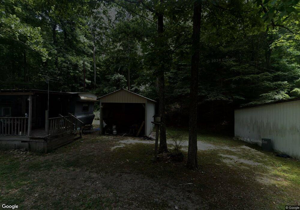
360 Mayfield Ln Stewart, TN 37175
Estimated Value: $67,297 - $94,000
--
Bed
--
Bath
--
Sq Ft
0.35
Acres
About This Home
This home is located at 360 Mayfield Ln, Stewart, TN 37175 and is currently estimated at $79,766. 360 Mayfield Ln is a home.
Ownership History
Date
Name
Owned For
Owner Type
Purchase Details
Closed on
Jul 10, 2016
Sold by
Thompson Charlotte Renee
Bought by
Rummel Tamara S
Current Estimated Value
Purchase Details
Closed on
Feb 18, 2011
Sold by
Thompson George Tandy
Bought by
Thompson Charlotte Renee
Purchase Details
Closed on
Mar 2, 2009
Sold by
Wilson Terry S
Bought by
Thompson George Tandy
Purchase Details
Closed on
May 5, 1997
Bought by
Wilson Terry S
Purchase Details
Closed on
Aug 3, 1993
Bought by
Lynch Bobby and Lynch Geneva
Purchase Details
Closed on
Mar 4, 1986
Bought by
Smith Charles E and Smith Judith M
Create a Home Valuation Report for This Property
The Home Valuation Report is an in-depth analysis detailing your home's value as well as a comparison with similar homes in the area
Home Values in the Area
Average Home Value in this Area
Purchase History
| Date | Buyer | Sale Price | Title Company |
|---|---|---|---|
| Rummel Tamara S | $4,750 | -- | |
| Thompson Charlotte Renee | -- | -- | |
| Thompson George Tandy | $8,300 | -- | |
| Wilson Terry S | $7,100 | -- | |
| Lynch Bobby | $3,700 | -- | |
| Smith Charles E | $3,000 | -- | |
| Thompson George Tandy | $8,300 | -- |
Source: Public Records
Tax History Compared to Growth
Tax History
| Year | Tax Paid | Tax Assessment Tax Assessment Total Assessment is a certain percentage of the fair market value that is determined by local assessors to be the total taxable value of land and additions on the property. | Land | Improvement |
|---|---|---|---|---|
| 2024 | $66 | $3,725 | $1,275 | $2,450 |
| 2023 | $66 | $3,725 | $1,275 | $2,450 |
| 2022 | $73 | $2,625 | $875 | $1,750 |
| 2021 | $73 | $2,625 | $875 | $1,750 |
| 2020 | $76 | $2,625 | $875 | $1,750 |
| 2019 | $76 | $2,375 | $1,250 | $1,125 |
| 2018 | $76 | $2,375 | $1,250 | $1,125 |
| 2017 | $76 | $2,375 | $1,250 | $1,125 |
| 2016 | $76 | $2,375 | $1,250 | $1,125 |
| 2015 | $76 | $2,375 | $1,250 | $1,125 |
| 2014 | -- | $2,370 | $0 | $0 |
Source: Public Records
Map
Nearby Homes
- 85 Lakeview Ln
- 10120 Highway 147
- 0 Highway 232 Unit 25510404
- 79 Overlook Ln
- 71 Overlook Ln
- 67 Overlook Ln
- 35 Airport Ln
- 372 Cheree Loop
- 11175 Highway 147
- 943 Overlook Trail
- 0 Rocky Point Rd Unit RTC2700425
- 8955 Tennessee 147
- 0 Overlook Trail
- 0 Day Cemetery Ln
- 78 Vista Ridge Dr
- 0 Vista Ridge Dr
- 33 Vista Ridge Dr
- 1025 Vista Ridge Dr
- 27 Vista Ridge Dr
- 0 Lake Ridge Dr Unit RTC3017496
- 190 Mayfield Ln
- 171 Mayfield Ln
- 19 Lakeview Ln
- 66 Mayfield Rd
- 81 Mayfield Ln
- 66 Mayfield Ln
- 55 Lakeview Ln
- 15 Muscadine Ln
- 270 Mayfield Ln
- 61 Mayfield Ln
- 10328 Highway 147
- 55 Muscadine Ln
- 10254 Highway 147
- 10254 Tennessee 147
- 70 Lakeview Ln
- 105 Lakeview Ln
- 10448 Highway 147
- 190 Lakeview Ln
- 131 Lakeview Ln
- 0 Highway 147 Unit RTC2642337