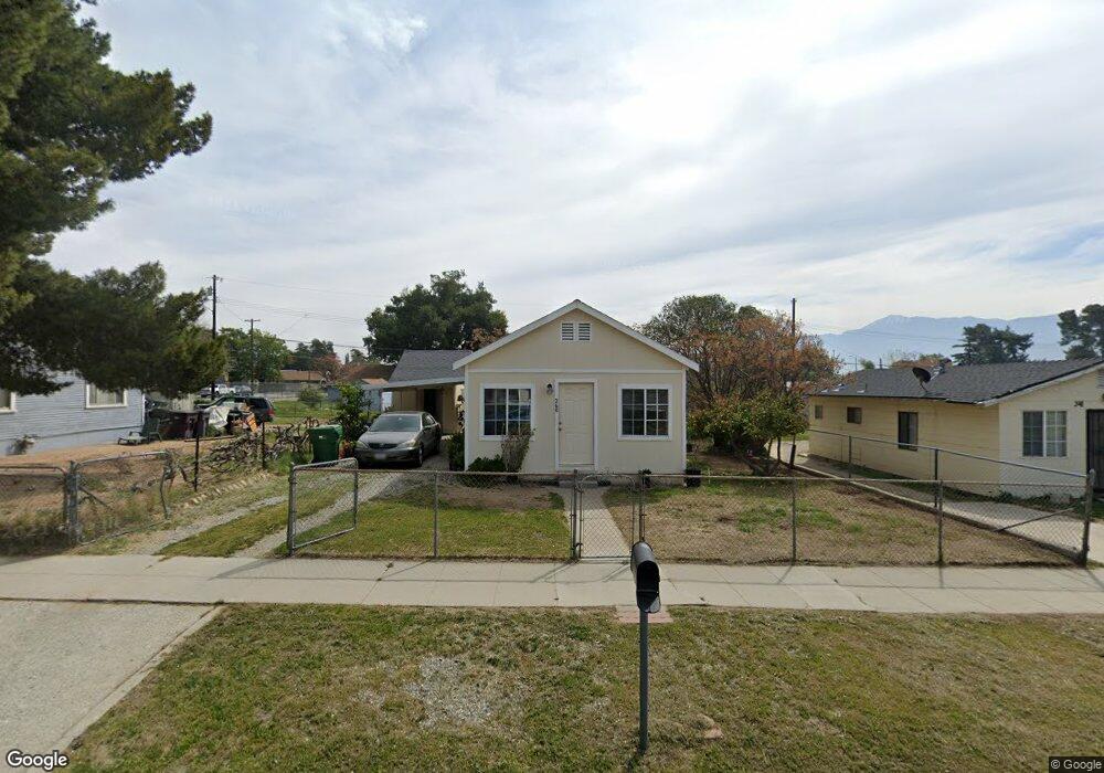
360 N 6th St Banning, CA 92220
Estimated Value: $269,000 - $320,000
2
Beds
1
Bath
684
Sq Ft
$421/Sq Ft
Est. Value
About This Home
This home is located at 360 N 6th St, Banning, CA 92220 and is currently estimated at $288,182, approximately $421 per square foot. 360 N 6th St is a home located in Riverside County with nearby schools including Banning High School.
Ownership History
Date
Name
Owned For
Owner Type
Purchase Details
Closed on
Dec 20, 2023
Sold by
Vedaa Robert
Bought by
Vedaa Roy Family Trust and Vedaa
Current Estimated Value
Purchase Details
Closed on
Dec 30, 2004
Sold by
Roy Jennifer
Bought by
Vedaa Robert
Purchase Details
Closed on
Jan 14, 1994
Sold by
Filhe Hazelle
Bought by
Scanlan David
Home Financials for this Owner
Home Financials are based on the most recent Mortgage that was taken out on this home.
Original Mortgage
$28,800
Interest Rate
7.21%
Create a Home Valuation Report for This Property
The Home Valuation Report is an in-depth analysis detailing your home's value as well as a comparison with similar homes in the area
Home Values in the Area
Average Home Value in this Area
Purchase History
| Date | Buyer | Sale Price | Title Company |
|---|---|---|---|
| Vedaa Roy Family Trust | -- | None Listed On Document | |
| Vedaa Robert | -- | Commonwealth Title | |
| Vedaa Robert | $110,000 | Commonwealth | |
| Scanlan David | $36,000 | Fidelity National Title Ins |
Source: Public Records
Mortgage History
| Date | Status | Borrower | Loan Amount |
|---|---|---|---|
| Previous Owner | Scanlan David | $28,800 |
Source: Public Records
Tax History
| Year | Tax Paid | Tax Assessment Tax Assessment Total Assessment is a certain percentage of the fair market value that is determined by local assessors to be the total taxable value of land and additions on the property. | Land | Improvement |
|---|---|---|---|---|
| 2025 | $2,127 | $153,306 | $48,775 | $104,531 |
| 2023 | $2,127 | $147,355 | $46,882 | $100,473 |
| 2022 | $2,082 | $144,466 | $45,963 | $98,503 |
| 2021 | $2,042 | $141,634 | $45,062 | $96,572 |
| 2020 | $2,023 | $140,182 | $44,600 | $95,582 |
| 2019 | $1,992 | $137,434 | $43,726 | $93,708 |
| 2018 | $1,979 | $134,740 | $42,869 | $91,871 |
| 2017 | $1,946 | $132,099 | $42,029 | $90,070 |
| 2016 | $1,852 | $129,509 | $41,205 | $88,304 |
| 2015 | $1,825 | $127,566 | $40,587 | $86,979 |
| 2014 | $1,123 | $76,000 | $24,000 | $52,000 |
Source: Public Records
Map
Nearby Homes
- 640 W Nicolet St
- 546 N 5th St
- 182 N 4th St
- 314 N 6th St
- 437 W Ramsey St
- 545 N 2nd St
- 57 S 3rd St
- 339 W Wilson St
- 680 N 10th St
- 906 N 4th St
- 1117 W Hays St
- 0 Cabazon Unit CV26001873
- 0 Cabazon Unit CV25280859
- 0 Gorgonio Rd Unit SW25208341
- 1174 W Hays St
- 958 N 1st St
- 296 N Alessandro St
- 495 Martin St
- 266 N 14th St
- 450 Martin St