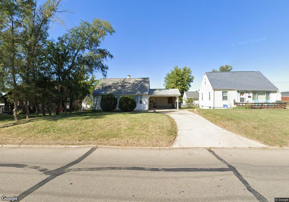
360 Wilson Ave SW Cedar Rapids, IA 52404
Southwest Area NeighborhoodEstimated Value: $133,750 - $143,000
2
Beds
1
Bath
873
Sq Ft
$158/Sq Ft
Est. Value
About This Home
This home is located at 360 Wilson Ave SW, Cedar Rapids, IA 52404 and is currently estimated at $138,188, approximately $158 per square foot. 360 Wilson Ave SW is a home located in Linn County with nearby schools including Junction City Elementary School, Grant Elementary School, and Bruce Hall Day Treatment Center.
Ownership History
Date
Name
Owned For
Owner Type
Purchase Details
Closed on
Mar 4, 2009
Sold by
Carter Daman R
Bought by
Carter Misty D
Current Estimated Value
Purchase Details
Closed on
Mar 11, 2008
Sold by
Lloyd Robert B and Lloyd Joye D
Bought by
Lloyd Joye D and Lloyd Robert B
Purchase Details
Closed on
Feb 27, 2003
Sold by
Faynola Petersen Louis C and Faynola Petersen
Bought by
Carter Daman
Home Financials for this Owner
Home Financials are based on the most recent Mortgage that was taken out on this home.
Original Mortgage
$65,550
Outstanding Balance
$28,427
Interest Rate
6%
Estimated Equity
$109,761
Purchase Details
Closed on
Dec 17, 1999
Sold by
Young Wayne Herbert and Young Mary Lou
Bought by
Young Mary Lou
Create a Home Valuation Report for This Property
The Home Valuation Report is an in-depth analysis detailing your home's value as well as a comparison with similar homes in the area
Home Values in the Area
Average Home Value in this Area
Purchase History
| Date | Buyer | Sale Price | Title Company |
|---|---|---|---|
| Carter Misty D | -- | None Available | |
| Lloyd Joye D | -- | None Available | |
| Carter Daman | $68,500 | -- | |
| Young Mary Lou | -- | -- |
Source: Public Records
Mortgage History
| Date | Status | Borrower | Loan Amount |
|---|---|---|---|
| Open | Carter Daman | $65,550 |
Source: Public Records
Tax History Compared to Growth
Tax History
| Year | Tax Paid | Tax Assessment Tax Assessment Total Assessment is a certain percentage of the fair market value that is determined by local assessors to be the total taxable value of land and additions on the property. | Land | Improvement |
|---|---|---|---|---|
| 2025 | $1,900 | $119,200 | $32,000 | $87,200 |
| 2024 | $1,972 | $107,400 | $29,500 | $77,900 |
| 2023 | $1,972 | $107,400 | $29,500 | $77,900 |
| 2022 | $1,768 | $93,500 | $24,600 | $68,900 |
| 2021 | $1,758 | $85,300 | $24,600 | $60,700 |
| 2020 | $1,758 | $79,700 | $22,100 | $57,600 |
| 2019 | $1,672 | $77,600 | $22,100 | $55,500 |
| 2018 | $1,626 | $77,600 | $22,100 | $55,500 |
| 2017 | $1,504 | $69,100 | $22,100 | $47,000 |
| 2016 | $1,670 | $78,600 | $22,100 | $56,500 |
| 2015 | $1,610 | $75,682 | $22,140 | $53,542 |
| 2014 | $1,610 | $75,682 | $22,140 | $53,542 |
| 2013 | $1,576 | $75,682 | $22,140 | $53,542 |
Source: Public Records
Map
Nearby Homes
- 2417 Illinois St SW
- 2511 Indiana St SW
- 2536 L St SW
- 648 22nd Ave SW
- 826 21st Ave SW
- 1804 I St SW
- 1435 N St SW
- 657 16th Ave SW
- 1426 N St SW
- 186 22nd Ave SW
- 1323 M St SW
- 1621 9th St SW
- 1617 9th St SW
- 280 14th Ave SW
- 2021 Hamilton St SW
- 815 15th Ave SW
- 1300 M St SW
- 192 15th Ave SW
- 1132 21st Ave SW
- 1424 9th St SW
- 352 Wilson Ave SW
- 364 Wilson Ave SW
- 349 22nd Ave SW
- 361 22nd Ave SW
- 340 Wilson Ave SW
- 343 22nd Ave SW
- 386 Wilson Ave SW
- 336 Wilson Ave SW
- 339 22nd Ave SW
- 2415 Wisconsin St SW
- 2202 N St SW
- 360 22nd Ave SW
- 352 22nd Ave SW
- 390 Wilson Ave SW
- 364 22nd Ave SW
- 345 Wilson Ave SW
- 2411 Wisconsin St SW
- 346 22nd Ave SW
- 2200 N St SW
- 337 22nd Ave SW