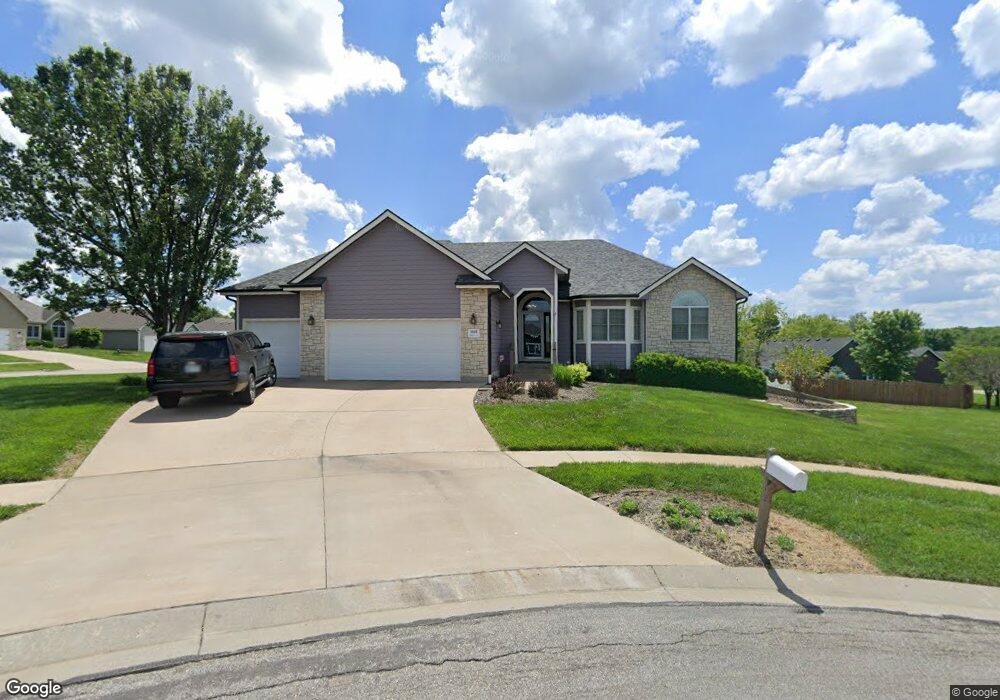
3601 SW Norman Ct Topeka, KS 66610
Estimated Value: $349,456 - $393,000
3
Beds
3
Baths
1,860
Sq Ft
$197/Sq Ft
Est. Value
About This Home
This home is located at 3601 SW Norman Ct, Topeka, KS 66610 and is currently estimated at $366,114, approximately $196 per square foot. 3601 SW Norman Ct is a home located in Shawnee County with nearby schools including Pauline Central Primary School, Pauline South Intermediate School, and Washburn Rural Middle School.
Ownership History
Date
Name
Owned For
Owner Type
Purchase Details
Closed on
Jul 15, 2005
Sold by
Underwood Paul W and Underwood Carole R
Bought by
Hall Sean C and Hall Kelly A
Current Estimated Value
Home Financials for this Owner
Home Financials are based on the most recent Mortgage that was taken out on this home.
Original Mortgage
$160,980
Outstanding Balance
$83,391
Interest Rate
5.64%
Mortgage Type
New Conventional
Estimated Equity
$282,723
Create a Home Valuation Report for This Property
The Home Valuation Report is an in-depth analysis detailing your home's value as well as a comparison with similar homes in the area
Home Values in the Area
Average Home Value in this Area
Purchase History
| Date | Buyer | Sale Price | Title Company |
|---|---|---|---|
| Hall Sean C | -- | Kansas Secured Title |
Source: Public Records
Mortgage History
| Date | Status | Borrower | Loan Amount |
|---|---|---|---|
| Open | Hall Sean C | $160,980 |
Source: Public Records
Tax History Compared to Growth
Tax History
| Year | Tax Paid | Tax Assessment Tax Assessment Total Assessment is a certain percentage of the fair market value that is determined by local assessors to be the total taxable value of land and additions on the property. | Land | Improvement |
|---|---|---|---|---|
| 2025 | $6,888 | $38,832 | -- | -- |
| 2023 | $6,888 | $36,962 | $0 | $0 |
| 2022 | $6,208 | $33,002 | $0 | $0 |
| 2021 | $5,124 | $29,206 | $0 | $0 |
| 2020 | $5,263 | $27,815 | $0 | $0 |
| 2019 | $5,059 | $26,491 | $0 | $0 |
| 2018 | $4,476 | $25,718 | $0 | $0 |
| 2017 | $4,892 | $25,214 | $0 | $0 |
| 2014 | $4,780 | $24,236 | $0 | $0 |
Source: Public Records
Map
Nearby Homes
- 4229 SW Cambridge Ave
- 3334 SW 43rd St
- 4313 SW Stone Ave
- 4329 SW Cambridge Ave
- 4419 SW Stone Ave
- 4334 SW Lakeside Dr
- 3817 SW Wood Valley Dr
- 4406 SW Lakeside Dr
- 3313 SW 46th St
- 3724 SW Brook Lawn Cir
- 3903 SW Burlingame Rd
- 2920 SW Twilight Dr
- 3513 SW Moundview Dr
- 3600 SW Randolph Square Unit 40
- 3572 SW Willow Brook Dr
- 3429 SW Moundview Dr
- 3000 SW 35th St
- 3609 SW Eveningside Dr
- 3400 SW Oakley Ave
- 3751 SW Summerfield Dr
- 4207 SW Cambridge Ave
- 3614 SW Norman Ct
- Lot 2, Blk SW Cambridge Ave
- XXX SW Norman Ct
- 4215 SW Cambridge Ave
- 3608 SW Nicholas Ct
- 4204 SW Cambridge Ave
- 3603 SW Norman Ct
- 4200 SW Cambridge Ave
- 3609 SW Norman Ct
- 4208 SW Cambridge Ave
- 3612 SW Nicholas Ct
- 4112 SW Cambridge Ave
- 4219 SW Cambridge Ave
- 4212 SW Cambridge Ave
- 4112 SW Stone Ave
- 4200 SW Stone Ave
- 4108 SW Stone Ave
- 4108 SW Cambridge Ave
- 3605 SW Nicholas Ct