Estimated Value: $292,344 - $308,000
3
Beds
2
Baths
1,832
Sq Ft
$164/Sq Ft
Est. Value
About This Home
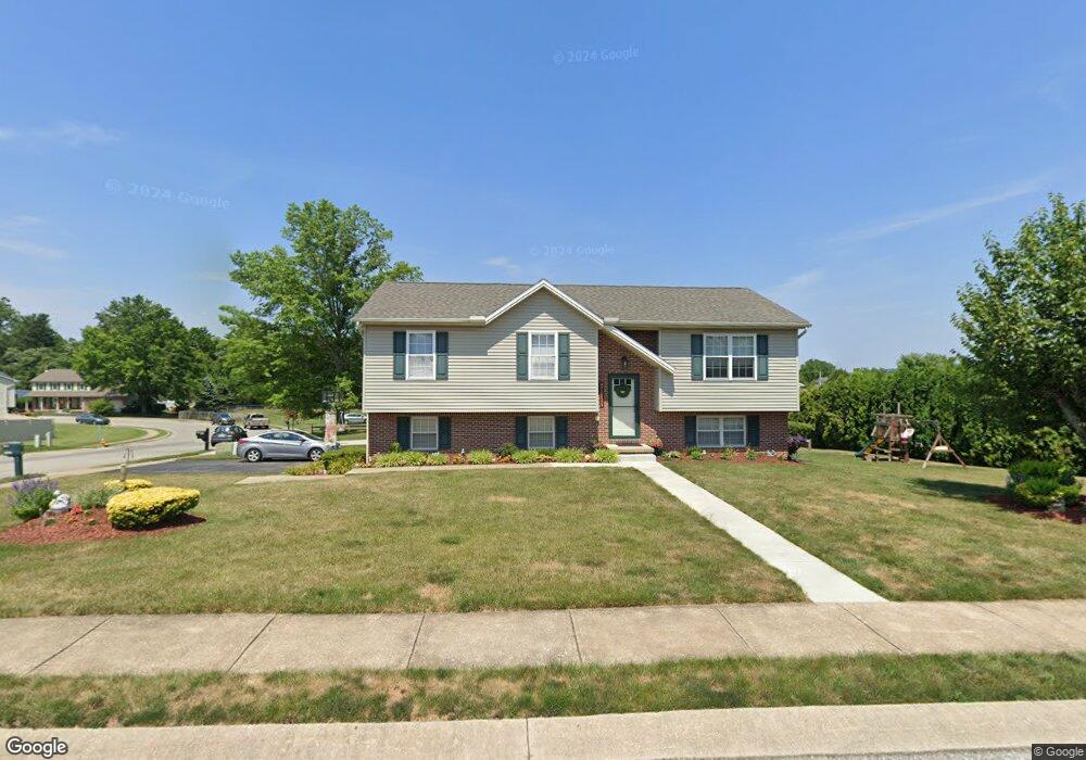
This home is located at 3601 Wyngate Rd, Dover, PA 17315 and is currently estimated at $299,836, approximately $163 per square foot. 3601 Wyngate Rd is a home located in York County with nearby schools including Dover Area High School and Lighthouse Christian School.
Ownership History
Date
Name
Owned For
Owner Type
Purchase Details
Closed on
Jun 27, 2002
Sold by
Wolf Connie S and Wolf Brian L
Bought by
Henning Charles W and Henning Lisa M
Current Estimated Value
Home Financials for this Owner
Home Financials are based on the most recent Mortgage that was taken out on this home.
Original Mortgage
$107,426
Outstanding Balance
$45,120
Interest Rate
6.58%
Mortgage Type
VA
Estimated Equity
$254,716
Purchase Details
Closed on
Dec 4, 1998
Sold by
Lohman Brian E and Lohman Barbra H
Bought by
Wolf Connie S
Home Financials for this Owner
Home Financials are based on the most recent Mortgage that was taken out on this home.
Original Mortgage
$107,845
Interest Rate
6.67%
Mortgage Type
FHA
Create a Home Valuation Report for This Property
The Home Valuation Report is an in-depth analysis detailing your home's value as well as a comparison with similar homes in the area
Home Values in the Area
Average Home Value in this Area
Purchase History
| Date | Buyer | Sale Price | Title Company |
|---|---|---|---|
| Henning Charles W | $117,900 | -- | |
| Wolf Connie S | $107,900 | -- |
Source: Public Records
Mortgage History
| Date | Status | Borrower | Loan Amount |
|---|---|---|---|
| Open | Henning Charles W | $107,426 | |
| Previous Owner | Wolf Connie S | $107,845 |
Source: Public Records
Tax History
| Year | Tax Paid | Tax Assessment Tax Assessment Total Assessment is a certain percentage of the fair market value that is determined by local assessors to be the total taxable value of land and additions on the property. | Land | Improvement |
|---|---|---|---|---|
| 2025 | $4,370 | $133,200 | $29,540 | $103,660 |
| 2024 | $4,330 | $133,200 | $29,540 | $103,660 |
| 2023 | $4,330 | $133,200 | $29,540 | $103,660 |
| 2022 | $4,251 | $133,200 | $29,540 | $103,660 |
| 2021 | $4,011 | $133,200 | $29,540 | $103,660 |
| 2020 | $3,975 | $133,200 | $29,540 | $103,660 |
| 2019 | $3,926 | $133,200 | $29,540 | $103,660 |
| 2018 | $3,827 | $133,200 | $29,540 | $103,660 |
| 2017 | $3,827 | $133,200 | $29,540 | $103,660 |
| 2016 | $0 | $133,200 | $29,540 | $103,660 |
| 2015 | -- | $133,200 | $29,540 | $103,660 |
| 2014 | -- | $133,200 | $29,540 | $103,660 |
Source: Public Records
Map
Nearby Homes
- 3711 AB Tiffany Dr
- 3541 Village Rd
- 2601 Village Rd
- 3700 Castle Dr
- 2510 Redwood Rd
- 2602 Brownstone Dr
- 3471 Holly Rd
- 3807 Castle Dr
- 3843 Castle Dr
- 3835 Castle Dr
- 3805 Castle Dr
- 3811 Castle Dr
- 3803 Castle Dr
- 3801 Castle Dr
- 3809 Castle Dr
- 3720 Davidsburg Rd
- 2311 Tower Dr
- 3836 Country Dr
- 3460 Sycamore Rd
- 3832 Country Dr
- 3611 Wyngate Rd
- 3600 Tower Dr
- 3610 Tower Dr
- 2621 Dunbarton Dr
- 3621 Wyngate Rd
- 3560 Tower Dr
- 3620 Tower Dr
- 3550 Wyngate Rd
- 2620 Wyngate Rd
- 2630 Dunbarton Dr
- 3541 Wyngate Rd
- 2631 Dunbarton Dr
- 3630 Tower Dr
- 3550 Tower Dr
- 3601 Tower Dr
- 3540 Wyngate Rd
- 2640 Dunbarton Dr
- 2641 Dunbarton Dr
- 3581 Tower Dr
- 3531 Wyngate Rd
Your Personal Tour Guide
Ask me questions while you tour the home.