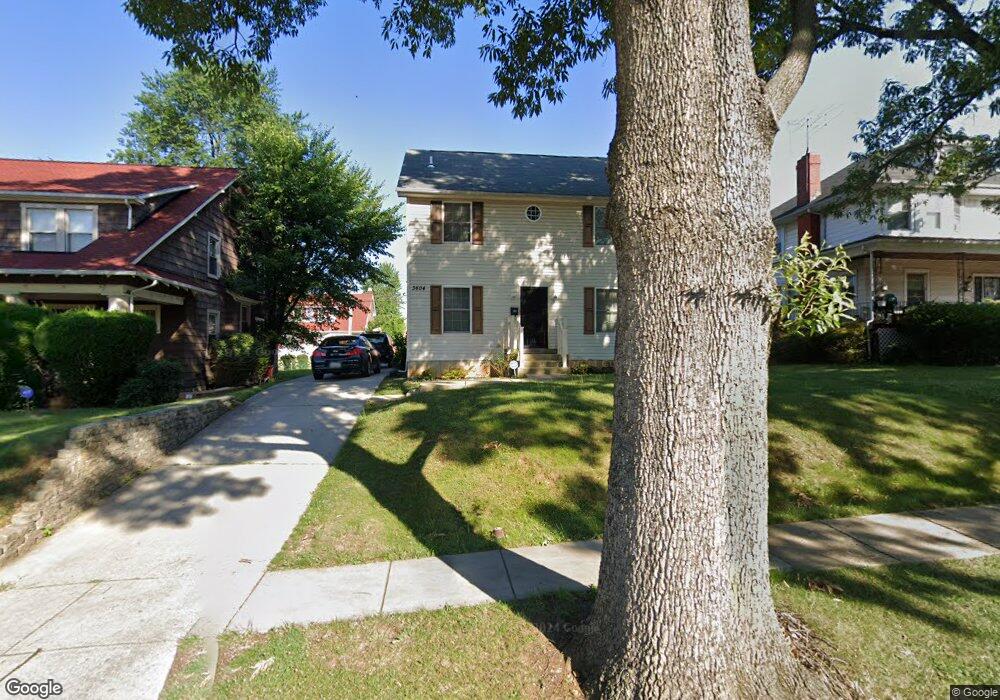
3604 Denison Rd Baltimore, MD 21215
Ashburton NeighborhoodEstimated Value: $360,000 - $398,599
4
Beds
4
Baths
1,568
Sq Ft
$242/Sq Ft
Est. Value
About This Home
This home is located at 3604 Denison Rd, Baltimore, MD 21215 and is currently estimated at $379,300, approximately $241 per square foot. 3604 Denison Rd is a home located in Baltimore City with nearby schools including Dr. Nathan A. Pitts-Ashburton Elementary/Middle School, Booker T. Washington Middle School, and Forest Park High School.
Ownership History
Date
Name
Owned For
Owner Type
Purchase Details
Closed on
Jul 19, 2011
Sold by
Dupree Mieasha
Bought by
Chester Linwood M and Chester Magdalene
Current Estimated Value
Purchase Details
Closed on
May 13, 2011
Sold by
Dupree Meiasha and Dupree Adriad L
Bought by
Chester Linwood M and Chester Magdalene
Purchase Details
Closed on
Dec 28, 2005
Sold by
Wang Lanzhi
Bought by
Dupree Mieasha and Dupree Adrian L
Purchase Details
Closed on
Dec 1, 2004
Sold by
Watson Anthony F
Bought by
Wang Lanzhi and Meyer Ronald B
Purchase Details
Closed on
Nov 11, 2004
Sold by
Watson Anthony F
Bought by
Wang Lanzhi and Meyer Ronald B
Purchase Details
Closed on
Jul 30, 2003
Sold by
Watson Bernice F
Bought by
Watson Anthony F
Purchase Details
Closed on
Jan 9, 2002
Sold by
Watson Edward Z
Bought by
Watson Bernice F
Create a Home Valuation Report for This Property
The Home Valuation Report is an in-depth analysis detailing your home's value as well as a comparison with similar homes in the area
Home Values in the Area
Average Home Value in this Area
Purchase History
| Date | Buyer | Sale Price | Title Company |
|---|---|---|---|
| Chester Linwood M | $169,000 | -- | |
| Chester Linwood M | $169,000 | -- | |
| Chester Linwood M | $169,000 | Signature Title & Settlement | |
| Dupree Mieasha | $288,000 | -- | |
| Wang Lanzhi | $30,000 | -- | |
| Wang Lanzhi | $30,000 | -- | |
| Watson Anthony F | -- | -- | |
| Watson Bernice F | -- | -- |
Source: Public Records
Tax History
| Year | Tax Paid | Tax Assessment Tax Assessment Total Assessment is a certain percentage of the fair market value that is determined by local assessors to be the total taxable value of land and additions on the property. | Land | Improvement |
|---|---|---|---|---|
| 2025 | $7,846 | $350,400 | $60,800 | $289,600 |
| 2024 | $7,846 | $334,033 | -- | -- |
| 2023 | $7,461 | $317,667 | $0 | $0 |
| 2022 | $7,111 | $301,300 | $60,800 | $240,500 |
| 2021 | $7,076 | $299,833 | $0 | $0 |
| 2020 | $7,041 | $298,367 | $0 | $0 |
| 2019 | $6,973 | $296,900 | $60,800 | $236,100 |
| 2018 | $7,007 | $296,900 | $60,800 | $236,100 |
| 2017 | $7,007 | $296,900 | $0 | $0 |
| 2016 | $6,064 | $302,200 | $0 | $0 |
| 2015 | $6,064 | $286,800 | $0 | $0 |
| 2014 | $6,064 | $271,400 | $0 | $0 |
Source: Public Records
Map
Nearby Homes
- 3522 White Chapel Rd
- 3504 Edgewood Rd
- 3505 Grantley Rd
- 3410 Edgewood Rd
- 3302 Sequoia Ave
- 3211 Dorchester Rd
- 3415 Copley Rd
- 3802 Grantley Rd
- 3210 Sequoia Ave
- 3814 Grantley Rd
- 3306 N Hilton St Unit 202
- 3817 Copley Rd
- 3708 Dennlyn Rd
- 3701 Barrington Rd
- 3409 W Forest Park Ave
- 3206 Yosemite Ave
- 3802 Callaway Ave
- 3625 Liberty Heights Ave
- 3121 Sequoia Ave
- 3814 Callaway Ave
- 3602 Denison Rd
- 3606 Denison Rd
- 3600 Denison Rd
- 3605 Edgewood Rd
- 3607 Edgewood Rd
- 3603 Edgewood Rd
- 3609 Edgewood Rd
- 3601 Edgewood Rd
- 3527 Denison Rd
- 3610 Denison Rd
- 3529 Denison Rd
- 3510 Denison Rd
- 3525 Denison Rd
- 3531 Denison Rd
- 3523 Denison Rd
- 3611 Edgewood Rd
- 3511 Edgewood Rd
- 3612 Denison Rd
- 3533 Denison Rd
- 3521 Denison Rd
Your Personal Tour Guide
Ask me questions while you tour the home.