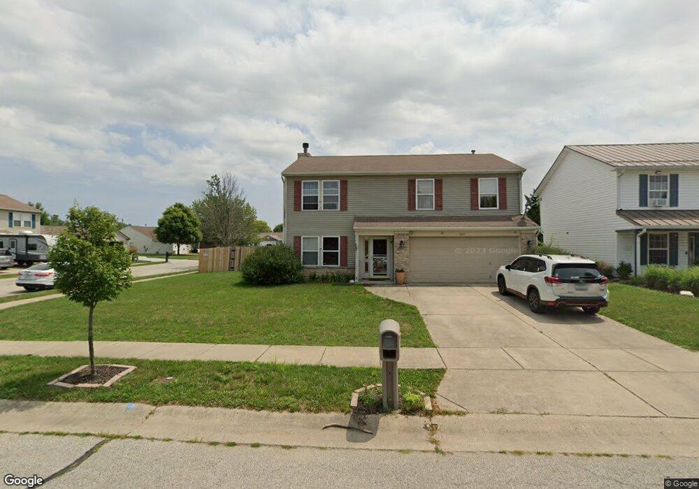
3607 Durantt Dr Lafayette, IN 47909
Bridge Water NeighborhoodEstimated Value: $273,000 - $301,553
--
Bed
1
Bath
1,808
Sq Ft
$160/Sq Ft
Est. Value
About This Home
This home is located at 3607 Durantt Dr, Lafayette, IN 47909 and is currently estimated at $289,888, approximately $160 per square foot. 3607 Durantt Dr is a home located in Tippecanoe County with nearby schools including Amelia Earhart Elementary School, Lafayette Tecumseh Junior High School, and Sunnyside Intermediate School.
Ownership History
Date
Name
Owned For
Owner Type
Purchase Details
Closed on
Jun 2, 2010
Sold by
Wentworth Pamela D
Bought by
Kudrak Donald J
Current Estimated Value
Purchase Details
Closed on
Jul 11, 2003
Sold by
Stevens Jacob R and Stevens Christi M
Bought by
Kudrak Donald J
Home Financials for this Owner
Home Financials are based on the most recent Mortgage that was taken out on this home.
Original Mortgage
$117,300
Interest Rate
3.75%
Mortgage Type
Unknown
Purchase Details
Closed on
Aug 19, 2002
Sold by
Woods Denver R and Woods Peggy W
Bought by
Stevens Jacob R and Stevens Christi M
Home Financials for this Owner
Home Financials are based on the most recent Mortgage that was taken out on this home.
Original Mortgage
$123,405
Interest Rate
4.37%
Create a Home Valuation Report for This Property
The Home Valuation Report is an in-depth analysis detailing your home's value as well as a comparison with similar homes in the area
Home Values in the Area
Average Home Value in this Area
Purchase History
| Date | Buyer | Sale Price | Title Company |
|---|---|---|---|
| Kudrak Donald J | -- | None Available | |
| Kudrak Donald J | -- | -- | |
| Stevens Jacob R | -- | -- |
Source: Public Records
Mortgage History
| Date | Status | Borrower | Loan Amount |
|---|---|---|---|
| Previous Owner | Kudrak Donald J | $117,300 | |
| Previous Owner | Stevens Jacob R | $123,405 |
Source: Public Records
Tax History Compared to Growth
Tax History
| Year | Tax Paid | Tax Assessment Tax Assessment Total Assessment is a certain percentage of the fair market value that is determined by local assessors to be the total taxable value of land and additions on the property. | Land | Improvement |
|---|---|---|---|---|
| 2024 | $2,218 | $221,800 | $43,000 | $178,800 |
| 2023 | $2,053 | $207,000 | $43,000 | $164,000 |
| 2022 | $1,644 | $166,500 | $23,000 | $143,500 |
| 2021 | $1,548 | $156,900 | $23,000 | $133,900 |
| 2020 | $1,424 | $144,500 | $23,000 | $121,500 |
| 2019 | $1,287 | $134,000 | $23,000 | $111,000 |
| 2018 | $1,239 | $130,000 | $23,000 | $107,000 |
| 2017 | $1,215 | $129,600 | $22,000 | $107,600 |
| 2016 | $1,177 | $128,900 | $22,000 | $106,900 |
| 2014 | $1,026 | $119,800 | $22,000 | $97,800 |
| 2013 | $971 | $116,900 | $22,000 | $94,900 |
Source: Public Records
Map
Nearby Homes
- 2200 Winterset Dr
- 3303 Crosspoint Ct S
- 1609 Tabor Ct
- 1907 Griffon Dr
- 3320 Norwegian Dr
- 1512 Sherwood Dr
- 1801 Bengal Place
- 3314 Pickwick Ct
- 1401 Normandy Dr
- 3244 Walton St
- 1301 Norma Jean Dr
- 2003 Kingfisher Dr
- 1817 Kingfisher Dr
- 120 Coldbrook Dr
- 3905 Rushgrove Dr
- 1007 Waterstone Dr
- 1120 Stoneripple Cir
- 936 Brookridge Ct
- 51 Brookberry Dr
- 1821 Whisper Valley Dr
- 3611 Durantt Dr
- 3604 Braddock Dr
- 3615 Durantt Dr
- 3608 Braddock Dr
- 1932 Honeybrook Way
- 1928 Honeybrook Way
- 3606 Durantt Dr
- 1936 Honeybrook Way
- 3612 Braddock Dr
- 3610 Durantt Dr
- 3619 Durantt Dr
- 1924 Honeybrook Way
- 1940 Honeybrook Way
- 3614 Durantt Dr
- 3616 Braddock Dr
- 1920 Honeybrook Way
- 3623 Durantt Dr
- 3618 Durantt Dr
- 1911 Honeybrook Way
- 3620 Braddock Dr