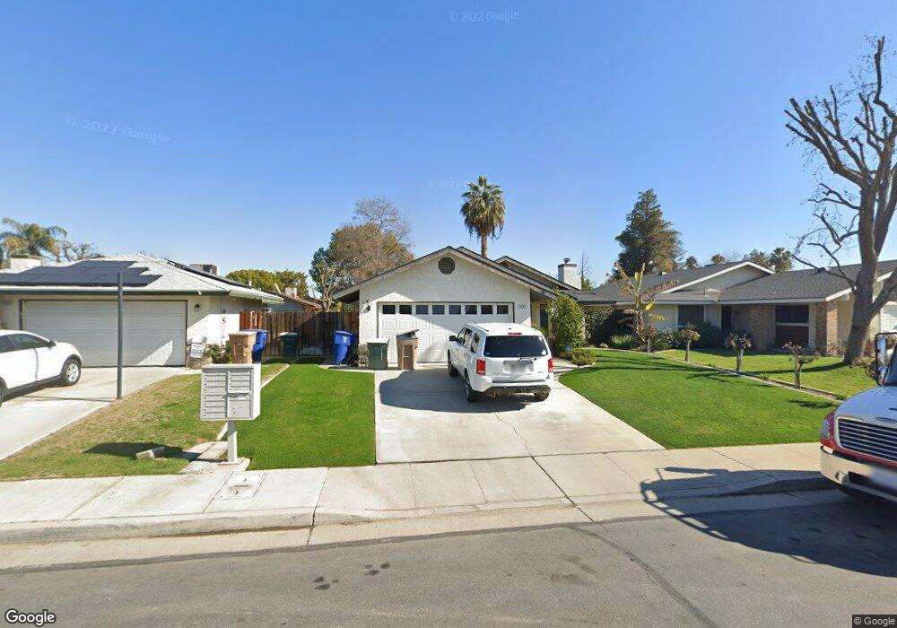
3608 Cumbre Ct Bakersfield, CA 93311
Tevis Ranch NeighborhoodEstimated Value: $337,000 - $366,000
3
Beds
2
Baths
1,234
Sq Ft
$279/Sq Ft
Est. Value
About This Home
This home is located at 3608 Cumbre Ct, Bakersfield, CA 93311 and is currently estimated at $344,436, approximately $279 per square foot. 3608 Cumbre Ct is a home located in Kern County with nearby schools including Old River Elementary School, Earl Warren Junior High School, and Stockdale High School.
Ownership History
Date
Name
Owned For
Owner Type
Purchase Details
Closed on
Aug 10, 2023
Sold by
Bunyan Robin
Bought by
Robin Bunyan Revocable Trust and Bunyan
Current Estimated Value
Purchase Details
Closed on
Jun 28, 2003
Sold by
Fondren Artemous
Bought by
Bunyan Robin
Home Financials for this Owner
Home Financials are based on the most recent Mortgage that was taken out on this home.
Original Mortgage
$137,750
Interest Rate
5.18%
Mortgage Type
Purchase Money Mortgage
Purchase Details
Closed on
Sep 3, 1998
Sold by
Michele Liburdy Robert C and Michele P
Bought by
Fondren Artemous
Home Financials for this Owner
Home Financials are based on the most recent Mortgage that was taken out on this home.
Original Mortgage
$84,875
Interest Rate
6.88%
Create a Home Valuation Report for This Property
The Home Valuation Report is an in-depth analysis detailing your home's value as well as a comparison with similar homes in the area
Home Values in the Area
Average Home Value in this Area
Purchase History
| Date | Buyer | Sale Price | Title Company |
|---|---|---|---|
| Robin Bunyan Revocable Trust | -- | None Listed On Document | |
| Bunyan Robin | $145,000 | First American Title | |
| Fondren Artemous | $87,500 | American Title |
Source: Public Records
Mortgage History
| Date | Status | Borrower | Loan Amount |
|---|---|---|---|
| Previous Owner | Bunyan Robin | $137,750 | |
| Previous Owner | Fondren Artemous | $84,875 |
Source: Public Records
Tax History
| Year | Tax Paid | Tax Assessment Tax Assessment Total Assessment is a certain percentage of the fair market value that is determined by local assessors to be the total taxable value of land and additions on the property. | Land | Improvement |
|---|---|---|---|---|
| 2025 | $3,202 | $206,139 | $56,858 | $149,281 |
| 2024 | $3,153 | $202,098 | $55,744 | $146,354 |
| 2023 | $3,153 | $198,136 | $54,651 | $143,485 |
| 2022 | $3,028 | $194,252 | $53,580 | $140,672 |
| 2021 | $2,914 | $190,444 | $52,530 | $137,914 |
| 2020 | $2,914 | $188,492 | $51,992 | $136,500 |
| 2019 | $2,775 | $188,492 | $51,992 | $136,500 |
| 2018 | $2,653 | $181,174 | $49,974 | $131,200 |
| 2017 | $2,666 | $177,623 | $48,995 | $128,628 |
| 2016 | $2,423 | $174,141 | $48,035 | $126,106 |
| 2015 | $2,394 | $171,000 | $43,000 | $128,000 |
| 2014 | $2,282 | $167,000 | $42,000 | $125,000 |
Source: Public Records
Map
Nearby Homes
- 3801 Gaelic Ct
- 3809 Wensley Ct
- 10703 Petalo Dr
- 3808 Killarney Ct
- 10616 Petalo Dr
- 10600 Petalo Dr
- 3501 Via Iglesia
- 10821 Tivoli Ct
- 10808 Tivoli Ct
- 4008 Desert Springs Way
- 10904 Mirage Dr
- 3905 Dos Lagos Dr
- 10213 Single Oak Dr
- 12625 Camino Glorieta
- 3513 Running Springs Way
- 10408 Barnes Dr
- 3807 Looming Bend Dr
- 10204 Sunset Canyon Dr
- 8318 Lismore Castle Dr
- 8324 Lismore Castle Dr
- 3604 Cumbre Ct
- 3612 Cumbre Ct
- 3600 Cumbre Ct
- 3616 Cumbre Ct
- 3609 El Hogar Ct
- 3613 El Hogar Ct
- 3605 El Hogar Ct
- 3516 Cumbre Ct
- 3601 El Hogar Ct
- 3617 El Hogar Ct
- 3609 Cumbre Ct
- 3613 Cumbre Ct
- 3605 Cumbre Ct
- 3517 El Hogar Ct
- 3617 Cumbre Ct
- 3512 Cumbre Ct
- 3601 Cumbre Ct
- 3513 El Hogar Ct
- 3513 Cumbre Ct
- 10613 Camino El Canon
Your Personal Tour Guide
Ask me questions while you tour the home.