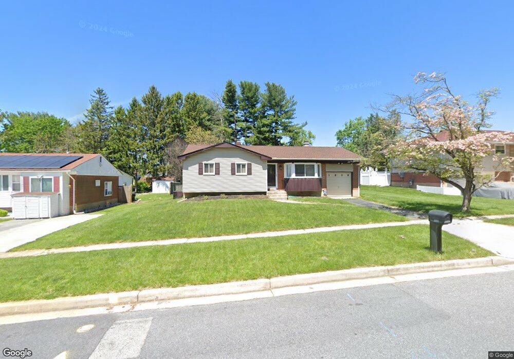
3608 Kings Point Rd Randallstown, MD 21133
Estimated Value: $272,000 - $392,000
--
Bed
2
Baths
1,140
Sq Ft
$295/Sq Ft
Est. Value
About This Home
This home is located at 3608 Kings Point Rd, Randallstown, MD 21133 and is currently estimated at $336,563, approximately $295 per square foot. 3608 Kings Point Rd is a home located in Baltimore County with nearby schools including Hernwood Elementary School, Deer Park Middle Magnet School, and New Town High.
Ownership History
Date
Name
Owned For
Owner Type
Purchase Details
Closed on
Mar 30, 2022
Sold by
Birchwood Associates Liquidating Trust
Bought by
Howie-Downs Kim L
Current Estimated Value
Purchase Details
Closed on
Apr 14, 1995
Sold by
Hud Housing Urban Development
Bought by
Howie Downs Kim L
Home Financials for this Owner
Home Financials are based on the most recent Mortgage that was taken out on this home.
Original Mortgage
$82,550
Interest Rate
8.49%
Purchase Details
Closed on
Oct 17, 1991
Sold by
Johnson Linda Jean
Bought by
Secretary Of Housing And
Create a Home Valuation Report for This Property
The Home Valuation Report is an in-depth analysis detailing your home's value as well as a comparison with similar homes in the area
Home Values in the Area
Average Home Value in this Area
Purchase History
| Date | Buyer | Sale Price | Title Company |
|---|---|---|---|
| Howie-Downs Kim L | $2,500 | Pritchett M Wingate | |
| Howie Downs Kim L | $75,800 | -- | |
| Secretary Of Housing And | $82,000 | -- |
Source: Public Records
Mortgage History
| Date | Status | Borrower | Loan Amount |
|---|---|---|---|
| Previous Owner | Howie Downs Kim L | $82,550 |
Source: Public Records
Tax History Compared to Growth
Tax History
| Year | Tax Paid | Tax Assessment Tax Assessment Total Assessment is a certain percentage of the fair market value that is determined by local assessors to be the total taxable value of land and additions on the property. | Land | Improvement |
|---|---|---|---|---|
| 2025 | $2,922 | $214,333 | -- | -- |
| 2024 | $2,922 | $199,300 | $82,100 | $117,200 |
| 2023 | $1,438 | $197,567 | $0 | $0 |
| 2022 | $2,877 | $195,833 | $0 | $0 |
| 2021 | $2,694 | $194,100 | $82,100 | $112,000 |
| 2020 | $2,694 | $179,933 | $0 | $0 |
| 2019 | $2,417 | $165,767 | $0 | $0 |
| 2018 | $2,247 | $151,600 | $68,100 | $83,500 |
| 2017 | $2,272 | $150,300 | $0 | $0 |
| 2016 | $2,180 | $149,000 | $0 | $0 |
| 2015 | $2,180 | $147,700 | $0 | $0 |
| 2014 | $2,180 | $147,700 | $0 | $0 |
Source: Public Records
Map
Nearby Homes
- 3517 Kings Point Rd
- 9804 Marriottsville Rd
- 3525 Cabot Rd
- 30 Sheraton Rd
- 3803 Marriottsville Rd
- 3538 Corn Stream Rd
- 9605 Mendoza Rd
- 3618 Granite Rd
- 3518 Orchard Shade Rd
- 3827 Rayton Rd
- 3903 Innerdale Ct
- 3903 Red Deer Cir
- 10520 Marriottsville Rd
- 9931 Tuscarora Rd
- 9401 Summer Squal Dr
- 9302 Silver Charm Dr
- 3200 Peddicoat Ct
- 9 Bannock Ct
- 9311 Colorado Ave
- 4264 Cayuga Rd
- 3606 Kings Point Rd
- 3610 Kings Point Rd
- 3604 Kings Point Rd
- 9917 Hoyt Cir
- 9919 Hoyt Cir
- 9903 Hoyt Cir
- 9915 Hoyt Cir
- 9921 Hoyt Cir
- 3605 Kings Point Rd
- 3602 Kings Point Rd
- 3607 Kings Point Rd
- 3603 Kings Point Rd
- 9909 Hoyt Cir
- 3601 Kings Point Rd
- 3609 Kings Point Rd
- 9923 Hoyt Cir
- 3611 Kings Point Rd
- 9902 Gunstock Rd
- 3600 Kings Point Rd
- 9820 Kerrigan Ct