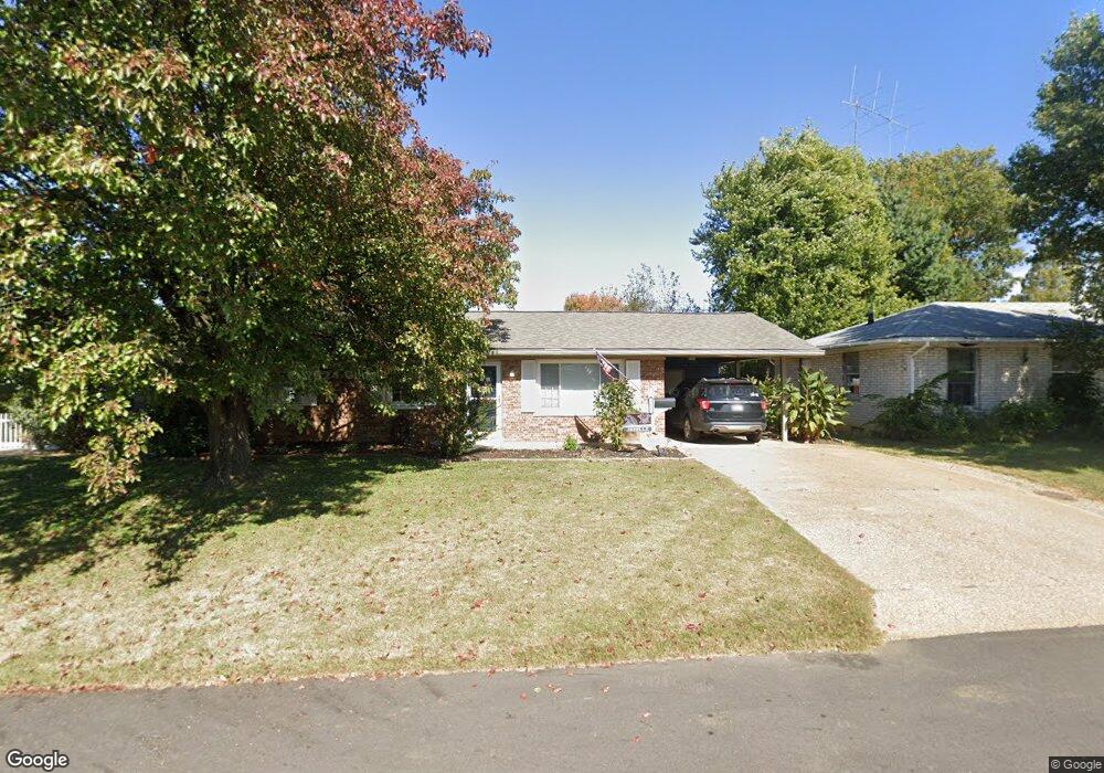
361 Audubon Dr Mount Vernon, IN 47620
Estimated Value: $155,000 - $224,000
3
Beds
2
Baths
1,053
Sq Ft
$171/Sq Ft
Est. Value
About This Home
This home is located at 361 Audubon Dr, Mount Vernon, IN 47620 and is currently estimated at $179,666, approximately $170 per square foot. 361 Audubon Dr is a home located in Posey County with nearby schools including Mount Vernon Junior High School, Mount Vernon High School, and St. Matthew Elementary School.
Ownership History
Date
Name
Owned For
Owner Type
Purchase Details
Closed on
Nov 19, 2010
Sold by
Price Valerie Lynn
Bought by
Phillips Dustin M
Current Estimated Value
Home Financials for this Owner
Home Financials are based on the most recent Mortgage that was taken out on this home.
Original Mortgage
$82,901
Outstanding Balance
$54,417
Interest Rate
4.17%
Mortgage Type
New Conventional
Estimated Equity
$125,249
Create a Home Valuation Report for This Property
The Home Valuation Report is an in-depth analysis detailing your home's value as well as a comparison with similar homes in the area
Home Values in the Area
Average Home Value in this Area
Purchase History
| Date | Buyer | Sale Price | Title Company |
|---|---|---|---|
| Phillips Dustin M | -- | Direct Title Insurance Agenc |
Source: Public Records
Mortgage History
| Date | Status | Borrower | Loan Amount |
|---|---|---|---|
| Open | Phillips Dustin M | $82,901 |
Source: Public Records
Tax History Compared to Growth
Tax History
| Year | Tax Paid | Tax Assessment Tax Assessment Total Assessment is a certain percentage of the fair market value that is determined by local assessors to be the total taxable value of land and additions on the property. | Land | Improvement |
|---|---|---|---|---|
| 2024 | $1,203 | $120,300 | $10,200 | $110,100 |
| 2023 | $1,068 | $106,800 | $10,200 | $96,600 |
| 2022 | $1,001 | $100,100 | $10,200 | $89,900 |
| 2021 | $926 | $92,600 | $10,200 | $82,400 |
| 2020 | $882 | $88,200 | $10,000 | $78,200 |
| 2019 | $848 | $84,800 | $9,600 | $75,200 |
| 2018 | $821 | $82,100 | $9,300 | $72,800 |
| 2017 | $785 | $81,200 | $10,000 | $71,200 |
| 2016 | $821 | $85,100 | $11,100 | $74,000 |
| 2014 | $711 | $81,500 | $11,100 | $70,400 |
| 2013 | $711 | $76,900 | $10,100 | $66,800 |
Source: Public Records
Map
Nearby Homes
- 433 Coronado Dr
- 317 Kennedy Dr
- 405 Washington Ave
- 311 W Grant St
- 444 Kennedy Dr
- 1230 Dereham Dr
- 300 Roosevelt Dr
- 10800 Hwy 69 & Along Ohio River Rd
- 305 Brown St
- 316 Sunset Dr
- 317 E Lincoln Ave
- 1240 Mulberry St
- 1305 Locust St
- 718 Davis Dr
- 1300 Harriett St
- 601 N Canal St
- 427 E 5th St
- 407 W 4th St
- 531 E 5th St
- 905 Smith Rd