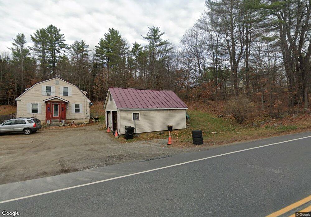
361 John Stark Hwy Newport, NH 03773
Estimated Value: $290,000 - $351,000
4
Beds
1
Bath
1,644
Sq Ft
$192/Sq Ft
Est. Value
About This Home
This home is located at 361 John Stark Hwy, Newport, NH 03773 and is currently estimated at $315,468, approximately $191 per square foot. 361 John Stark Hwy is a home located in Sullivan County with nearby schools including Richards Elementary School, Newport High School, and Newport Montessori School.
Ownership History
Date
Name
Owned For
Owner Type
Purchase Details
Closed on
Jun 3, 2010
Sold by
Pillsbury Laura L
Bought by
Mascoma Savings Bank
Current Estimated Value
Create a Home Valuation Report for This Property
The Home Valuation Report is an in-depth analysis detailing your home's value as well as a comparison with similar homes in the area
Home Values in the Area
Average Home Value in this Area
Purchase History
| Date | Buyer | Sale Price | Title Company |
|---|---|---|---|
| Mascoma Savings Bank | $96,000 | -- |
Source: Public Records
Mortgage History
| Date | Status | Borrower | Loan Amount |
|---|---|---|---|
| Previous Owner | Mascoma Savings Bank | $79,168 |
Source: Public Records
Tax History Compared to Growth
Tax History
| Year | Tax Paid | Tax Assessment Tax Assessment Total Assessment is a certain percentage of the fair market value that is determined by local assessors to be the total taxable value of land and additions on the property. | Land | Improvement |
|---|---|---|---|---|
| 2024 | $6,279 | $258,300 | $90,800 | $167,500 |
| 2023 | $6,091 | $258,300 | $90,800 | $167,500 |
| 2022 | $5,398 | $258,300 | $90,800 | $167,500 |
| 2021 | $4,112 | $124,600 | $47,800 | $76,800 |
| 2020 | $4,124 | $124,600 | $47,800 | $76,800 |
| 2019 | $4,053 | $124,600 | $47,800 | $76,800 |
| 2018 | $3,788 | $124,600 | $47,800 | $76,800 |
| 2017 | $3,743 | $124,600 | $47,800 | $76,800 |
| 2016 | $3,723 | $129,600 | $43,900 | $85,700 |
| 2015 | $3,791 | $129,600 | $43,900 | $85,700 |
| 2014 | $4,101 | $129,600 | $43,900 | $85,700 |
| 2013 | $3,887 | $129,600 | $43,900 | $85,700 |
Source: Public Records
Map
Nearby Homes
- 146 Elm St
- 12 4th St
- 430 John Stark Hwy
- 680-2 John Stark Hwy
- 39 Myrtle St
- 13 Fairbanks Rd
- 9 Depot St
- 11 Putnam Rd
- 37 Park St
- 151 Cheney St
- 8 Prospect St
- 38 River St
- 736 John Stark Hwy
- 150 S Main St
- 0 Unity Rd
- 4 River View Rd Unit Lot 4 Phase II
- 434 S Main St
- 44 Brook View Rd
- 45 Brook View Rd
- 33 Brook View Rd
- 351 John Stark Hwy
- 11 Whitcher Rd
- 0 Whitcher Rd Unit 4254704
- 321 John Stark Hwy
- 42 Whitcher Rd
- 49 Whitcher Rd
- 0 Route 11 103 Unit 2811610
- 0 Route 11 103 Unit 2763047
- 55 Whitcher Rd
- 56 Whitcher Rd
- 289 John Stark Hwy
- 24 Brown Rd
- 279 John Stark Hwy
- 74 Whitcher Rd
- 300 John Stark Hwy
- 300 John Stark Hwy
- 23 Brown Rd
- 17 Brown Rd
- 78 Whitcher Rd
- 00 Brown Rd