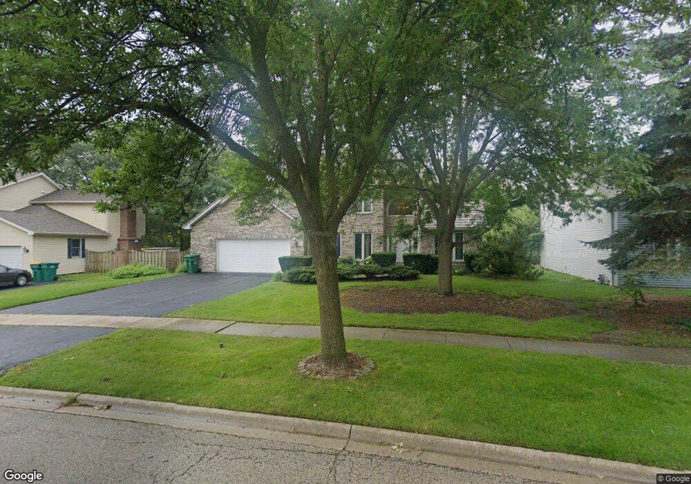
361 Kerry Way Grayslake, IL 60030
Estimated Value: $432,959 - $470,000
3
Beds
3
Baths
2,612
Sq Ft
$174/Sq Ft
Est. Value
About This Home
This home is located at 361 Kerry Way, Grayslake, IL 60030 and is currently estimated at $453,490, approximately $173 per square foot. 361 Kerry Way is a home located in Lake County with nearby schools including Woodland Primary School, Woodland Elementary School, and Woodland Intermediate School.
Ownership History
Date
Name
Owned For
Owner Type
Purchase Details
Closed on
Nov 10, 2000
Sold by
Hall Patricia S and Hall Glenn A
Bought by
Miller Marc C and Miller Susan A
Current Estimated Value
Home Financials for this Owner
Home Financials are based on the most recent Mortgage that was taken out on this home.
Original Mortgage
$237,400
Interest Rate
7.77%
Purchase Details
Closed on
Jul 23, 1996
Sold by
Kourakis Keith and Murphy Patty
Bought by
Hall Patricia S and Hall Glenn A
Home Financials for this Owner
Home Financials are based on the most recent Mortgage that was taken out on this home.
Original Mortgage
$189,000
Interest Rate
8.47%
Mortgage Type
Balloon
Create a Home Valuation Report for This Property
The Home Valuation Report is an in-depth analysis detailing your home's value as well as a comparison with similar homes in the area
Home Values in the Area
Average Home Value in this Area
Purchase History
| Date | Buyer | Sale Price | Title Company |
|---|---|---|---|
| Miller Marc C | $250,000 | -- | |
| Hall Patricia S | $219,000 | -- |
Source: Public Records
Mortgage History
| Date | Status | Borrower | Loan Amount |
|---|---|---|---|
| Previous Owner | Miller Marc C | $237,400 | |
| Previous Owner | Hall Patricia S | $189,000 |
Source: Public Records
Tax History Compared to Growth
Tax History
| Year | Tax Paid | Tax Assessment Tax Assessment Total Assessment is a certain percentage of the fair market value that is determined by local assessors to be the total taxable value of land and additions on the property. | Land | Improvement |
|---|---|---|---|---|
| 2024 | $9,864 | $104,524 | $18,216 | $86,308 |
| 2023 | $10,138 | $95,929 | $16,718 | $79,211 |
| 2022 | $10,138 | $96,052 | $16,321 | $79,731 |
| 2021 | $9,985 | $92,322 | $15,687 | $76,635 |
| 2020 | $11,007 | $96,683 | $14,926 | $81,757 |
| 2019 | $10,600 | $92,759 | $14,320 | $78,439 |
| 2018 | $11,787 | $103,592 | $21,123 | $82,469 |
| 2017 | $11,675 | $97,443 | $19,869 | $77,574 |
| 2016 | $11,209 | $89,950 | $18,341 | $71,609 |
| 2015 | $10,772 | $82,176 | $16,756 | $65,420 |
| 2014 | $9,783 | $73,704 | $13,589 | $60,115 |
| 2012 | $9,721 | $76,975 | $14,192 | $62,783 |
Source: Public Records
Map
Nearby Homes
- 1617 Albany St
- 1191 Hummingbird Ln
- 23 Bobolink Dr
- 1544 Portia Rd
- 355 Buckingham Dr
- 390 N Garfield Blvd
- 399 Banbury Ln
- 33276 N Sunset Ave
- 33336 N Indian Ln
- 977 Harris Rd Unit 34
- 1023 Harris Rd
- 146 Westerfield Place
- 1544 Syracuse Dr
- 18740 W Willow Point Dr
- 707 Crossland Dr
- 32381 N Forest Dr
- 633 Dove Ct Unit 4
- 827 Easton Ct
- 745 Dillon Ct
- 121 Park Ave
- 367 Kerry Way
- 355 Kerry Way
- 373 Kerry Way
- 345 Stevens Ct
- 347 Stevens Ct
- 343 Stevens Ct
- 349 Stevens Ct
- 341 Stevens Ct
- 351 Stevens Ct
- 353 Stevens Ct
- 1150 Silo Hill Dr
- 327 Stevens Ct
- 1174 Silo Hill Dr
- 355 Stevens Ct
- 379 Kerry Way
- 325 Stevens Ct
- 1138 Silo Hill Dr
- 1198 Silo Hill Dr
- 323 Stevens Ct
- 404 Stevens Ct