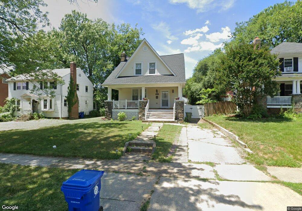
3610 Cedardale Rd Baltimore, MD 21215
Ashburton NeighborhoodEstimated Value: $203,618 - $347,000
Studio
2
Baths
1,548
Sq Ft
$178/Sq Ft
Est. Value
About This Home
This home is located at 3610 Cedardale Rd, Baltimore, MD 21215 and is currently estimated at $275,309, approximately $177 per square foot. 3610 Cedardale Rd is a home located in Baltimore City with nearby schools including Dr. Nathan A. Pitts-Ashburton Elementary/Middle School, Booker T. Washington Middle School, and Forest Park High School.
Ownership History
Date
Name
Owned For
Owner Type
Purchase Details
Closed on
May 30, 2024
Sold by
Grant Toba W
Bought by
M & E Investments Llc
Current Estimated Value
Purchase Details
Closed on
Jun 3, 2021
Sold by
Duncan Rebecca A and Duncan William A
Bought by
Duncan Rebecca A
Home Financials for this Owner
Home Financials are based on the most recent Mortgage that was taken out on this home.
Original Mortgage
$137,000
Interest Rate
2.9%
Mortgage Type
New Conventional
Purchase Details
Closed on
Apr 25, 1995
Sold by
Jan Ltd
Bought by
Duncan Rebecca A
Home Financials for this Owner
Home Financials are based on the most recent Mortgage that was taken out on this home.
Original Mortgage
$78,650
Interest Rate
8.55%
Create a Home Valuation Report for This Property
The Home Valuation Report is an in-depth analysis detailing your home's value as well as a comparison with similar homes in the area
Home Values in the Area
Average Home Value in this Area
Purchase History
| Date | Buyer | Sale Price | Title Company |
|---|---|---|---|
| M & E Investments Llc | $23,870 | None Listed On Document | |
| Duncan Rebecca A | -- | Accommodation | |
| Duncan Rebecca A | $54,000 | -- |
Source: Public Records
Mortgage History
| Date | Status | Borrower | Loan Amount |
|---|---|---|---|
| Previous Owner | Duncan Rebecca A | $137,000 | |
| Previous Owner | Duncan Rebecca A | $78,650 |
Source: Public Records
Tax History
| Year | Tax Paid | Tax Assessment Tax Assessment Total Assessment is a certain percentage of the fair market value that is determined by local assessors to be the total taxable value of land and additions on the property. | Land | Improvement |
|---|---|---|---|---|
| 2025 | $3,594 | $180,200 | $60,600 | $119,600 |
| 2024 | $3,594 | $171,267 | -- | -- |
| 2023 | $3,431 | $162,333 | $0 | $0 |
| 2022 | $3,363 | $153,400 | $60,600 | $92,800 |
| 2021 | $3,560 | $150,867 | $0 | $0 |
| 2020 | $2,935 | $148,333 | $0 | $0 |
| 2019 | $2,822 | $145,800 | $60,600 | $85,200 |
| 2018 | $2,753 | $145,800 | $60,600 | $85,200 |
| 2017 | $2,672 | $145,800 | $0 | $0 |
| 2016 | $2,280 | $150,900 | $0 | $0 |
| 2015 | $2,280 | $147,367 | $0 | $0 |
| 2014 | $2,280 | $143,833 | $0 | $0 |
Source: Public Records
Map
Nearby Homes
- 3505 Grantley Rd
- 3504 Edgewood Rd
- 3415 Copley Rd
- 3522 White Chapel Rd
- 3802 Grantley Rd
- 3701 Barrington Rd
- 3302 Sequoia Ave
- 3802 Callaway Ave
- 3814 Grantley Rd
- 3817 Copley Rd
- 3625 Liberty Heights Ave
- 3704 Egerton Rd
- 3703 Egerton Rd
- 3211 Dorchester Rd
- 3409 W Forest Park Ave
- 3707 Liberty Heights Ave
- 3306 N Hilton St Unit 202
- 3210 Sequoia Ave
- 3603 Springdale Ave
- 3417 Springdale Ave
- 3612 Cedardale Rd
- 3608 Cedardale Rd
- 3700 Cedardale Rd
- 3606 Cedardale Rd
- 3611 Grantley Rd
- 3613 Grantley Rd
- 3609 Grantley Rd
- 3607 Grantley Rd
- 3611 Cedardale Rd
- 3702 Cedardale Rd
- 3613 Cedardale Rd
- 3609 Cedardale Rd
- 3701 Grantley Rd
- 3604 Cedardale Rd
- 3701 Cedardale Rd
- 3607 Cedardale Rd
- 3605 Grantley Rd
- 3704 Cedardale Rd
- 3703 Cedardale Rd
- 3602 Cedardale Rd
Your Personal Tour Guide
Ask me questions while you tour the home.