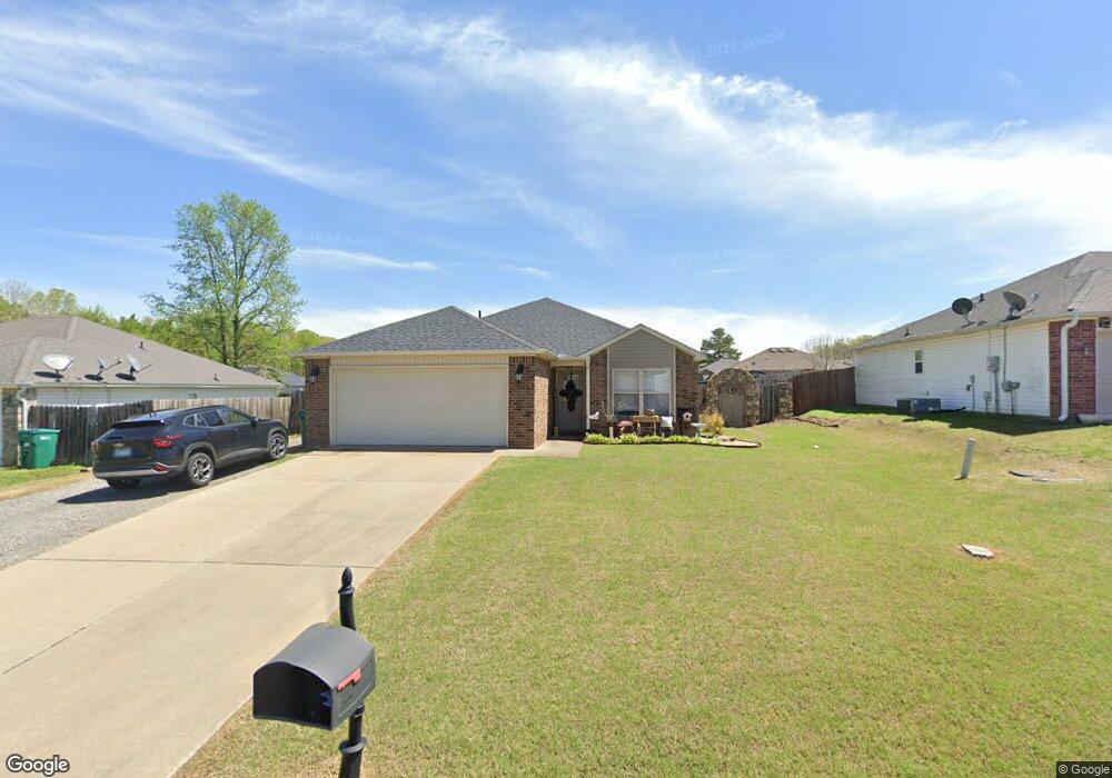
3610 Firefly Cir Conway, AR 72032
Estimated Value: $203,000 - $218,589
3
Beds
2
Baths
1,243
Sq Ft
$168/Sq Ft
Est. Value
About This Home
This home is located at 3610 Firefly Cir, Conway, AR 72032 and is currently estimated at $209,147, approximately $168 per square foot. 3610 Firefly Cir is a home located in Faulkner County with nearby schools including Theodore Jones Elementary School, Conway Junior High School, and Conway High School.
Ownership History
Date
Name
Owned For
Owner Type
Purchase Details
Closed on
Mar 20, 2020
Sold by
Doss Cindy
Bought by
Delargy Tonya L
Current Estimated Value
Home Financials for this Owner
Home Financials are based on the most recent Mortgage that was taken out on this home.
Original Mortgage
$141,414
Outstanding Balance
$125,003
Interest Rate
3.4%
Mortgage Type
New Conventional
Estimated Equity
$84,144
Purchase Details
Closed on
Nov 29, 2010
Sold by
Rausch Coleman Conway Llc
Bought by
Doss Cindy
Home Financials for this Owner
Home Financials are based on the most recent Mortgage that was taken out on this home.
Original Mortgage
$117,249
Interest Rate
4.23%
Mortgage Type
FHA
Create a Home Valuation Report for This Property
The Home Valuation Report is an in-depth analysis detailing your home's value as well as a comparison with similar homes in the area
Home Values in the Area
Average Home Value in this Area
Purchase History
| Date | Buyer | Sale Price | Title Company |
|---|---|---|---|
| Delargy Tonya L | $140,000 | Lenders Title Company | |
| Doss Cindy | $121,000 | -- | |
| Doss Cindy | $121,000 | First National Title Co |
Source: Public Records
Mortgage History
| Date | Status | Borrower | Loan Amount |
|---|---|---|---|
| Open | Delargy Tonya L | $141,414 | |
| Previous Owner | Doss Cindy | $117,249 |
Source: Public Records
Tax History Compared to Growth
Tax History
| Year | Tax Paid | Tax Assessment Tax Assessment Total Assessment is a certain percentage of the fair market value that is determined by local assessors to be the total taxable value of land and additions on the property. | Land | Improvement |
|---|---|---|---|---|
| 2025 | $1,747 | $47,300 | $6,000 | $41,300 |
| 2024 | $1,668 | $47,300 | $6,000 | $41,300 |
| 2023 | $1,589 | $34,240 | $6,000 | $28,240 |
| 2022 | $1,314 | $34,240 | $6,000 | $28,240 |
| 2021 | $1,274 | $34,240 | $6,000 | $28,240 |
| 2020 | $991 | $28,150 | $6,000 | $22,150 |
| 2019 | $991 | $28,150 | $6,000 | $22,150 |
| 2018 | $983 | $27,440 | $6,000 | $21,440 |
| 2017 | $983 | $27,440 | $6,000 | $21,440 |
| 2016 | $965 | $27,040 | $6,000 | $21,040 |
| 2015 | $1,195 | $25,750 | $6,000 | $19,750 |
| 2014 | $905 | $25,750 | $6,000 | $19,750 |
Source: Public Records
Map
Nearby Homes
- 3610 Breezy Cir
- 1950 Shadow Falls Dr
- 3655 Campfire Cove
- 23 Gapview Rd
- 13 Oak Leaf Dr
- 15 Oak Leaf Dr
- 3030 Plateau Dr
- 6 Cedar Hill Rd
- 32 Hardin Ln
- 1250 Edge Valley Dr N
- 104 N Woodland Dr
- 2800 Plateau Dr
- 1230 Littlewood Cove
- 20 Caddo Dr
- 10 Kim Dr
- 0 Victory Ln
- 1200 Mae Ln
- 0 Blake Ln
- 2240 Eldridge Ln
- 17 Oak Creek Dr
- 3610 Firefly Cr
- 3620 Firefly Cir
- 0 Firefly Unit 17028631
- 3600 Firefly Cir
- 3630 Firefly Cir
- 3615 Firefly Cir
- 3625 Firefly Cir
- 3615 Breezy Cir
- 3625 Breezy Cir
- 3605 Breezy Cir
- 3605 Firefly Cir
- 3635 Breezy Cir
- 0 Breezy Cir Unit 10316928
- 0 Breezy Cir Unit 16003412
- 0 Breezy Cir Unit 16035298
- 3635 Breezy Cir
- 3635 Firefly Cir
- 3640 Firefly Cir
- 2045 Shadow Ridge Rd
- 2065 Shadow Ridge Rd