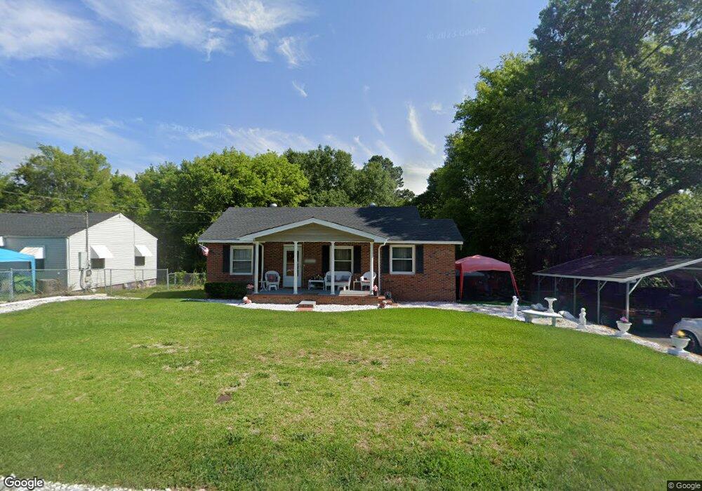
3611 Mckenzie Dr Macon, GA 31204
Estimated Value: $61,000 - $107,000
3
Beds
1
Bath
1,177
Sq Ft
$69/Sq Ft
Est. Value
About This Home
This home is located at 3611 Mckenzie Dr, Macon, GA 31204 and is currently estimated at $80,933, approximately $68 per square foot. 3611 Mckenzie Dr is a home located in Bibb County with nearby schools including Brookdale Elementary School, Howard Middle School, and Howard High School.
Ownership History
Date
Name
Owned For
Owner Type
Purchase Details
Closed on
Aug 29, 2022
Sold by
Bryant Debra F
Bought by
London Eric
Current Estimated Value
Home Financials for this Owner
Home Financials are based on the most recent Mortgage that was taken out on this home.
Original Mortgage
$25,580
Outstanding Balance
$5,317
Interest Rate
5.3%
Mortgage Type
Seller Take Back
Estimated Equity
$75,616
Purchase Details
Closed on
Mar 4, 2021
Sold by
Thompson Dennis and Estate Of Tillman Roland Jacks
Bought by
Bryant Debra F
Purchase Details
Closed on
Oct 8, 1985
Sold by
Quilla F Jackson
Bought by
Jackson Tillman R
Create a Home Valuation Report for This Property
The Home Valuation Report is an in-depth analysis detailing your home's value as well as a comparison with similar homes in the area
Home Values in the Area
Average Home Value in this Area
Purchase History
| Date | Buyer | Sale Price | Title Company |
|---|---|---|---|
| London Eric | $25,580 | -- | |
| Bryant Debra F | -- | None Available | |
| Jackson Tillman R | -- | -- |
Source: Public Records
Mortgage History
| Date | Status | Borrower | Loan Amount |
|---|---|---|---|
| Open | London Eric | $25,580 |
Source: Public Records
Tax History Compared to Growth
Tax History
| Year | Tax Paid | Tax Assessment Tax Assessment Total Assessment is a certain percentage of the fair market value that is determined by local assessors to be the total taxable value of land and additions on the property. | Land | Improvement |
|---|---|---|---|---|
| 2025 | $716 | $29,122 | $3,240 | $25,882 |
| 2024 | $712 | $28,019 | $3,240 | $24,779 |
| 2023 | $260 | $26,326 | $2,650 | $23,676 |
| 2022 | $655 | $18,909 | $3,350 | $15,559 |
| 2021 | $486 | $12,789 | $1,898 | $10,891 |
| 2020 | $497 | $12,789 | $1,898 | $10,891 |
| 2019 | $501 | $12,789 | $1,898 | $10,891 |
| 2018 | $947 | $12,789 | $1,898 | $10,891 |
| 2017 | $479 | $12,789 | $1,898 | $10,891 |
| 2016 | $652 | $18,848 | $3,417 | $15,430 |
| 2015 | $923 | $18,848 | $3,417 | $15,430 |
| 2014 | $1,061 | $18,848 | $3,417 | $15,430 |
Source: Public Records
Map
Nearby Homes
- 3560 Mckenzie Dr
- 3558 Morgan Dr
- 3591 Napier Ave
- 3679 W Napier Ave
- 3465 Morgan Dr
- 3817 Lake St
- 3821 Melrose St
- 3765 Del Park
- 3957 Atlantic Ave
- 3775 Grand Ave
- 130 Comer Terrace
- 82 Green St
- 126 Comer Terrace
- 3452 Brookdale Ave
- 3362 Shaw Dr
- 75 Short St
- 3440 Brookdale Ave
- 173 Gardner St
- 3457 Shenandoah Dr
- 3619 Mckenzie Dr
- 3593 Mckenzie Dr
- 3627 Mckenzie Dr
- 3579 Mckenzie Dr
- 3639 Mckenzie Dr
- 3614 Mckenzie Dr
- 3567 Mckenzie Dr
- 3612 Mckenzie Dr
- 3645 Mckenzie Dr
- 3592 Mckenzie Dr
- 3626 Mckenzie Dr
- 3578 Mckenzie Dr
- 3651 Mckenzie Dr
- 3640 Mckenzie Dr
- 3566 Mckenzie Dr
- 3561 Mckenzie Dr
- 3657 Mckenzie Dr
- 3650 Mckenzie Dr
- 3549 Mckenzie Dr
- 3665 Mckenzie Dr