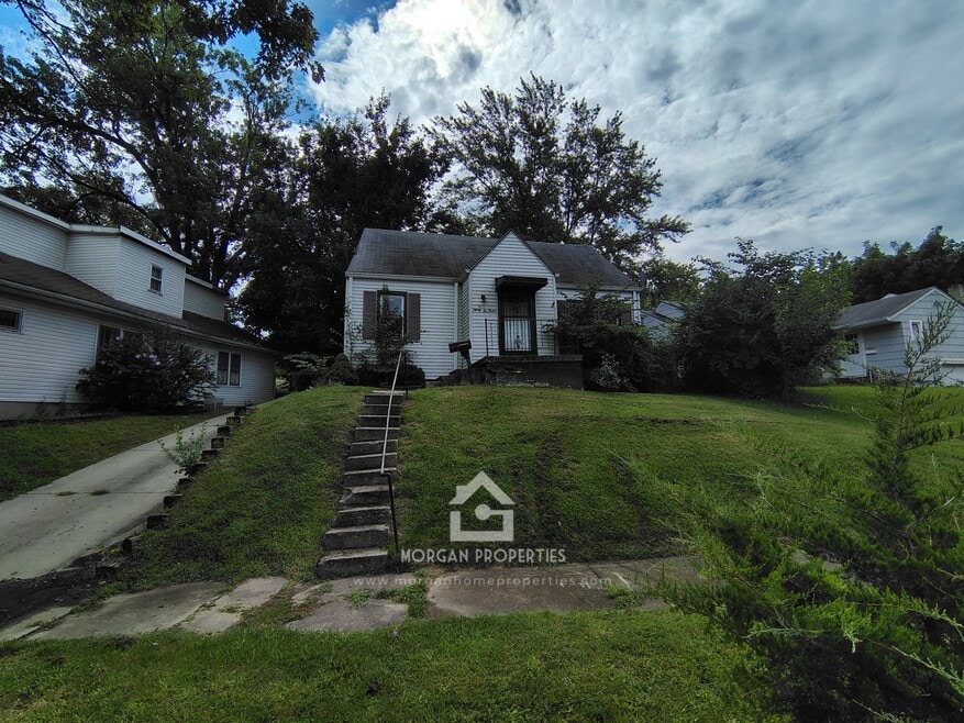
3612 Brown St Anderson, IN 46013
2
Beds
1
Bath
2,233
Sq Ft
7,318
Sq Ft Lot
About This Home
3612 BROWN ST. ANDERSON
SEC DEP $1,050.00
RENT: $243.00 WEEKLY $486.00 BI-WEEKLY $1,050.00 MONTH
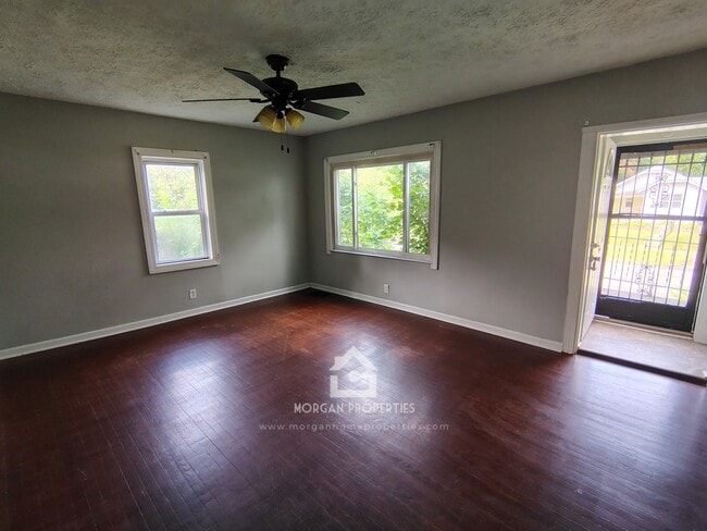
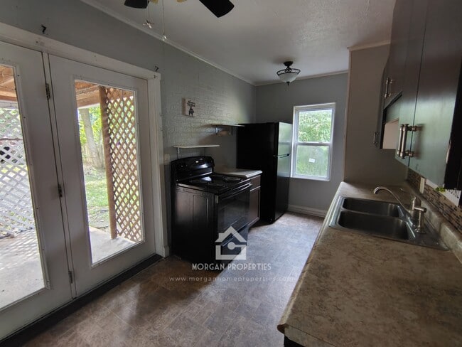
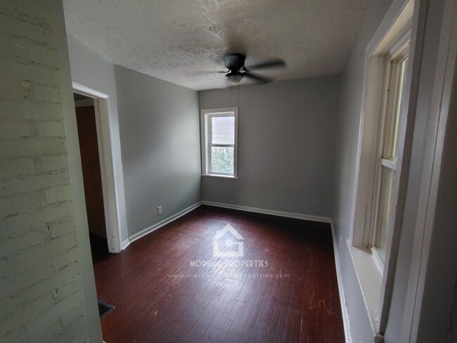
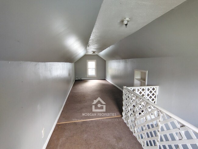
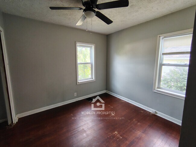
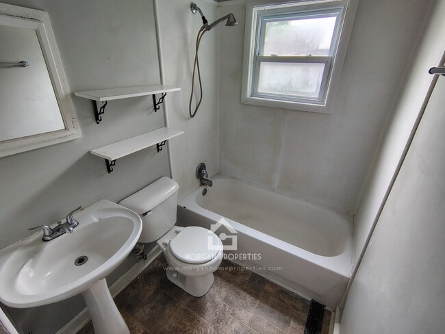
SPACIOUS 3 BEDROOM / 2 FULL BATHROOM HOUSE. HARDWOOD FLOORS ON MAIN LEVEL. NICELY PAINTED THROUGHOUT. 1 BEDROOM ON MAIN LEVEL AND 1 LARGE BEDROOM ON 2ND FLOOR. THE KITCHEN INCLUDES AN ELECTRIC STOVE & REFRIGERATOR. LARGE DINING ROOM, BOTH BATHROOMS HAVE TUB AND SHOWER COMBO. BASEMENT WITH A BONUS ROOM AND W/D HK-UP. LARGE YARD, COVERED BACK PATIO, DETACHED GARAGE, AND SHED. CENTRAL AIR CONDITIONING. TENANT PAYS ALL UTILITIES. PETS MAY BE NEGOTIABLE WITH THE OWNER’S APPROVAL AND $300 PET DEPOSIT PER PET & $25 FEE PER MONTH PER PET. 2 PETS MAX. RENTER’S INSURANCE REQUIRED AT TENANT COST.
Listing Provided By

Map
Nearby Homes
- 3618 Brown St
- 239 W 38th St
- 148 South Dr
- 115 South Dr
- 304 Andover Rd
- 38 Ringwood Way
- 128 Ringwood Way
- 0 Fairview Dr Unit MBR22021213
- 0 Fairview Dr Unit MBR22021211
- 614 W 34th St
- 912 Crescent Dr
- 0 W 42nd St
- 128 E 36th St
- 4005 Main St
- 309 E 34th St
- 3121 Sherman St
- 324 E 35th St
- 320 E 34th St
- 421 E 36th St
- 4413 Brenda Dr
- 425 E 36th St
- 3634 Oaklawn Dr
- 4325 S Madison Ave
- 2530 Lincoln St
- 924 Sun Valley Dr
- 2418 Lincoln St
- 3002 Mckinley St
- 702 W 23rd St
- 2304 Hendricks St
- 524 W 53rd St
- 524 W 53rd St
- 1016 E 26th St Unit 3
- 2119 Noble St
- 3608 Burton Place
- 1514 E 30th St
- 1506 Walnut St Unit 2
- 1604 W 15th St Unit A
- 202 E 13th St Unit 1
- 1024 W 13th St
- 1212 Meridian St